The Pacific Coast bike route: sections, camping and when to ride
See how the coast from Vancouver to Mexico breaks into sections, where to camp, what the weather does each month and which way to ride.
The short answer
The Pacific Coast bike route is the Adventure Cycling Association's 2,998 km (1,863-mile) road route from Vancouver, British Columbia, to Imperial Beach, California, at the Mexican border. The whole route takes five to seven weeks, and summer winds favour riding south. The best months are May and September to October, and many coastal state parks have cheap hiker/biker campsites.
Key takeaways
- The route runs 2,998 km (1,863 miles), mostly paved, in five sections through Washington, Oregon and California.
- The best months are May and September to October, avoiding summer traffic.
- From June to September, gusty days were 2% or fewer in our data, and July was the driest month.
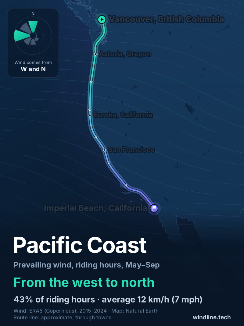
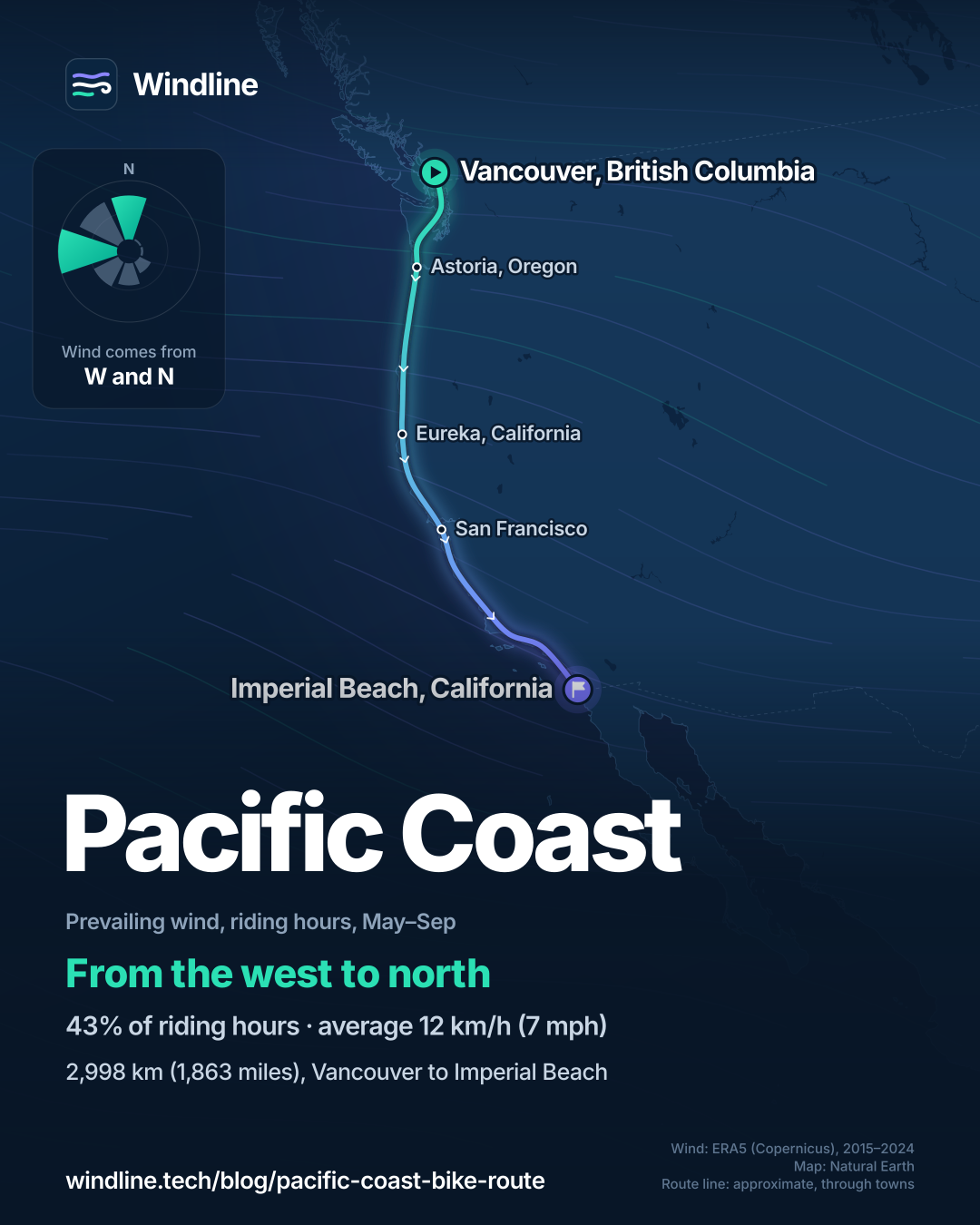
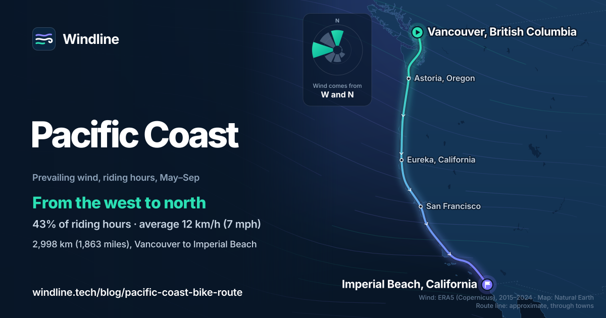
- From May to September the wind came most often from the west or north, which favours riding south.
Definitions
- Hiker/biker site
- A shared, low-cost campsite in a state park for people arriving on foot or by bicycle, usually first come, first served.
What is the Pacific Coast bike route?
The Pacific Coast bike route is a long-distance road route down the west coast of North America, from Vancouver, Canada, through Washington, Oregon and California to the Mexican border. It's one of North America's most popular cycling tours and the world's great cycling routes.
The Adventure Cycling Association (ACA) publishes its maps.
| Fact | Detail |
|---|---|
| Length | 2,998 km (1,863 miles) |
| Start and finish | Vancouver, British Columbia, to Imperial Beach, California |
| Country and states | Canada (British Columbia); US (Washington, Oregon, California) |
| Usual time | Five to seven weeks |
| Surface | Mostly paved; some narrow stretches with little or no shoulder |
| Climbing | About 32,500 m (106,520 ft) southbound; high point 582 m (1,910 ft) |
| Signage | Partial, and signs go missing; navigate by map or GPS track |
| Best months | May, September and October |
Which sections do people ride?
The ACA splits the route into five map sections of 403–665 km (251–414 miles). Each makes a tour of five to ten riding days.
| Section | Length, km (miles) | What it's like |
|---|---|---|
| Vancouver to Astoria, Oregon | 665 (414) | Ferries, Whidbey Island, the Olympic Peninsula's east side; flat to rolling |
| Astoria to Crescent City, California | 656 (408) | The Oregon coast: hills, some steep, and logging trucks |
| Crescent City to San Francisco | 656 (408) | Redwoods, generally hilly, the Golden Gate Bridge |
| San Francisco to Santa Barbara | 617 (383) | Big Sur, which the ACA calls the most spectacular part |
| Santa Barbara to Imperial Beach | 403 (251) | Rolling to flat, beach paths, the Coronado ferry |
The ACA warns that dense fog can come in any season. To set your daily distance, see how far you can cycle in a day. If you like coast roads, compare Australia's Great Ocean Road and Scotland's North Coast 500.
Want this for your own route? Windline shows the wind for every stretch, timed to your pace. Free. Make a free ride page →
What's the weather like through the year?
Summer is calm and dry; the ACA steers riders away from winter's floods and mudslides.
Weather across the year on the Pacific Coast bike route, 2015–2024
| Month | Wind from | Average wind, km/h (mph) | Gusty days | Start → high, °C (°F) | Wet days |
|---|---|---|---|---|---|
| Jan | ~Changeable | 12 (7) | 11% | 8° (47°) → 11° (52°) | 47% |
| Feb | ~Changeable | 13 (8) | 11% | 8° (46°) → 11° (52°) | 45% |
| Mar | W, NW | 12 (8) | 9% | 9° (47°) → 12° (54°) | 45% |
| Apr | W, NW | 13 (8) | 7% | 10° (51°) → 14° (57°) | 37% |
| May | W, N | 13 (8) | 6% | 13° (55°) → 16° (60°) | 25% |
| Jun | W, N | 12 (8) | 2% | 15° (59°) → 18° (64°) | 18% |
| Jul | W, N | 12 (7) | 0% | 17° (62°) → 20° (68°) | 8% |
| Aug | W, NW | 11 (7) | 1% | 17° (63°) → 21° (69°) | 9% |
| Sep | W, N | 11 (7) | 1% | 16° (60°) → 19° (67°) | 19% |
| Oct | ~Changeable | 11 (7) | 6% | 13° (55°) → 17° (62°) | 27% |
| Nov | ~Changeable | 11 (7) | 9% | 10° (51°) → 14° (56°) | 41% |
| Dec | ~Changeable | 11 (7) | 9% | 8° (47°) → 11° (52°) | 46% |
From June to September, gusty days were 2% or fewer and the wind averaged 11–12 km/h (7–8 mph), mostly from the west and north. Wet days fell from 25% in May to 8% in July, then rose to 27% in October and 41–47% from November to February, when the wind was changeable in direction. It's mild rather than hot: in August, riding hours warmed from 17°C (63°F) at 08:00 to 21°C (69°F).
Which way should you ride it?
South, if wind decides it. From May to September, riding-hour wind came from the west or north in 43% of hours, averaging 12 km/h (7 mph), and only 2% came from the north-east or east.
On a coast that runs north to south, a north wind pushes southbound riders and a west wind is side-on. The ACA also says summer winds prevail from north to south. These are averages of past seasons, not a forecast. Our north or south guide breaks it down by month and state.
How do you get there, camp and get home?
By train or plane, camping in state parks on the way.
- Trains: Amtrak's Cascades, Coast Starlight and Pacific Surfliner carry full-size bikes in onboard racks. Most routes need a bike reservation, and fees vary by route.
- The finish: the ACA's maps note the San Diego Trolley to the San Ysidro border station, and the Pacific Surfliner leaves from San Diego.
- Camping: Oregon State Parks charges $7–8 a person for residents and $9–10 for non-residents (as of October 2026), first come, first served. Washington and California have similar sites for riders.
- Big Sur: Caltrans reopened Highway 1 through Big Sur on 14 January 2026; check its QuickMap before you go.
For camping off the route, see wild camping rules.
Frequently asked questions
How long does it take to cycle the Pacific Coast?
Five to seven weeks, on our arithmetic. At the Adventure Cycling Association's loaded-touring pace of 64–89 km (40–55 miles) a day, its 2,998 km (1,863 miles) take 34–47 riding days, plus rest days. Each of its five map sections takes five to ten riding days, so one makes a good shorter tour.
Is the Pacific Coast bike route good for beginners?
Not as a first tour, says the Adventure Cycling Association. It warns of narrow, winding stretches with little or no shoulder, logging trucks and steep Oregon hills, with about 32,500 m (106,520 ft) of climbing southbound. If you're new, try the last section, Santa Barbara to Imperial Beach: rolling to flat, with beach paths.
Do you need to book hiker/biker campsites?
Usually not. Oregon State Parks runs its hiker/biker areas first come, first served, at $9–10 a person for non-residents (as of October 2026), for up to two nights in seven. California's Half Moon Bay State Beach has a one-night hike and bike area. The ACA warns that some campgrounds charge a full site, often $20–50 a night.
Is Highway 1 through Big Sur open to cyclists?
It reopened on 14 January 2026, when Caltrans cleared Regent's Slide, giving through access between Carmel and Cambria for the first time in almost three years. Landslides have closed it before, so check Caltrans QuickMap. The ACA notes very limited services for 97 km (60 miles) south of Big Sur, so carry food and water.
Get the wind for your ride.
Upload a GPX, add your start time and pace, and see the headwind, gusts, rain and heat for every stretch of the route, timed to when you’ll be there. Free for riders.
Make a free ride page →Sources and method
- Adventure Cycling Association (2026). Pacific Coast route (overview, sections, riding conditions and logistics)
- Oregon State Parks (2026). Statewide FAQ (hiker/biker camping)
- Washington State Parks (2026). Fees (campsite descriptions)
- California State Parks (2020). Half Moon Bay State Beach campground map
- Caltrans (California Department of Transportation) (2026). Highway 1 to reopen today at Regent's Slide
- Amtrak (2026). Bring your bicycle onboard
- Copernicus Climate Change Service (ECMWF) (2026). ERA5 hourly time-series data on single levels from 1940 to present
- Copernicus Climate Change Service (ECMWF) (2026). ERA5 hourly data on single levels from 1940 to present
- Natural Earth (2026). Terms of use (public domain map data)
Route facts are from the Adventure Cycling Association's Pacific Coast page, read on 10 October 2026: the 1,862.6-mile length from Vancouver, BC, to Imperial Beach, California; its five map sections (413.5, 407.7, 407.8, 383.1 and 250.5 miles) and their terrain; the 106,520 ft of climbing southbound and the 1,910 ft high point; the best months (May and September to October); the warnings about shoulders, logging trucks, fog, missing signs and limited services south of Big Sur; hiker/biker sites and their prices; the ferries; and the summer winds from north to south. Camping rules are from Oregon State Parks, Washington State Parks and California State Parks; the Big Sur reopening is from Caltrans; trains and bikes are from Amtrak; all read on 10 October 2026. Usual time is our arithmetic on the ACA's loaded-touring pace of 64–89 km (40–55 miles) a day, as on our North America list: 2,998 km takes 34–47 riding days, about five to seven weeks with rest days; a 617–665 km section takes 7–10 riding days and the 403 km last section 5–6. Conversions use 1 mile = 1.609 km and 1 ft = 0.3048 m, rounded: 106,520 ft = 32,467 m, 1,910 ft = 582 m, 60 miles = 97 km. The weather table and every weather figure in the text are Windline's own analysis of Copernicus ERA5 reanalysis, 1 January 2015 to 31 December 2024, downloaded from the Copernicus Climate Data Store (dataset reanalysis-era5-single-levels-timeseries) for the 0.25° grid cell nearest each of three sample points along the route: Vancouver, British Columbia; Eureka, California; and Imperial Beach, California, with hours and days pooled across the three. Riding hours are 08:00 to 17:00 local time. Wind is the 10 m (33 ft) wind; direction counts where it blows from, in eight compass sectors, and hours under 5 km/h (3 mph) count as calm. A month whose two commonest directions are not neighbours, or whose hours barely agree on a direction, is called changeable in direction. A gusty day has a riding-hour gust of 50 km/h (31 mph) or more; a wet day has 1 mm or more of rain; start is the 08:00 temperature and high is the warmest riding hour. The prevailing wind for May to September (west or north, 43% of riding hours, averaging 12 km/h (7 mph), 2% from the north-east or east) uses the same data and points. Three points cannot capture headlands, valleys or coastal fog, so the figures smooth out local extremes. They are averages of past seasons, not forecasts. The map's route line is an approximate line through towns, not an official route map, and no Adventure Cycling map or GPX was traced; basemap from Natural Earth (public domain). Contains modified Copernicus Climate Change Service information (ERA5, 2015–2024); neither the European Commission nor ECMWF is responsible for any use of this information.
About the author
Wes Thomson, Founder, Windline. Wes Thomson builds Windline, live wind and weather forecasts timed to when riders reach each stretch of road. He built it for his own 2,093 km tour from Pont Drift to Cape Town, and writes these guides with the same focus: what the wind will do to your ride, and how to plan around it.