The Great Divide Mountain Bike Route: Jasper to the Mexican border
Plan the Great Divide with its sections, a year of weather and wind, which way to ride, and how to reach both ends.
The short answer
The Great Divide Mountain Bike Route runs 4,985 km (3,097 miles) along the Rocky Mountains from Jasper, Alberta, to Antelope Wells on New Mexico's border with Mexico. About 70% is unpaved, and most riders need nine weeks or more. Adventure Cycling's season is June to October, when riding-hour winds average about 10 km/h (6 mph).
Key takeaways
- About 70% unpaved, with more than 60,000 m (200,000 ft) of climbing and few reliable signs.
- Adventure Cycling advises staying off Colorado's high country until early July and off the route after mid-October.
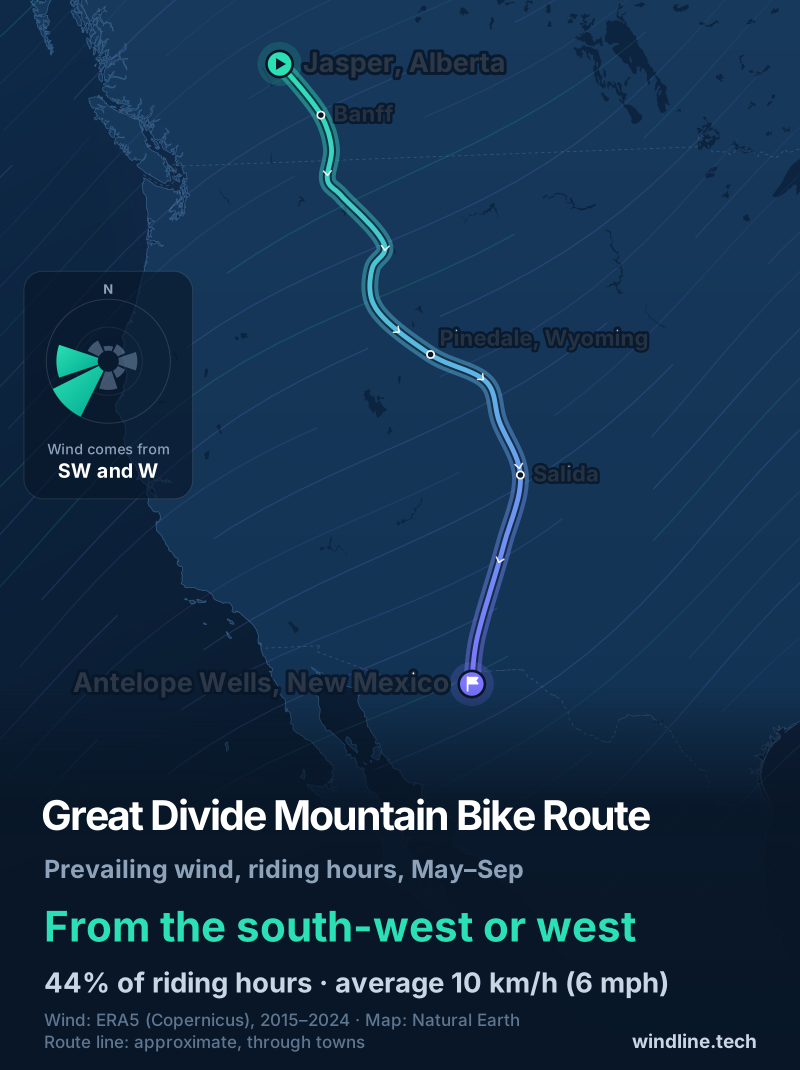
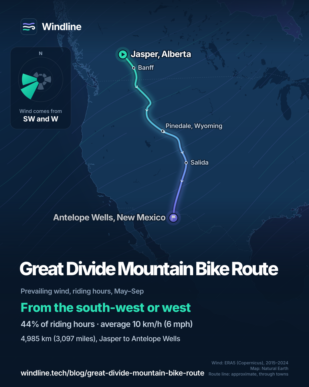
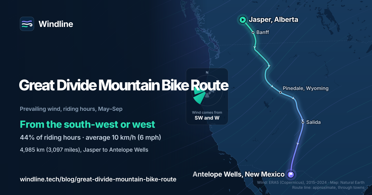
- In summer, riding-hour winds come mostly from the south-west or west, averaging 10 km/h (6 mph).
- Phone coverage reaches only about 5% of the route, so save forecasts in town.
Definitions
- Continental Divide
- The line of high ground in the Rockies that splits rivers draining to the Pacific from those draining to the Atlantic and Arctic.
- Resupply
- A town or shop where you restock food, water and fuel before the next remote stretch.
What is the Great Divide Mountain Bike Route?
The Great Divide Mountain Bike Route is the Adventure Cycling Association's (ACA) dirt-road line along the Rocky Mountains, from Jasper in Canada to Antelope Wells on the Mexican border. It's the long off-road entry in our best cycling routes in North America, and one of the world's great cycling routes.
ACA once started it in Banff; its Canada section now begins in Jasper. The line on our map is approximate, not an official route map.
| Fact | Detail |
|---|---|
| Length | 4,985 km (3,097 miles), Jasper to Antelope Wells |
| Provinces and states | Alberta, British Columbia, Montana, Idaho, Wyoming, Colorado, New Mexico |
| Usual time | 9 weeks or more (see how far to bikepack in a day) |
| Surface | About 70% unpaved roads and singletrack |
| Climbing | More than 60,000 m (200,000 ft) |
| Signage | Don't count on signs: ride from maps or GPS |
| Best months | June to October (ACA) |
Which sections do people ride?
ACA splits the route into seven map sections, and you can ride any one on its own.
- Canada: Jasper to Roosville, 942 km (585 miles). It runs north to Hinton first, then south through Banff and over Elk Pass.
- Roosville to Helena: 597 km (371 miles) through Montana.
- Helena to Colter Bay: 730 km (453 miles), past Idaho to the Tetons.
- Colter Bay to Rawlins: 588 km (366 miles), including Wyoming's treeless Great Divide Basin.
- Rawlins to Salida: 608 km (378 miles) into Colorado's high country.
- Salida to Grants: 868 km (539 miles), over Indiana Pass, the highest at 3,630 m (11,910 ft).
- Grants to Antelope Wells: 652 km (405 miles) of New Mexico desert.
ACA says towns sit two to three days apart on most of the route, and about a third of nights are at wilderness sites.
Want this for your own route? Windline shows the wind for every stretch, timed to your pace. Free. Make a free ride page →
What's the weather like through the year?
Summers are mild and fairly calm, but July is wettest.
Weather across the year on the Great Divide Mountain Bike Route (Jasper to Antelope Wells), 2015–2024
| Month | Wind from | Average wind, km/h (mph) | Gusty days | Start → high, °C (°F) | Wet days |
|---|---|---|---|---|---|
| Jan | S, SW | 9 (6) | 14% | -7° (20°) → 0° (32°) | 30% |
| Feb | SW, W | 10 (6) | 20% | -6° (22°) → 2° (36°) | 35% |
| Mar | SW, W | 11 (7) | 21% | -2° (28°) → 7° (44°) | 32% |
| Apr | SW, W | 11 (7) | 25% | 2° (36°) → 11° (52°) | 33% |
| May | SW, W | 11 (7) | 18% | 8° (46°) → 17° (62°) | 33% |
| Jun | SW, W | 10 (6) | 19% | 13° (56°) → 23° (73°) | 33% |
| Jul | W, SW | 9 (6) | 15% | 15° (60°) → 25° (78°) | 36% |
| Aug | SW, W | 9 (6) | 14% | 14° (56°) → 24° (76°) | 33% |
| Sep | SW, W | 10 (6) | 16% | 9° (48°) → 20° (68°) | 30% |
| Oct | SW, W | 10 (6) | 19% | 3° (37°) → 13° (55°) | 29% |
| Nov | SW, S | 9 (6) | 17% | -3° (27°) → 5° (41°) | 29% |
| Dec | S, SW | 9 (5) | 14% | -7° (20°) → 0° (31°) | 30% |
From June to October, the average riding-hour wind is 9–10 km/h (6 mph), mostly from the south-west or west. July is the warmest month, from 15°C (60°F) at 08:00 to 25°C (78°F), and the wettest, with 1 mm or more of rain on 36% of days. Gusty days fall from 19% in June to 14% in August. By October, mornings start at 3°C (37°F), and the passes run colder than these averages.
Which way should you ride the Great Divide?
The wind gives northbound riders a small edge, but the season matters more. ACA's maps run southbound.
From May to September, the riding-hour wind came from the south-west or west in 44% of hours, averaging 10 km/h (6 mph), with 22% calm. The route heads roughly south-south-east, so that wind is mostly side-on: slightly against you riding south, slightly behind you riding north.
Wyoming's Great Divide Basin differs. Our bikepacking weather guide found stronger south-westerlies and westerlies there, and ACA warns of big north-west winds. The route crosses the basin south-eastwards, so all three are side-on or partly behind southbound riders.
Timing decides more. ACA warns snow can fall at any time, advises against riding Colorado's high country before early July, and says to be off the route by mid-October. These are averages of past seasons, not a forecast.
How do you get there and back?
Both ends are remote, so book transport early.
- Jasper: VIA Rail's Vancouver–Toronto train stops there. ACA's shuttle list includes services from Calgary and Edmonton to Banff and Jasper.
- Park passes: Parks Canada asks you to buy a pass when you stop in its national parks' towns or camp there; one daily pass covers Banff and Jasper.
- Antelope Wells: ACA describes one building on the border and nothing else for miles. Its list includes shuttles to El Paso, Silver City and Tucson.
- Signal: ACA puts phone coverage at about 5% of the route, so save each forecast in town.
For a shorter epic in the southern summer, New Zealand's Tour Aotearoa runs 3,000 km (1,864 miles): see our Australia and New Zealand list.
Frequently asked questions
Do you need a mountain bike for the Great Divide?
Usually, yes. Adventure Cycling says a standard mountain bike frame is your best bet unless you've done self-contained, off-pavement touring on another style of bike. It recommends 2.25 in (57 mm) tyres with a low-profile tread and thick sidewalls, and says front suspension helps smooth out the many miles of dirt. See our guide to the [best bike for bikepacking](/blog/best-bike-for-bikepacking/).
How much water should you carry on the Great Divide?
It depends on the gap. Between Pinedale and Rawlins in Wyoming, Adventure Cycling advises carrying at least 11–15 litres (3–4 US gallons) a person for what is typically a two-day ride. It calls a high-quality water filter mandatory, ideally one per rider. See [bikepacking food and water](/blog/bikepacking-food-and-water/).
Are there bears on the Great Divide?
Yes. Adventure Cycling says most of the route is bear country, with grizzly and black bears north of Pinedale, Wyoming, and black bears only south of it. Store all food, rubbish and other attractants in a bear-resistant way, well away from your tent: hung from a high, isolated branch, or in the bear-proof containers some campgrounds provide.
Get the wind for your ride.
Upload a GPX, add your start time and pace, and see the headwind, gusts, rain and heat for every stretch of the route, timed to when you’ll be there. Free for riders.
Make a free ride page →Sources and method
- Adventure Cycling Association (2026). Great Divide Mountain Bike Route
- Adventure Cycling Association (2026). Great Divide: Canada section (map description)
- Adventure Cycling Association (2023). Great Divide shuttle options (updated January 2023)
- Adventure Cycling Association (2015). Choosing a bike for the Great Divide
- Parks Canada (2026). Banff National Park: park passes
- VIA Rail Canada (2026). Train schedule: Vancouver - Jasper - Winnipeg - Toronto
- Copernicus Climate Change Service (ECMWF) (2026). ERA5 hourly time-series data on single levels from 1940 to present
- Copernicus Climate Change Service (ECMWF) (2026). ERA5 hourly data on single levels from 1940 to present
- Natural Earth (2026). Terms of use (public domain map data)
Route facts come from the Adventure Cycling Association (ACA), which publishes the official maps, read on 10 October 2026: the route page (length 3,097.3 miles, section lengths, surface, season, climbing, Indiana Pass, signs, phone coverage, overnights, water and bears), the Canada section's map description and its shuttle list (updated January 2023). Best months are ACA's own: "typically June to October". The share unpaved is (2,100 + 60) ÷ (2,100 + 60 + 950) = 69.5%, about 70%. Usual time matches our other guides: 4,985 km at 80 km (50 miles) a day = 62 riding days, so nine weeks or more; at BIKEPACKING.com's weekend pace for mixed-surface routes, 49–81 km (31–50 miles) a day, plus one rest day per ten, about 10–16 weeks. Section lengths are ACA's miles converted with 1 mile = 1.609344 km and rounded; heights use 1 ft = 0.3048 m (11,910 ft = 3,630 m; 200,000 ft = 60,960 m). The weather table and the wind figures are Windline's own analysis of Copernicus ERA5 reanalysis, 1 January 2015 to 31 December 2024, downloaded from the Copernicus Climate Data Store (hourly time series for the nearest 0.25° grid cell), at three sample points along the route (Jasper, Pinedale and Antelope Wells), with hours and days pooled across the three. Riding hours are 08:00 to 17:00 local time. Wind is the 10 m (33 ft) wind; the direction is the commonest two of eight compass sectors, hours under 5 km/h (3 mph) count as calm, and months with no steady direction are called changeable in direction. A gusty day has a riding-hour gust of 50 km/h (31 mph) or more; a wet day has 1 mm or more of rain; start is the 08:00 temperature and high is the warmest riding hour. The summer wind (May to September) is from the same data. ERA5 cells are about 25–30 km (16–19 miles) across, so they smooth out passes, valleys and local gusts. The direction reading compares the prevailing wind with the route's overall heading, roughly south-south-east from Jasper to Antelope Wells. These are averages of past seasons, not forecasts. The map's line is an approximate line through town waypoints, not an official route map; Adventure Cycling publishes the official maps. Basemap from Natural Earth (public domain). Contains modified Copernicus Climate Change Service information (ERA5, 2015–2024); neither the European Commission nor ECMWF is responsible for any use of this information.
About the author
Wes Thomson, Founder, Windline. Wes Thomson builds Windline, live wind and weather forecasts timed to when riders reach each stretch of road. He built it for his own 2,093 km tour from Pont Drift to Cape Town, and writes these guides with the same focus: what the wind will do to your ride, and how to plan around it.