The Erie Canalway Trail by bike: Buffalo to Albany, weather and wind
New York's canal towpath from Buffalo to Albany, with its sections, a year of weather, which way to ride and how to get home.
The short answer
The Erie Canalway Trail is a signed, level and mostly paved bike path that crosses New York State for 580 km (360 miles), from Buffalo to Albany through Rochester, Syracuse and Utica. Most riders take seven to nine days. Summer is the season, and the usual south-westerly or westerly wind favours riding west to east.
Key takeaways
- 580 km (360 miles) of signed, level trail, mostly paved, with some stone dust, gravel and streets.
- In summer riding hours the wind averages 10–12 km/h (6–7 mph), most often from the south-west or west.
- Riding Buffalo to Albany puts that wind behind you more often than in your face.
- Amtrak trains with bike racks link Buffalo, Rochester, Syracuse, Utica and Albany. Reserve a bike space.
Definitions
- Towpath
- The path beside a canal once used by mules pulling canal boats; much of the trail follows one.
- Stone dust
- Finely ground, compacted limestone used as a trail surface. It rolls a little slower than asphalt.
What is the Erie Canalway Trail?
The Erie Canalway Trail is a signed, level bike path across New York State, 580 km (360 miles) from Buffalo in the west to Albany in the east. It's one of the great cycling routes of the world and the most-visited trail on our list of the best cycling routes in North America.
It follows old towpaths and rail lines through Rochester, Syracuse and Utica, run by the New York State Canal Corporation, and forms the western arm of the 1,207 km (750-mile) Empire State Trail.
| At a glance | Erie Canalway Trail |
|---|---|
| Length | 580 km (360 miles), Buffalo to Albany |
| State | New York, US |
| Usual days | 7–9 |
| Surface | Mostly paved; some stone dust, gravel and local streets |
| Signage | Canalway Trail signs along the route |
| Best months | June to August (canal campsites open May to October) |
Which sections do people ride?
The Empire State Trail maps it in four legs, west to east. Each ends at an Amtrak station, so any one makes a short trip.
- Buffalo to Rochester: the Shoreline Trail out of Buffalo to Tonawanda, then the canal through Lockport, Albion and Brockport.
- Rochester to Syracuse: Fairport, Palmyra and Newark, with an on-road stretch from Savannah to Port Byron.
- Syracuse to Utica: including Old Erie Canal State Historic Park, 58 km (36 miles) from East Syracuse to Rome, shared with horse riders.
- Utica to Albany: Little Falls, Canajoharie, Amsterdam and Schenectady to Green Island, then on to Albany.
On-road sections use shoulders or quiet rural roads, rarely with bike lanes.
Want this for your own route? Windline shows the wind for every stretch, timed to your pace. Free. Make a free ride page →
What's the weather like through the year?
Summer is warm and fairly calm, while winter is cold, windier and much gustier.
Weather across the year on the Erie Canalway Trail, 2015–2024
| Month | Wind from | Average wind, km/h (mph) | Gusty days | Start → high, °C (°F) | Wet days |
|---|---|---|---|---|---|
| Jan | NW, W | 14 (9) | 24% | -4° (24°) → 0° (31°) | 45% |
| Feb | NW, W | 15 (9) | 25% | -4° (25°) → 1° (34°) | 46% |
| Mar | NW, W | 15 (9) | 27% | 0° (31°) → 6° (42°) | 43% |
| Apr | NW, W | 14 (9) | 26% | 6° (42°) → 12° (54°) | 49% |
| May | SW, NW | 12 (7) | 13% | 13° (55°) → 20° (67°) | 39% |
| Jun | SW, W | 12 (7) | 11% | 18° (64°) → 24° (75°) | 43% |
| Jul | SW, W | 10 (6) | 6% | 21° (69°) → 27° (81°) | 42% |
| Aug | SW, W | 10 (6) | 5% | 19° (67°) → 26° (79°) | 42% |
| Sep | S, SW | 10 (6) | 6% | 15° (60°) → 23° (73°) | 32% |
| Oct | S, SW | 13 (8) | 16% | 9° (49°) → 16° (61°) | 44% |
| Nov | W, NW | 14 (9) | 23% | 4° (38°) → 9° (47°) | 45% |
| Dec | W, S | 14 (9) | 20% | 0° (31°) → 3° (38°) | 50% |
From June to August the average riding-hour wind is 10–12 km/h (6–7 mph), and only 5–11% of days bring a gust of 50 km/h (31 mph) or more. July warms from 21°C (69°F) at 08:00 to 27°C (81°F), but rain falls on about 42% of summer days. September is the driest month, wet on 32% of days, with highs of 23°C (73°F). From November to April, 20–27% of days are gusty.
Which way should you ride it?
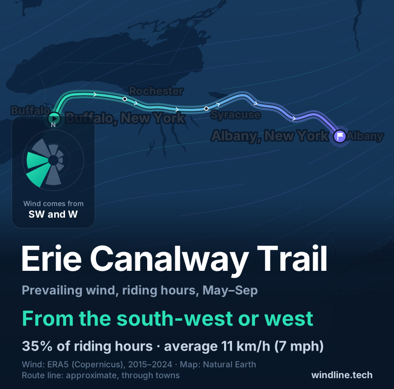
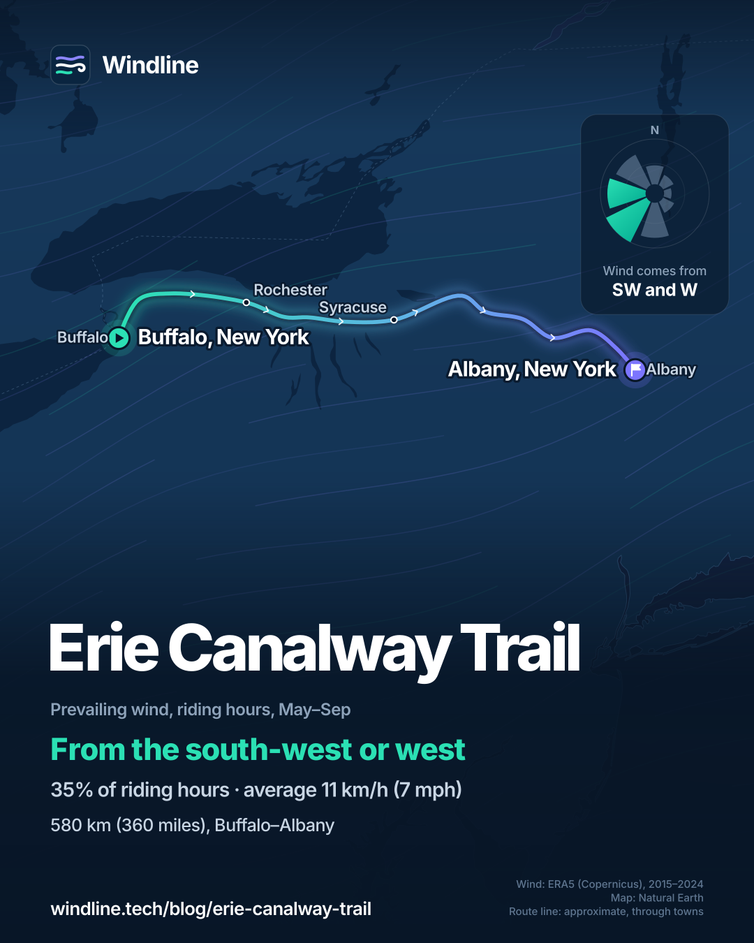
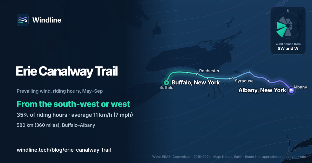
West to east, Buffalo to Albany, if the wind decides it. From May to September the wind came most often from the south-west or west (35% of riding hours between them), averaging 11 km/h (7 mph). It blew from the north-east, east or south-east in only 13% of hours, and 16% were calm.
The trail heads broadly east, so that wind is behind or across you far more often than in your face. At these speeds the gain is modest; see how much a headwind slows you down. These are averages of past seasons, not a forecast, so check each day before you set off.
How do you get there, sleep and get home?
By train. Amtrak's Empire Service and Maple Leaf trains stop at Buffalo, Rochester, Syracuse, Utica and Albany-Rensselaer, with bike racks in the coaches. Bikes must be reserved, a fee may apply, and some trains have only four racks, so book early. Both end stations are about 1.6 km (1 mile) from the trail.
- Camping: the Canal Corporation runs basic campsites at locks from May to October: four tents, 48 hours at most, a portable toilet and no drinking water. Email a week ahead to check a site is open.
- Rooms: New York lists hundreds of hotels, inns and B&Bs within 8 km (5 miles) of the trail.
- Hours: dawn to dusk; there's no lighting.
Multi-day riders usually cover 48–80 km (30–50 miles) a day, says the Empire State Trail; see how far you can cycle in a day.
If you like flat, signed water-level routes, try the Great Allegheny Passage and C&O Canal, or Europe's Danube and Loire paths on our best cycling routes in Europe list.
Frequently asked questions
Is the Erie Canalway Trail paved all the way?
No. The Canal Corporation describes it as mostly paved, with some stone dust, gravel and natural surfaces, and parts on local streets. The Empire State Trail says any bike, including a road bike, can ride stone dust, but it can be dusty when dry and rolls slightly slower than asphalt. Riders on narrow, high-pressure tyres often prefer the paved stretches.
How busy is the Erie Canalway Trail?
Busy by trail standards: Parks & Trails New York estimated 3.66 million visits on the Erie Canalway Trail in 2025, and use peaks in summer. Expect walkers and families near towns. Keep right, call out or ring before passing, and give way to pedestrians. The Canal Corporation sets a 15 mph (24 km/h) limit unless signs say otherwise.
Are e-bikes allowed on the Erie Canalway Trail?
Class 1 and 2 e-bikes are, on the sections run by the Canal Corporation and New York State Parks: those with working pedals and no assistance beyond 20 mph (32 km/h). Class 3 e-bikes are banned on New York's trails by state law. A few stretches belong to other owners, so check local rules where the trail changes hands.
Get the wind for your ride.
Upload a GPX, add your start time and pace, and see the headwind, gusts, rain and heat for every stretch of the route, timed to when you’ll be there. Free for riders.
Make a free ride page →Sources and method
- New York State Canal Corporation (2026). About the Canalway Trail
- New York State Canal Corporation (2026). Camping along the Canalway Trail
- Empire State Trail (NYS Office of Parks, Recreation and Historic Preservation) (2026). Empire State Trail
- Empire State Trail (2026). Trail map and sections
- Empire State Trail (2026). Trip planning
- Empire State Trail (2026). Frequently asked questions
- Empire State Trail (2026). Camping
- Amtrak (2026). Bring your bicycle onboard
- Parks & Trails New York (2026). Bikes on Board: a guide to using Amtrak to ride the Erie Canalway Trail
- Parks & Trails New York (2026). Who's on the Trail 2025 (Canalway Trail user count report)
- Copernicus Climate Change Service (ECMWF) (2026). ERA5 hourly time-series data on single levels from 1940 to present
Facts about the trail (length, surface, signs, sections, campsites, rules, trains) come from the New York State Canal Corporation, the Empire State Trail (NYS Office of Parks, Recreation and Historic Preservation), Amtrak and Parks & Trails New York, read on 10 October 2026; see the evidence file. Best months (June to August) reflect Parks & Trails New York's finding that use of the trail peaks in summer, as on our North America list. Usual days are our arithmetic on the Adventure Cycling Association's loaded-touring pace of 64–89 km (40–55 miles) a day: 580 km gives 7–9 days. Conversions use 1 mile = 1.609 km. The weather table and every weather figure in the text are Windline's own analysis of Copernicus ERA5 reanalysis, 1 January 2015 to 31 December 2024, downloaded from the Copernicus Climate Data Store, for riding hours 08:00 to 17:00 local time at three sample points along the route (Buffalo, Syracuse and Albany), using the nearest 0.25° grid cell. Wind is at 10 m (33 ft); directions are the commonest of eight compass sectors, and hours under 5 km/h (3 mph) count as calm. A gusty day has a riding-hour gust of 50 km/h (31 mph) or more; a wet day has 1 mm or more of rain; start is the 08:00 temperature and high is the warmest riding hour. The direction advice uses May to September riding hours. These are averages of past seasons, not forecasts. Contains modified Copernicus Climate Change Service information (ERA5, 2015–2024); neither the European Commission nor ECMWF is responsible for any use of this information. The map's line is an approximate line through towns along the trail, not an official route map.
About the author
Wes Thomson, Founder, Windline. Wes Thomson builds Windline, live wind and weather forecasts timed to when riders reach each stretch of road. He built it for his own 2,093 km tour from Pont Drift to Cape Town, and writes these guides with the same focus: what the wind will do to your ride, and how to plan around it.