Cycling the Cabot Trail: weather by month and which way to ride
Plan a Cabot Trail ride with its weather by month, the prevailing wind, the four big climbs, park passes and campgrounds.
The short answer
Cycling the Cabot Trail means a 298 km (185-mile) loop of Cape Breton Island, Nova Scotia, with four big climbs of 9–15% through Cape Breton Highlands National Park. Allow four to five days. Go between June and mid-October, and ride clockwise to have the usual south-westerly behind you up the exposed west coast.
Key takeaways
- The loop runs 298 km (185 miles) from Baddeck through Chéticamp, Pleasant Bay and Ingonish.
- Parks Canada grades North Mountain and Smokey Mountain at 12–15%.
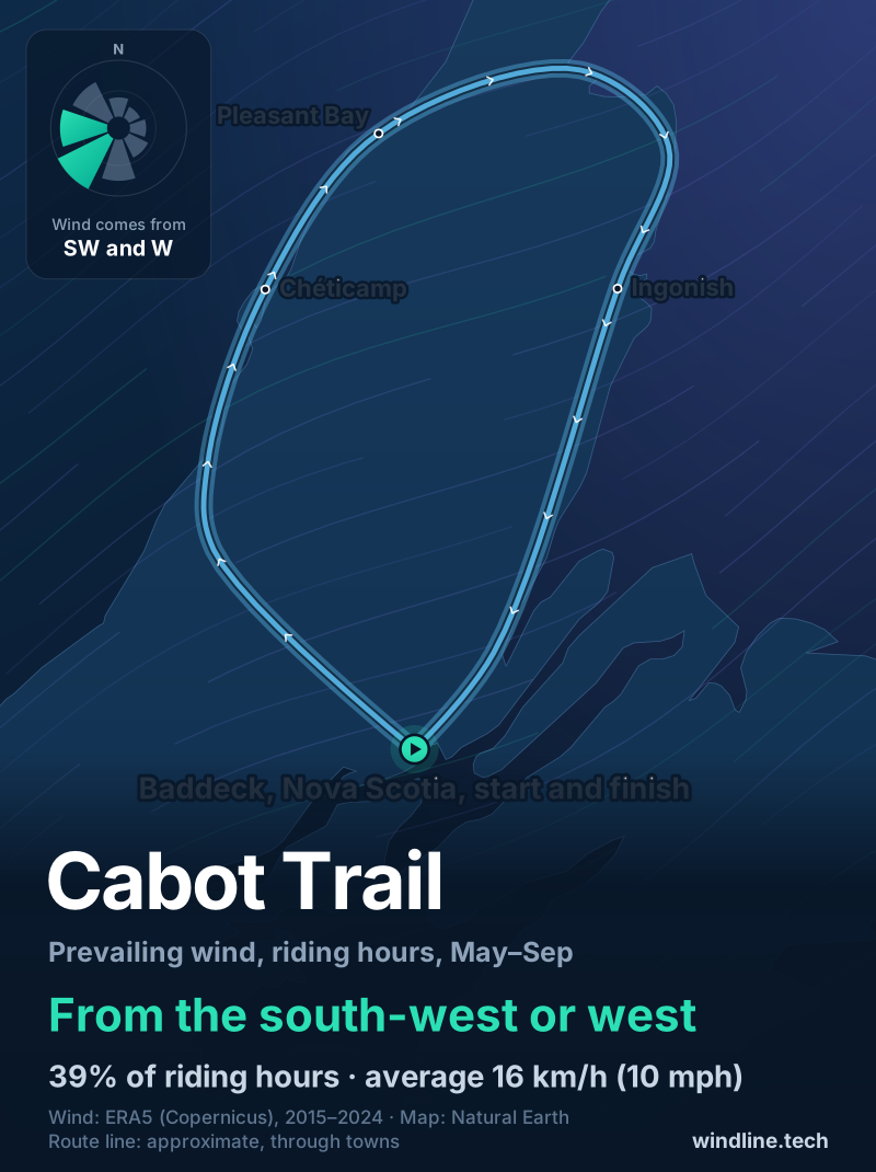
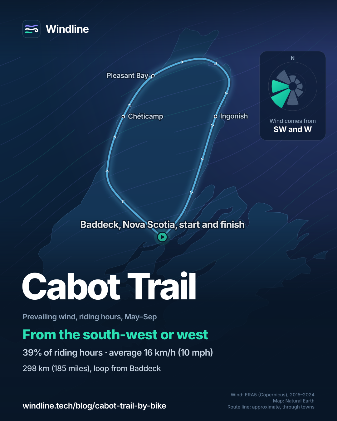
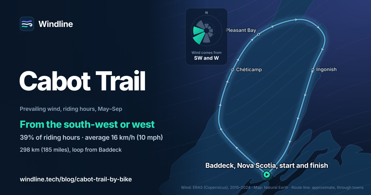
- From May to September, riding-hour winds come most often from the south-west or west.
- July has the fewest gusty days (9%); October has 31%.
Definitions
- Look-off
- A roadside viewpoint with space to pull over, as the lookouts along the Cabot Trail are called in Nova Scotia.
What is the Cabot Trail?
It's a 298 km (185-mile) road loop around the north of Cape Breton Island, Nova Scotia, partly through Cape Breton Highlands National Park. Cycling the Cabot Trail means sea cliffs, Acadian and Gaelic communities, and four mountain climbs.
It's one of our 10 most popular cycling tours in North America, and part of our guide to the world's great cycling routes.
| Fact | Detail |
|---|---|
| Length | 298 km (185 miles), a loop |
| Province | Nova Scotia, Canada (Cape Breton Island) |
| Usual days | 4–5 |
| Surface | Paved road shared with traffic; paved shoulders being added in the park |
| Signage | A named highway; steep inclines marked in the park |
| Big climbs | Four, graded 9–15% |
| Best months | June to mid-October |
Which sections do people ride?
Most riders start and finish in Baddeck and break the loop at Chéticamp, Pleasant Bay and Ingonish, the communities Tourism Nova Scotia names along it.
- Baddeck to Chéticamp. Through the Margarees to the Gulf of St Lawrence coast and Acadian Chéticamp.
- Chéticamp to Pleasant Bay. Into the national park and over French and MacKenzie mountains, both 9–12%.
- Pleasant Bay to Ingonish. Over North Mountain, 12–15%, then down the east coast.
- Ingonish to Baddeck. Over Smokey Mountain, also 12–15%, then back inland to the start.
Split the loop with how far you can cycle in a day.
Want this for your own route? Windline shows the wind for every stretch, timed to your pace. Free. Make a free ride page →
What's the weather like through the year?
Summer brings the lightest winds and the warmest days; autumn turns gustier.
Weather across the year on the Cabot Trail, 2015–2024
| Month | Wind from | Average wind, km/h (mph) | Gusty days | Start → high, °C (°F) | Wet days |
|---|---|---|---|---|---|
| Jan | W, NW | 22 (14) | 45% | -4° (25°) → -2° (29°) | 61% |
| Feb | W, NW | 23 (14) | 50% | -6° (21°) → -3° (27°) | 56% |
| Mar | W, NW | 21 (13) | 43% | -4° (25°) → 0° (31°) | 51% |
| Apr | W, NW | 19 (12) | 32% | 1° (34°) → 4° (39°) | 47% |
| May | NW, W | 17 (11) | 23% | 6° (44°) → 10° (49°) | 40% |
| Jun | S, SW | 16 (10) | 14% | 12° (54°) → 15° (59°) | 45% |
| Jul | SW, W | 15 (9) | 9% | 17° (63°) → 20° (68°) | 43% |
| Aug | SW, W | 16 (10) | 14% | 18° (65°) → 21° (71°) | 45% |
| Sep | NW, SW | 18 (11) | 25% | 15° (58°) → 18° (64°) | 40% |
| Oct | W, NW | 19 (12) | 31% | 9° (49°) → 12° (54°) | 47% |
| Nov | W, NW | 23 (14) | 47% | 4° (40°) → 6° (43°) | 61% |
| Dec | W, NW | 23 (14) | 50% | 0° (31°) → 1° (34°) | 64% |
July has the fewest gusty days, 9%, and the wind averages 15 km/h (9 mph); it warms from 17°C (63°F) at 08:00 to 20°C (68°F). August is warmest, from 18°C (65°F) to 21°C (71°F). Rain is the constant: 40–47% of days are wet from May to October. By October, 31% of days are gusty and the wind averages 19 km/h (12 mph).
Should you ride it clockwise or anticlockwise?
Clockwise, by a modest margin, if wind is your main concern. From May to September the riding-hour wind blows most often from the south-west or west (39% of hours), averaging 16 km/h (10 mph), and only 5% of hours are calm.
Clockwise, you start into it, heading north-west to the Margarees. Then, up the Gulf coast and east across the top, a south-westerly or westerly sits behind you or on your left. You pay on the way back: south from Ingonish over Smokey, a south-westerly is in your face. Anticlockwise reverses the deal, putting the headwind on the open west coast, where the wind comes straight off the water. On the east side, a westerly blows off the land.
It isn't certain. North-westerlies are among the two commonest winds in May and September, and they blow against you heading north up the west coast. A headwind also costs more than a tailwind gives back. These are averages of past seasons, not a forecast. Our prevailing winds guide explains the method.
Other things count. A Tourism Nova Scotia blog says clockwise makes the climbs easier for large vehicles, while anticlockwise puts most park look-offs on your right, between the road and the ocean. Clockwise, you climb Smokey from Ingonish Harbour, 10 km (6.2 miles); anticlockwise, from Wreck Cove, 7.2 km (4.5 miles).
What should you know before cycling the Cabot Trail?
Bring low gears, a helmet (Nova Scotia law requires one at every age) and a park pass if you'll stop in the national park.
- Getting there: by road over the Canso Causeway. JA Douglas McCurdy Sydney Airport is the island's only commercial airport, with pre-booked shuttles to Baddeck. Halifax Stanfield is about three hours' drive away.
- By sea: Marine Atlantic sails from Port aux Basques, Newfoundland, to North Sydney, about 7 hours.
- Camping: the park's campgrounds open 15 May to 26 October in 2026; book the popular ones early.
- Gusty days: read how windy is too windy before the exposed headlands.
If you like it, compare Scotland's North Coast 500.
Frequently asked questions
Do you need a park pass to cycle the Cabot Trail?
Only if you stop inside Cape Breton Highlands National Park. Parks Canada exempts anyone travelling along the Cabot Trail highway without stopping in the park, or stopping for an emergency. Pull in at a look-off, trail or campground and you need a pass: adult daily admission was $10 (Canadian) as of October 2026. Check the Parks Canada notice for the dates it applies.
How steep are the climbs on the Cabot Trail?
Parks Canada grades North Mountain (467 m, 1,532 ft) and Smokey Mountain (366 m, 1,200 ft) at 12–15%, and French Mountain (452 m) and MacKenzie Mountain (370 m) at 9–12%. The longest is Smokey from Ingonish Harbour, 10 km (6.2 miles) from bottom to top. Low gears matter more than fitness here, so fit the lowest you can before a loaded tour.
Where can you camp on the Cabot Trail?
Cape Breton Highlands National Park has seven frontcountry campgrounds, open from 15 May to 26 October in 2026. Chéticamp, Mkwesaqtuk/Cap-Rouge, Ingonish Beach and Broad Cove take reservations through the Parks Canada Reservation Service; Corney Brook, MacIntosh Brook and Big Intervale are first come, first served. Unserviced sites cost $22–$34 (Canadian) a night, as of October 2026.
Get the wind for your ride.
Upload a GPX, add your start time and pace, and see the headwind, gusts, rain and heat for every stretch of the route, timed to when you’ll be there. Free for riders.
Make a free ride page →Sources and method
- Tourism Nova Scotia (2026). Cabot Trail: Cape Breton's coastal adventure
- Tourism Nova Scotia (2026). What is the best way to travel around the Cabot Trail? Clockwise or counter-clockwise?
- Parks Canada (2026). Cape Breton Highlands National Park: cycling
- Parks Canada (2026). Cape Breton Highlands National Park: park entry pass
- Parks Canada (2026). Cape Breton Highlands National Park: fees
- Parks Canada (2026). Cape Breton Highlands National Park: frontcountry camping
- Destination Cape Breton (2026). Getting here and around: flights and airports
- Destination Cape Breton (2026). Getting here and around
- Copernicus Climate Change Service (ECMWF) (2026). ERA5 hourly time-series data on single levels from 1940 to present
- Copernicus Climate Change Service (ECMWF) (2026). ERA5 hourly data on single levels from 1940 to present
- Natural Earth (2026). Terms of use (public domain map data)
Facts about the loop (length, communities, season, climbs, shoulders, helmet law, park pass, fees and campgrounds) are from the Tourism Nova Scotia and Parks Canada pages listed in the sources, read on 10 October 2026; the airport, shuttle and ferry details are from Destination Cape Breton, the island's tourism organisation. Best months: Tourism Nova Scotia calls summer ideal and says late September to mid-October is popular for autumn colour; we shade June to October. Usual days are our arithmetic, as in our North America list: 298 km at 64–80 km (40–50 miles) a day on a hilly route is 4–5 days. Parks Canada gives North Mountain as 467 m and 1,460 ft; we convert the metres ourselves (1,532 ft). Conversions use 1 mile = 1.609 km and 1 m = 3.281 ft, rounded. The weather table and wind figures are Windline's own analysis of ERA5 reanalysis (Copernicus Climate Change Service, ECMWF), 1 January 2015 to 31 December 2024, via the Copernicus Climate Data Store, for riding hours 08:00 to 17:00 local time, at three sample points along the route (Baddeck, Chéticamp and Ingonish), using the nearest 0.25° grid cell and pooling hours and days across the points. Wind is at 10 m (33 ft); directions are the commonest two of eight compass sectors; hours under 5 km/h (3 mph) count as calm. A gusty day has a riding-hour gust of 50 km/h (31 mph) or more; a wet day has 1 mm or more of rain; start is the 08:00 temperature and high is the warmest riding hour. The prevailing wind is for May to September. The direction advice compares that wind with the loop's rough heading on each side (north-west from Baddeck to the Margarees, north-east up the Gulf coast, east across the top, south-west from Ingonish back to Baddeck); it is our reading, not an official recommendation. ERA5 cells are about 25–30 km (16–19 miles) across, so they smooth out the highlands, the cliffs and local winds. These are averages of past seasons, not forecasts. Credit: contains modified Copernicus Climate Change Service information (ERA5, 2015–2024); neither the European Commission nor ECMWF is responsible for any use of this information. The map's route line is an approximate line through towns, not an official route map; basemap from Natural Earth (public domain); town coordinates from Wikipedia.
About the author
Wes Thomson, Founder, Windline. Wes Thomson builds Windline, live wind and weather forecasts timed to when riders reach each stretch of road. He built it for his own 2,093 km tour from Pont Drift to Cape Town, and writes these guides with the same focus: what the wind will do to your ride, and how to plan around it.