Cycling the Katy Trail: Missouri's car-free rail trail, month by month
Plan a Katy Trail ride across Missouri with its sections, a year of weather and wind, which way to ride, and the train back.
The short answer
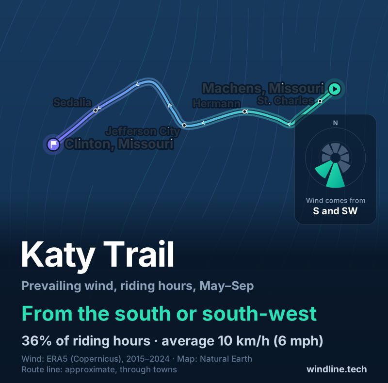
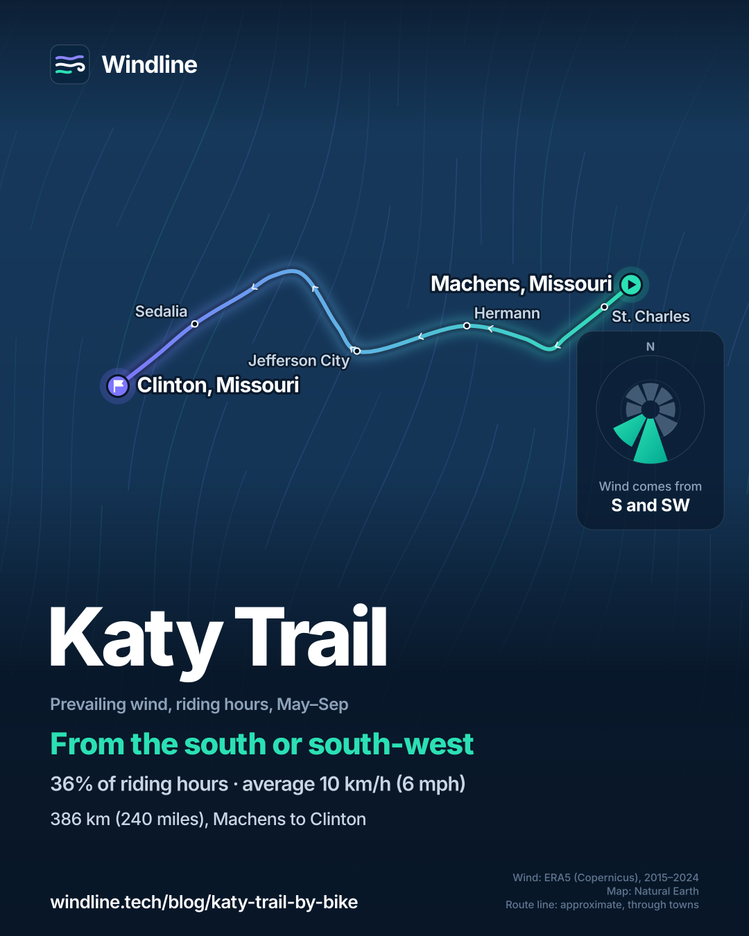
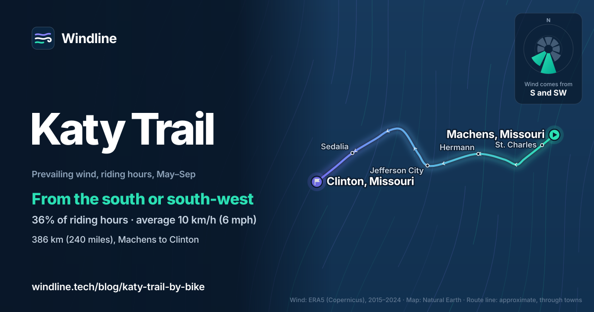
Cycling the Katy Trail means 386 km (240 miles) of mostly level, car-free crushed limestone across Missouri, from Machens near St. Louis to Clinton, usually over four to six days. Visit Missouri recommends spring and autumn. From May to September the riding-hour wind usually blows from the south or south-west, averaging 10 km/h (6 mph).
Key takeaways
- America's longest rails-to-trails project, on packed crushed limestone and closed to cars.
- Visit Missouri recommends spring and autumn; some trailheads turn their water off from November to March.
- In summer, riding-hour winds come mostly from the south or south-west, averaging 10 km/h (6 mph).
- Amtrak's Missouri River Runner can bring you back; carry-on bikes need a reservation.
Definitions
- Rail trail
- A path built on a disused railway line, usually gently graded and closed to motor traffic.
- Trailhead
- An access point to the trail, usually with parking and, in season, water and restrooms.
What is the Katy Trail?
The Katy Trail is a car-free path across Missouri on the old Missouri-Kansas-Texas railway, the "MKT" or "Katy". The National Park Service calls it America's longest rails-to-trails project, at 386 km (240 miles).
Cycling the Katy Trail is one of the gentlest long rides in our best cycling routes in North America, and one of the routes in our guide to the world's great cycling routes. It follows much of the Missouri River valley, on the line of Lewis and Clark's Corps of Discovery.
| Fact | Detail |
|---|---|
| Length | 386 km (240 miles), Machens to Clinton |
| State | Missouri, US |
| Usual days | 4–6 |
| Surface | Packed crushed limestone, mostly level |
| Access | 26 trailheads and four restored railway depots |
| Best months | Spring and autumn (Visit Missouri) |
| Entry | Free, open all year |
Which sections do people ride?
The trail falls into three parts: wine country in the east, the river valley in the middle, and quieter farmland in the west. You can ride one part over a weekend; the whole trail takes four to six days.
- East: St. Charles to Hermann. Visit Missouri says historic St. Charles marks the start of Lewis and Clark's expedition west. Wineries are common from Defiance and Augusta to Hermann, which you reach by a bridge on Highway 19.
- Middle: Jefferson City to Boonville. The trail runs past Missouri's capital and through Rocheport. Visit Missouri says that from New Franklin, across the river from Boonville, the trail is mostly flat and never strays far from the river.
- West: Sedalia to Clinton. The last 56 km (34.7 miles) are shared with horse riders. At Windsor, the Rock Island Trail branches off for 76 km (47.5 miles) to Pleasant Hill.
More than 20 small towns lie on or near the trail. Set your stages with how far you can cycle in a day.
Want this for your own route? Windline shows the wind for every stretch, timed to your pace. Free. Make a free ride page →
What's the weather like through the year?
Spring and autumn are mild but changeable; summer is hot and calmer.
Weather across the year on the Katy Trail (Machens to Clinton, Missouri), 2015–2024
| Month | Wind from | Average wind, km/h (mph) | Gusty days | Start → high, °C (°F) | Wet days |
|---|---|---|---|---|---|
| Jan | ~Changeable | 12 (8) | 11% | -2° (29°) → 4° (40°) | 27% |
| Feb | ~Changeable | 13 (8) | 14% | 0° (31°) → 7° (45°) | 29% |
| Mar | ~Changeable | 13 (8) | 19% | 5° (41°) → 14° (56°) | 39% |
| Apr | ~Changeable | 14 (9) | 26% | 10° (50°) → 19° (66°) | 38% |
| May | S, SW | 12 (7) | 15% | 17° (62°) → 24° (76°) | 46% |
| Jun | S, SW | 10 (6) | 5% | 22° (71°) → 30° (86°) | 35% |
| Jul | SW, S | 9 (5) | 2% | 23° (74°) → 31° (88°) | 37% |
| Aug | S, SW | 9 (5) | 2% | 22° (71°) → 30° (86°) | 34% |
| Sep | S, SE | 10 (6) | 2% | 18° (64°) → 28° (82°) | 22% |
| Oct | ~Changeable | 12 (8) | 12% | 11° (51°) → 21° (69°) | 28% |
| Nov | ~Changeable | 12 (8) | 12% | 5° (42°) → 13° (56°) | 28% |
| Dec | ~Changeable | 12 (8) | 12% | 1° (35°) → 8° (46°) | 22% |
April is the windiest month, averaging 14 km/h (9 mph), with a gust of 50 km/h (31 mph) or more on 26% of days, and May is the wettest, with 1 mm or more of rain on 46% of days. From June to August the wind drops to 9–10 km/h (5–6 mph), but the warmest riding hour reaches 30–31°C (86–88°F). September is the kindest month in the table: highs of 28°C (82°F), rain on 22% of days and gusts on just 2%. From October to April the wind is changeable in direction, and October's highs fall to 21°C (69°F).
Which way should you ride the Katy Trail?
In summer, riding east from Clinton has a small edge; in spring and autumn, choose by your train or car.
From May to September, the riding-hour wind came from the south or south-west in 36% of hours, averaging 10 km/h (6 mph), and 16% of hours were calm. The western section runs north-east from Clinton towards Rocheport, so a south-westerly is mostly behind eastbound riders there. Along the river the trail runs roughly east–west, so a southerly is mostly side-on, and on the short stretch from Rocheport down to Jefferson City it's partly against you.
These are averages of past seasons, not a forecast: for your actual days, read a route-timed forecast. Other routes are in our prevailing winds guide.
How do you get there and back?
The simplest way back is Amtrak's Missouri River Runner, which links St. Louis and Kansas City daily in about 5 hours 40 minutes. Visit Missouri suggests riding to a station along the trail and taking the train back.
- Stations: its ten stops include Kirkwood, Washington, Hermann, Jefferson City, Sedalia and Warrensburg.
- Bikes: carry-on bikes need a reservation, with the fee shown when you book. Remove your bags and arrive 30 minutes early.
- Sleeping: camping isn't allowed on the trail itself. Visit Missouri names Hermann City Parks and Cooper's Landing, near Columbia, for tents, and towns along the way have inns, motels and B&Bs.
- Water: some trailheads shut off water and close restrooms from November to March.
For another car-free tour, compare the GAP and C&O Canal, and plan with our multi-day tour guide.
Frequently asked questions
Can you ride the Katy Trail on a road bike?
Usually, yes. The National Park Service says the trail's relatively flat ground suits cycling on just about any type of bike. The surface is packed crushed limestone, not tarmac, so wider tyres are more comfortable and grip better when the stone is soft after rain.
Do you have to pay to ride the Katy Trail?
No. Visit Missouri lists Katy Trail State Park as free admission and open year-round, for walking, running and cycling along its whole length, and pets are welcome on a leash. You pay only for what you use: rooms, campgrounds, food, bike rental, and the train back.
Is there water on the Katy Trail in winter?
Only at some trailheads. Visit Missouri says water and restrooms are available at some trailheads all year, but at others the restrooms close and the water is shut off from November through March. In those months, carry enough to reach the next town and refill in cafés and shops.
Get the wind for your ride.
Upload a GPX, add your start time and pace, and see the headwind, gusts, rain and heat for every stretch of the route, timed to when you’ll be there. Free for riders.
Make a free ride page →Sources and method
- US National Park Service (2026). Katy Trail State Park
- Visit Missouri (Missouri Division of Tourism) (2026). How to experience the Katy Trail
- Visit Missouri (Missouri Division of Tourism) (2026). Katy Trail State Park
- Amtrak (2026). Missouri River Runner
- Amtrak (2026). Answers to your questions about bikes onboard
- Copernicus Climate Change Service (ECMWF) (2026). ERA5 hourly time-series data on single levels from 1940 to present
- Copernicus Climate Change Service (ECMWF) (2026). ERA5 hourly data on single levels from 1940 to present
- Natural Earth (2026). Terms of use (public domain map data)
Route facts come from the US National Park Service and Visit Missouri (Missouri Division of Tourism), read on 10 October 2026; the Missouri State Parks website could not be opened from our location. Best months: Visit Missouri recommends spring and autumn; we shade April, May, September and October, leaving out March and November because Visit Missouri says some trailheads shut off their water from November through March. Usual days are our arithmetic on the Adventure Cycling Association's loaded-touring pace of 64–89 km (40–55 miles) a day: 386 km ÷ 89 = 4.3 and ÷ 64 = 6.0, so four to six days. Amtrak details are from Amtrak's own pages. Conversions use 1 mile = 1.609 km, rounded. The weather table and the wind figures are Windline's own analysis of Copernicus ERA5 reanalysis, 1 January 2015 to 31 December 2024, downloaded from the Copernicus Climate Data Store (hourly time series for the nearest 0.25° grid cell), at three sample points along the route (Machens, Jefferson City and Clinton), with hours and days pooled across the three. Riding hours are 08:00 to 17:00 local time. Wind is the 10 m (33 ft) wind; the direction is the commonest two of eight compass sectors, hours under 5 km/h (3 mph) count as calm, and months with no steady direction are called changeable in direction. A gusty day has a riding-hour gust of 50 km/h (31 mph) or more; a wet day has 1 mm or more of rain; start is the 08:00 temperature and high is the warmest riding hour. The summer wind (May to September) is from the same data. These are averages of past seasons, not forecasts. The map's line is an approximate line through town waypoints, not an official route map; basemap from Natural Earth (public domain). Contains modified Copernicus Climate Change Service information (ERA5, 2015–2024); neither the European Commission nor ECMWF is responsible for any use of this information.
About the author
Wes Thomson, Founder, Windline. Wes Thomson builds Windline, live wind and weather forecasts timed to when riders reach each stretch of road. He built it for his own 2,093 km tour from Pont Drift to Cape Town, and writes these guides with the same focus: what the wind will do to your ride, and how to plan around it.