Cycling the Icefields Parkway: Lake Louise to Jasper by bike
Plan a three- or four-day ride from Lake Louise to Jasper, with the stops, bike campsites, park rules and the weather month by month.
The short answer
Cycling the Icefields Parkway means riding 232 km (144 miles) of paved highway from Lake Louise to Jasper, through Banff and Jasper national parks and over two passes, topping out at 2,070 m (6,791 ft). Plan on three or four days between June and September, when Parks Canada's campgrounds along the road are open.
Key takeaways
- You need a Parks Canada park pass, and most of the road has no cell coverage.
- Parks Canada advises riding before 10:00 or after 17:00 to avoid summer traffic.
- Jonas and Honeymoon Lake campgrounds keep shared, unreservable sites for unsupported bike tourers.
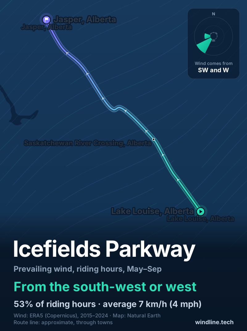
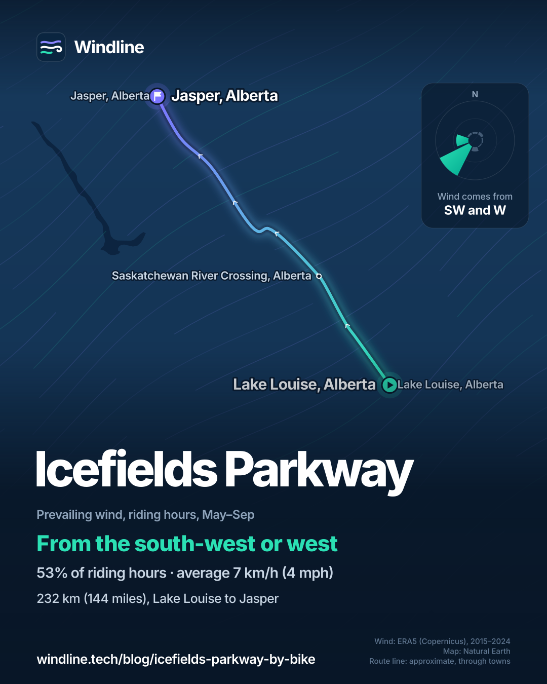
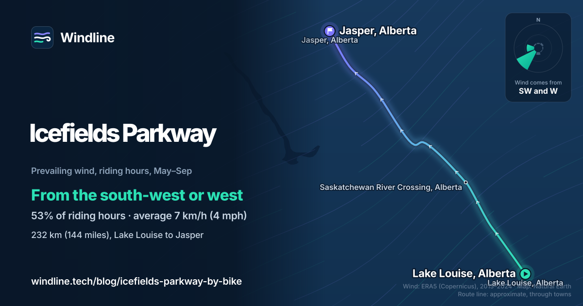
- Summer wind averages 7 km/h (4 mph), mostly south-west or west, and rarely decides your direction.
Definitions
- Park pass
- The Parks Canada admission pass every visitor needs to spend time in a national park, including on the Icefields Parkway.
- Shared bike camping site
- A campsite kept for unsupported cyclists, shared by several tents, with no reservations.
What is the Icefields Parkway like for cycling?
Cycling the Icefields Parkway takes you 232 km (144 miles) along Highway 93 North from Lake Louise to Jasper, Alberta, past glaciers, lakes and two high passes. It's one of three Canadian routes on our North America list and among the best cycling routes in the world.
| At a glance | Icefields Parkway |
|---|---|
| Length | 232 km (144 miles), Lake Louise to Jasper |
| Where | Alberta, Canada: Banff and Jasper national parks |
| Usual days | 3–4 |
| Surface | Paved highway, wide shoulder in most places |
| Signage | Highway 93 North road signs |
| Highest point | Bow Summit, 2,070 m (6,791 ft) |
| Best months | June to September |
Parks Canada warns that it's a busy road in summer.
How do riders split the 232 km?
Plan on three or four days, built around the few services and campgrounds.
| Stop | km (miles) from Lake Louise | What's there |
|---|---|---|
| Waterfowl Lakes | 60 (37) | Campground, first come, first served |
| Saskatchewan River Crossing | 80 (50) | Fuel and a restaurant |
| Rampart Creek | 91 (57) | Campground, reservations only; hostel |
| Sunwapta Pass | 125 (78) | 2,035 m (6,677 ft), the park boundary |
| Columbia Icefield Centre | 128 (80) | Restaurant; Wilcox and Icefield campgrounds |
| Jonas | 156 (97) | Shared bike camping site |
| Honeymoon Lake | 183 (114) | Shared bike camping site |
| Jasper | 232 (144) | Town, trains |
In three days: Lake Louise to Rampart Creek, 91 km (57 miles) over Bow Summit; 38 km (24 miles) over Sunwapta Pass to the Icefield campgrounds; then 103 km (64 miles) to Jasper. In four days, stop at Waterfowl Lakes, the Icefield and Honeymoon Lake: 60, 69, 54 and 49 km (37, 43, 34 and 30 miles). See how far you can cycle in a day.
Want this for your own route? Windline shows the wind for every stretch, timed to your pace. Free. Make a free ride page →
What's the weather like through the year?
It's cool even in summer: from June to September the warmest riding hour averages 9–16°C (48–61°F), and from November to March it stays below freezing.
Weather across the year on the Icefields Parkway, 2015–2024
| Month | Wind from | Average wind, km/h (mph) | Gusty days | Start → high, °C (°F) | Wet days |
|---|---|---|---|---|---|
| Jan | SW, S | 6 (4) | 24% | -14° (6°) → -11° (12°) | 44% |
| Feb | SW, NE | 6 (4) | 21% | -15° (4°) → -10° (13°) | 50% |
| Mar | SW, S | 6 (4) | 24% | -11° (12°) → -4° (24°) | 49% |
| Apr | SW, W | 7 (4) | 27% | -6° (21°) → 0° (32°) | 49% |
| May | SW, W | 6 (4) | 13% | 1° (33°) → 7° (44°) | 48% |
| Jun | SW, W | 7 (4) | 31% | 5° (41°) → 11° (52°) | 64% |
| Jul | SW, W | 7 (5) | 35% | 8° (47°) → 16° (61°) | 56% |
| Aug | SW, W | 7 (5) | 34% | 6° (44°) → 16° (60°) | 47% |
| Sep | SW, W | 7 (5) | 33% | 1° (33°) → 9° (48°) | 49% |
| Oct | SW, S | 7 (4) | 30% | -7° (20°) → 1° (34°) | 46% |
| Nov | SW, S | 6 (4) | 30% | -12° (10°) → -8° (18°) | 52% |
| Dec | SW, S | 6 (4) | 22% | -16° (3°) → -13° (8°) | 43% |
In July and August, mornings start at 6–8°C (44–47°F) and the warmest riding hour reaches about 16°C (60–61°F). June is the wettest month, with rain on 64% of days. The average wind stays light all year, 6–7 km/h (4–5 mph), but from June to September about a third of days bring a gust of 50 km/h (31 mph) or more. See how windy is too windy.
Which way should you ride it?
Either way works: the wind is light and mostly side-on, so pick a direction by logistics. From May to September, riding-hour wind came from the south-west or west in 53% of hours and averaged 7 km/h (4 mph); 31% of hours were calm.
The parkway runs roughly north-west from Lake Louise to Jasper. A south-west wind is side-on either way; a west wind is partly against you heading north. These are averages of past seasons, not a forecast, and valleys channel wind in ways a grid of 25–30 km (16–19-mile) cells can't see.
Check each day's wind before you start, and see choosing a direction by the prevailing wind.
What do you need to know before you go?
Buy a park pass, plan for no signal, and carry bear spray.
- Park pass: required. Buy it online or at a park gate.
- Timing: Parks Canada advises riding before 10:00 and after 17:00 to avoid traffic.
- Camping: Jonas (156 km) and Honeymoon Lake (183 km) each keep a shared bike site for unsupported tourers: 10 tents at Jonas, 6 at Honeymoon Lake, no reservations. In 2026, Jonas ran 3 June to 7 September and Honeymoon Lake 27 May to 14 September. Mosquito Creek and Rampart Creek hostels open all year.
- Wildlife: slow down at blind corners, make noise, and carry bear spray and know how to use it.
- Getting there: VIA Rail runs trains to Jasper from Edmonton and Vancouver, and Brewster Express buses use the parkway between Jasper and Banff.
Frequently asked questions
Is there phone signal on the Icefields Parkway?
Almost none. Parks Canada calls it a remote roadway with limited services and no cell coverage, and says there's none at any of its campgrounds on the parkway. In Jasper National Park, the signal stops beyond Athabasca Falls, about 30 km (19 miles) from Jasper. Download maps and each day's forecast before you leave, and tell someone your plan.
Do cyclists need bear spray on the Icefields Parkway?
Carry it. Banff National Park's cycling advice is to carry bear spray at all times on the trail and know how to use it, because a cyclist's speed and quietness risk sudden bear encounters. Slow down at shrubby stretches and blind corners, make noise, and skip the earbuds so you can hear what's around you.
How much does a park pass cost for the Icefields Parkway?
As of October 2026, Parks Canada charges C$12.25 a day for an adult, C$10.75 for a senior and C$24.50 for a family or group; youth go free. A daily pass is valid until 16:00 the day after you buy it, so a four-day ride needs several. The annual Discovery Pass, C$83.50 for an adult, covers Banff, Jasper and over 100 other places.
Get the wind for your ride.
Upload a GPX, add your start time and pace, and see the headwind, gusts, rain and heat for every stretch of the route, timed to when you’ll be there. Free for riders.
Make a free ride page →Sources and method
- Parks Canada (2026). Banff National Park: travelling the Icefields Parkway
- Parks Canada (2026). Banff National Park: Icefields Parkway stops and distances
- Parks Canada (2026). Jasper National Park: travelling the Icefields Parkway
- Parks Canada (2026). Banff National Park: road biking in the Lake Louise area
- Parks Canada (2026). Jasper National Park: road biking
- Parks Canada (2026). Banff National Park: biking (wildlife and highway safety)
- Parks Canada (2026). Jasper National Park: tent and RV camping
- Parks Canada (2026). Banff National Park: camping
- Parks Canada (2026). Banff National Park: park passes
- Parks Canada (2026). Banff National Park: fees
- Parks Canada (2026). Jasper National Park: getting here
- Copernicus Climate Change Service (ECMWF) (2026). ERA5 hourly time-series data on single levels from 1940 to present
- Natural Earth (2026). Terms of use (public domain basemap)
Official sources for the facts: the length (232 km), Bow Summit (2,070 m), Sunwapta Pass (2,035 m), the park pass, services, cell coverage, campground seasons and bike sites, wildlife advice and riding times are from the Parks Canada pages listed, read on 10 October 2026. Stop distances are Parks Canada's kilometres from Lake Louise; the stage lengths are differences between them. Campground dates are for the 2026 season and depend on the weather. Usual days are our arithmetic, as on our North America list: 232 km at 64–80 km (40–50 miles) a day, the Adventure Cycling Association's loaded-touring range for hilly routes, is 3–4 days. Best months are our summary of Parks Canada's summer-only campgrounds. The weather table and the wind figures are Windline's own analysis of hourly ERA5 reanalysis from the Copernicus Climate Change Service (ECMWF), 1 January 2015 to 31 December 2024, downloaded from the Copernicus Climate Data Store, at three sample points along the route (Lake Louise, Saskatchewan River Crossing and Jasper), using the nearest 0.25° grid cell, for riding hours 08:00 to 17:00 local time. Wind is at 10 m (33 ft); the prevailing wind is for May to September, with the two commonest of eight compass directions and hours under 5 km/h (3 mph) counted as calm. A gusty day has a riding-hour gust of 50 km/h (31 mph) or more; a wet day has 1 mm or more of rain; start is the temperature at 08:00 and high is the warmest riding hour. ERA5 cells are about 25–30 km (16–19 miles) across, so they smooth out valley winds and shelter. These are averages of past seasons, not forecasts. Conversions use 1 mile = 1.609 km and 1 m = 3.281 ft, rounded. The map's route line is approximate, drawn through landmarks along Highway 93, not an official route map; basemap from Natural Earth (public domain). Credit: Contains modified Copernicus Climate Change Service information (ERA5, 2015–2024); neither the European Commission nor ECMWF is responsible for any use of this information.
About the author
Wes Thomson, Founder, Windline. Wes Thomson builds Windline, live wind and weather forecasts timed to when riders reach each stretch of road. He built it for his own 2,093 km tour from Pont Drift to Cape Town, and writes these guides with the same focus: what the wind will do to your ride, and how to plan around it.