Cycling the North Coast 500: stages, weather and which way round
Plan the 830 km Highland loop from Inverness, from the stages and the weather each month to which way round suits the prevailing wind.
The short answer
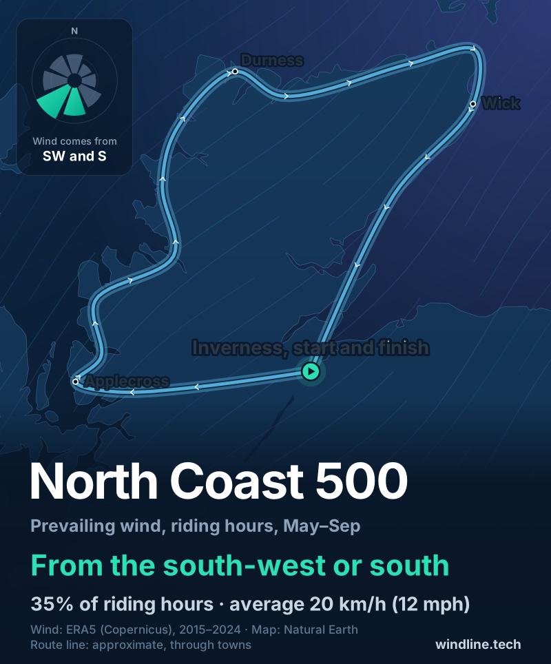
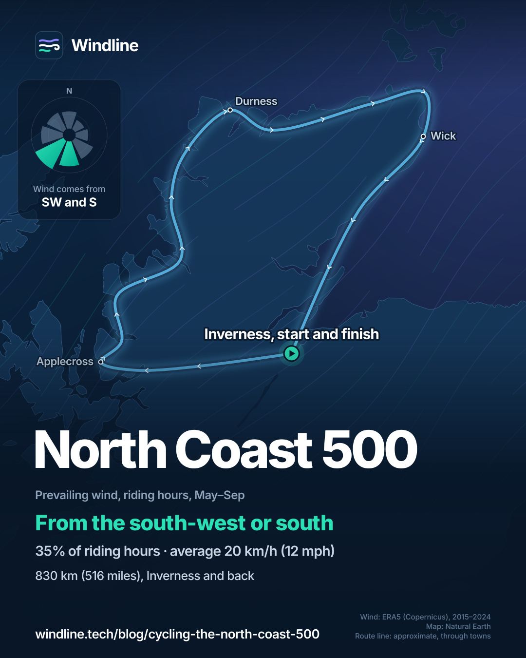
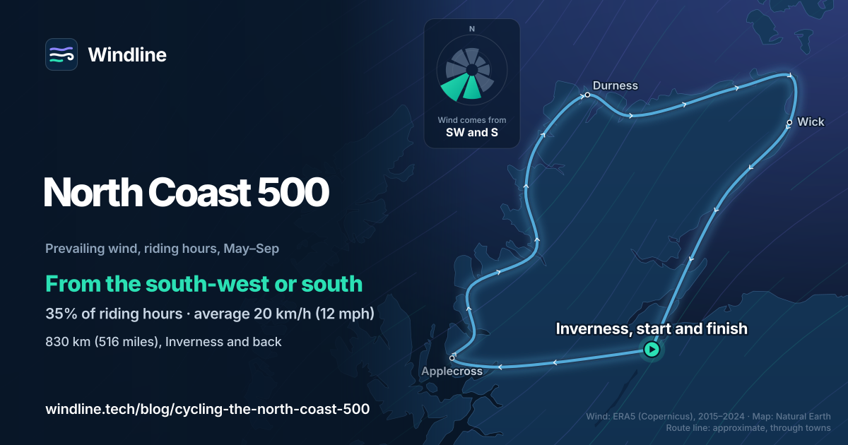
North Coast 500 cycling means an 830 km (516 mile) road loop of the Scottish Highlands from Inverness, usually ridden in about eight days, often on single-track roads. Late spring and early autumn are the best times. From May to September the wind blew most often from the south-west or south, which slightly favours clockwise.
Key takeaways
- The official loop is 830 km (516 miles), usually ridden in eight days.
- Summer riding-hour wind came most often from the south-west or south.
- Clockwise puts that wind behind you on the west and north coasts.
- Book beds early and learn how passing places work.
Definitions
- Single-track road
- A road only wide enough for one vehicle, with passing places where traffic can pull in to let others by.
- Prevailing wind
- The direction the wind blows from most often at a place, over a stated season.
What is the North Coast 500 by bike?
The North Coast 500 is a road loop of the northern Scottish Highlands, starting and finishing in Inverness. North Coast 500 cycling suits strong riders: the official site calls its cycling itinerary "aimed at the serious cyclist". It's in our best cycling routes in Europe, part of our guide to the best cycling routes in the world.
| The route at a glance | |
|---|---|
| Length | 830 km (516 miles); the official cycling page says 816 km (507 miles) |
| Country | Scotland, UK |
| Usual days | 8 |
| Surface | Paved roads, many single-track |
| Signage | None found for cyclists: follow a GPS track |
| Best months | Late spring and early autumn |
How do riders split it into stages?
The official cycling itinerary takes eight days of about 105 km (65 miles), "slightly more some days and considerably less on others". Day one runs Inverness to Lochcarron, about 106 km (66 miles).
- The west coast: over the Bealach na Bà to Applecross, then north to Durness.
- The north coast: east from Durness to John o' Groats, past open headlands.
- The east coast: south through Wick to Inverness on main roads.
The official site calls the NC500 "primarily a driving route" and warns that Contin to Garve is "particularly dangerous for cyclists". Shorter days? See how far you can cycle in a day.
Like coastal loops? Try the Cabot Trail in our North American list or the Great Ocean Road.
Want this for your own route? Windline shows the wind for every stretch, timed to your pace. Free. Make a free ride page →
What's the weather like through the year?
Cool, breezy and often wet: more than half of days are wet in every month, and summer highs average 13–15°C (55–58°F).
Weather across the year on the North Coast 500, 2015–2024
| Month | Wind from | Average wind, km/h (mph) | Gusty days | Start → high, °C (°F) | Wet days |
|---|---|---|---|---|---|
| Jan | SW, W | 27 (17) | 52% | 5° (41°) → 6° (43°) | 72% |
| Feb | SW, S | 27 (17) | 53% | 5° (40°) → 6° (43°) | 70% |
| Mar | SW, S | 24 (15) | 38% | 5° (41°) → 7° (44°) | 63% |
| Apr | ~Changeable | 21 (13) | 24% | 6° (43°) → 8° (47°) | 53% |
| May | ~Changeable | 20 (12) | 17% | 9° (48°) → 11° (51°) | 53% |
| Jun | ~Changeable | 19 (12) | 14% | 11° (52°) → 13° (55°) | 56% |
| Jul | W, SW | 18 (11) | 10% | 12° (54°) → 14° (57°) | 64% |
| Aug | SW, S | 19 (12) | 16% | 13° (55°) → 15° (58°) | 61% |
| Sep | S, SW | 22 (14) | 31% | 12° (53°) → 14° (56°) | 63% |
| Oct | SW, S | 25 (15) | 42% | 10° (49°) → 11° (52°) | 69% |
| Nov | S, SW | 25 (16) | 42% | 7° (45°) → 9° (47°) | 72% |
| Dec | SW, S | 26 (16) | 48% | 6° (43°) → 7° (45°) | 76% |
July is the least gusty month, with 10% of days bringing a riding-hour gust of 50 km/h (31 mph) or more, against 31% in September and 52% in January. May and June were changeable in direction, averaging 20 km/h (12 mph) and 19 km/h (12 mph). By September the wind averages 22 km/h (14 mph), mostly from the south or south-west.
Which way should you ride it, clockwise or anticlockwise?
Clockwise, by a small margin. From May to September, riding-hour wind came most often from the south-west or south (35% of hours), averaging 20 km/h (12 mph).
Clockwise, you head west from Inverness into that wind, then ride north up the west coast and east along the north coast with it mostly behind or across you. You pay it back on the run south from Wick. Anticlockwise flips this: help up the east coast, then a headwind along the exposed north coast and down the hilly west.
On a loop, a steady wind helps on one side as much as it hinders on the other, so changing direction moves the headwind rather than removing it. Clockwise puts the help where the big climb and exposed coast are, and the official itinerary starts that way.
It's a lean, not a rule: these are past averages, not a forecast, and in June the second commonest wind was northerly. As you start and finish in Inverness, decide on the morning from the forecast. See how much a headwind slows you down and choosing a direction by the wind.
How do you get there, and what should you know?
The Caledonian Sleeper runs from London Euston to Inverness and carries bikes free, with a reservation. It has eight bike spaces per service, one per guest, and no tandems, so book the bike with your ticket.
- Beds: the official site says to book accommodation in advance.
- Passing places: the Highway Code says pull into one on your left, or wait opposite one on your right. The official site adds: "If you are holding vehicles up behind you, let them pass."
- Camping: Scotland's access code allows lightweight wild camping, with conditions.
Frequently asked questions
How high is the Bealach na Bà, and should you ride it?
VisitScotland gives the pass to Applecross a maximum height of 626 m (2,054 ft), and it's single-track. The official North Coast 500 site calls it steep and winding, needing extra care, and not recommended for larger vehicles or motorhomes. On a bike, ride it fresh, early in the day, and check the forecast gusts before you commit to the exposed top.
Can you wild camp along the North Coast 500?
Yes, within the Scottish Outdoor Access Code. It allows lightweight camping in a tent, in small numbers, for no more than two or three nights in one place, away from buildings and roads. Use campsites where an area is busy, take all your rubbish away and never camp in a passing place or lay-by. Our guide to [wild camping rules by country](/blog/wild-camping-rules-by-country/) has the detail.
Are midges a problem on the North Coast 500?
They can be. The official North Coast 500 travel guide tells visitors to pack midge spray and, for extra protection, a midge net, particularly in the west and more sheltered areas. On a bike the worst moments are stops and setting up camp, so keep both where you can reach them.
Get the wind for your ride.
Upload a GPX, add your start time and pace, and see the headwind, gusts, rain and heat for every stretch of the route, timed to when you’ll be there. Free for riders.
Make a free ride page →Sources and method
- North Coast 500 (2026). North Coast 500 travel guide
- North Coast 500 (2026). Planning your North Coast 500 adventure
- North Coast 500 (2026). Cyclists itinerary
- North Coast 500 (2026). Cycling the NC500
- VisitScotland (2026). Inverness to Applecross and Torridon
- UK Government (2026). The Highway Code: general rules, techniques and advice for all drivers and riders (rule 155, single-track roads)
- Caledonian Sleeper (2026). Travelling with bikes
- NatureScot (Scottish Outdoor Access Code) (2026). Camping
- Copernicus Climate Change Service (ECMWF) (2026). ERA5 hourly time-series data on single levels from 1940 to present
- Quarterly Journal of the Royal Meteorological Society (2020). The ERA5 global reanalysis (Hersbach et al.)
Route facts are from the official North Coast 500 site, VisitScotland, the Highway Code, Caledonian Sleeper and the Scottish Outdoor Access Code, all opened on 10 October 2026. The official travel guide gives 516 miles (830 km); its cycling page gives 816 km, just over 500 miles. The eight days come from the official cycling itinerary of about 65 miles (105 km) a day, and its first day of about 66 miles (106 km) from Inverness to Lochcarron. The weather table and wind figures are Windline's own analysis of hourly ERA5 reanalysis from the Copernicus Climate Change Service (ECMWF), 1 January 2015 to 31 December 2024, downloaded from the Copernicus Climate Data Store, for riding hours 08:00 to 17:00 local time, at three sample points spread around the loop (Applecross, Durness and Wick), using the nearest 0.25° grid cell. Wind is at 10 m (33 ft); directions are where the wind blows from, in eight compass sectors, and hours under 5 km/h (3 mph) count as calm. A gusty day has a riding-hour gust of 50 km/h (31 mph) or more; a wet day has 1 mm or more of rain. Start is the 08:00 temperature and high is the warmest riding hour. Months with no settled direction are called changeable in direction. The direction advice compares that May–September wind with the compass heading of each side of the loop; on a closed loop a steady wind's push along the road sums to zero, so direction decides where the headwind falls, not how much there is. These are averages of past seasons, not forecasts. The shaded best months (May and September) are our reading of the official site's "late spring and early autumn". Conversions use 1 mile = 1.609 km and 1 m = 3.281 ft, rounded. Contains modified Copernicus Climate Change Service information (ERA5, 2015–2024); neither the European Commission nor ECMWF is responsible for any use of this information.
About the author
Wes Thomson, Founder, Windline. Wes Thomson builds Windline, live wind and weather forecasts timed to when riders reach each stretch of road. He built it for his own 2,093 km tour from Pont Drift to Cape Town, and writes these guides with the same focus: what the wind will do to your ride, and how to plan around it.