The Alpe-Adria Cycle Path: Salzburg to Grado, stages and weather
Plan Salzburg to the Adriatic by bike, from the eight stages and the Tauern train to the weather by month and the 2027 closure.
The short answer
The Alpe-Adria Cycle Path runs 410 km (255 miles) from Salzburg in Austria to Grado on Italy's Adriatic coast, usually in six to eight days. It is mostly cycle paths and quiet roads, with a short train through the Tauern tunnel. Its wind is light and changeable all year, so rain and climbing matter more.
Key takeaways
- The Tauern rail line closes from 8 February to 9 July 2027; a cyclist shuttle replaces it.
- Riding-hour wind averages 7–9 km/h (4–5 mph) in every month, light and changeable.
- Rain is the bigger risk; in May, 61% of days were wet.
- Many riders go south, from Salzburg to Grado, so the hardest stages come first.
Definitions
- Tauernschleuse
- The rail shuttle that carries cyclists and cars through the Tauern tunnel between Böckstein and Mallnitz, under the main ridge of the Alps.
- Valley wind
- A light local wind that mountain valleys make for themselves, changing direction with the time of day.
What is the Alpe-Adria Cycle Path?
The Alpe-Adria Cycle Path takes you from Salzburg over the Alps to the Adriatic at Grado, mostly on cycle paths and quiet roads. It's one of the ten routes on our list of the best cycling routes in Europe, and part of our guide to the world's great cycling routes.
| At a glance | Alpe-Adria Cycle Path |
|---|---|
| Length | 410 km (255 miles), Salzburg to Grado |
| Countries | Austria, Italy |
| Usual days | 6–8 |
| Surface | Mostly cycle paths and quiet roads, partly on old railway lines, with 20 tunnels |
| Signage | Well signposted throughout |
| Season | End of April to mid-October, when the Tauern shuttle has its own bike wagon |
The official site gives 5,410 m (17,750 ft) of climbing and 5,804 m (19,040 ft) of descent from Salzburg.
Which stages do people ride?
The official site splits the route into eight stages.
- Salzburg to Bischofshofen, up the Salzach valley past Werfen.
- Bischofshofen to Bad Gastein, climbing into the Gastein valley.
- Bad Gastein to Spittal an der Drau, through the Tauern tunnel by train to Mallnitz.
- Spittal to Villach, down the Drau valley.
- Villach to Tarvisio, uphill over the Italian border.
- Tarvisio to Venzone, through the Canal Valley on the old Pontebbana railway line.
- Venzone to Udine, onto the Friuli plain.
- Udine to Grado, via Palmanova and Aquileia to the lagoon.
The official site says ÖBB's Tauernsprinter-REX bike train has run daily from Schwarzach to Villach since July 2024, with room for up to 100 bikes. It skips the steep climb into the Gastein valley.
Want this for your own route? Windline shows the wind for every stretch, timed to your pace. Free. Make a free ride page →
What's the weather like through the year?
Our data shows light, changeable valley winds in every month, so rain and temperature shape your trip more.
Weather across the year on the Alpe-Adria Cycle Path, 2015–2024
| Month | Wind from | Average wind, km/h (mph) | Gusty days | Start → high, °C (°F) | Wet days |
|---|---|---|---|---|---|
| Jan | ~Changeable | 8 (5) | 13% | -1° (30°) → 4° (38°) | 38% |
| Feb | ~Changeable | 8 (5) | 13% | 1° (33°) → 6° (43°) | 40% |
| Mar | ~Changeable | 9 (5) | 12% | 3° (38°) → 9° (49°) | 41% |
| Apr | ~Changeable | 9 (5) | 12% | 7° (44°) → 13° (56°) | 44% |
| May | ~Changeable | 8 (5) | 8% | 12° (53°) → 17° (63°) | 61% |
| Jun | ~Changeable | 7 (5) | 6% | 17° (62°) → 23° (73°) | 51% |
| Jul | ~Changeable | 7 (4) | 5% | 18° (65°) → 24° (76°) | 50% |
| Aug | ~Changeable | 7 (4) | 3% | 18° (64°) → 24° (76°) | 45% |
| Sep | ~Changeable | 8 (5) | 8% | 13° (55°) → 19° (67°) | 45% |
| Oct | ~Changeable | 8 (5) | 10% | 9° (49°) → 15° (59°) | 40% |
| Nov | ~Changeable | 8 (5) | 10% | 5° (40°) → 9° (48°) | 40% |
| Dec | ~Changeable | 7 (4) | 9% | 1° (33°) → 5° (41°) | 37% |
Average riding-hour wind runs from 7 to 9 km/h (4–5 mph) all year, and gusty days are rare in summer: 3% in August. Rain is the real risk. In May, 61% of days were wet, and June and July still had about one wet day in two. July and August warm from 18°C (65°F) at 08:00 to 24°C (76°F), while September runs from 13°C (55°F) to 19°C (67°F).
Which way should you ride it?
South, from Salzburg to Grado, for the terrain rather than the wind. SalzburgerLand Tourism says you can ride either way, but many prefer going south because the harder stages come first and the run to the coast is relaxed.
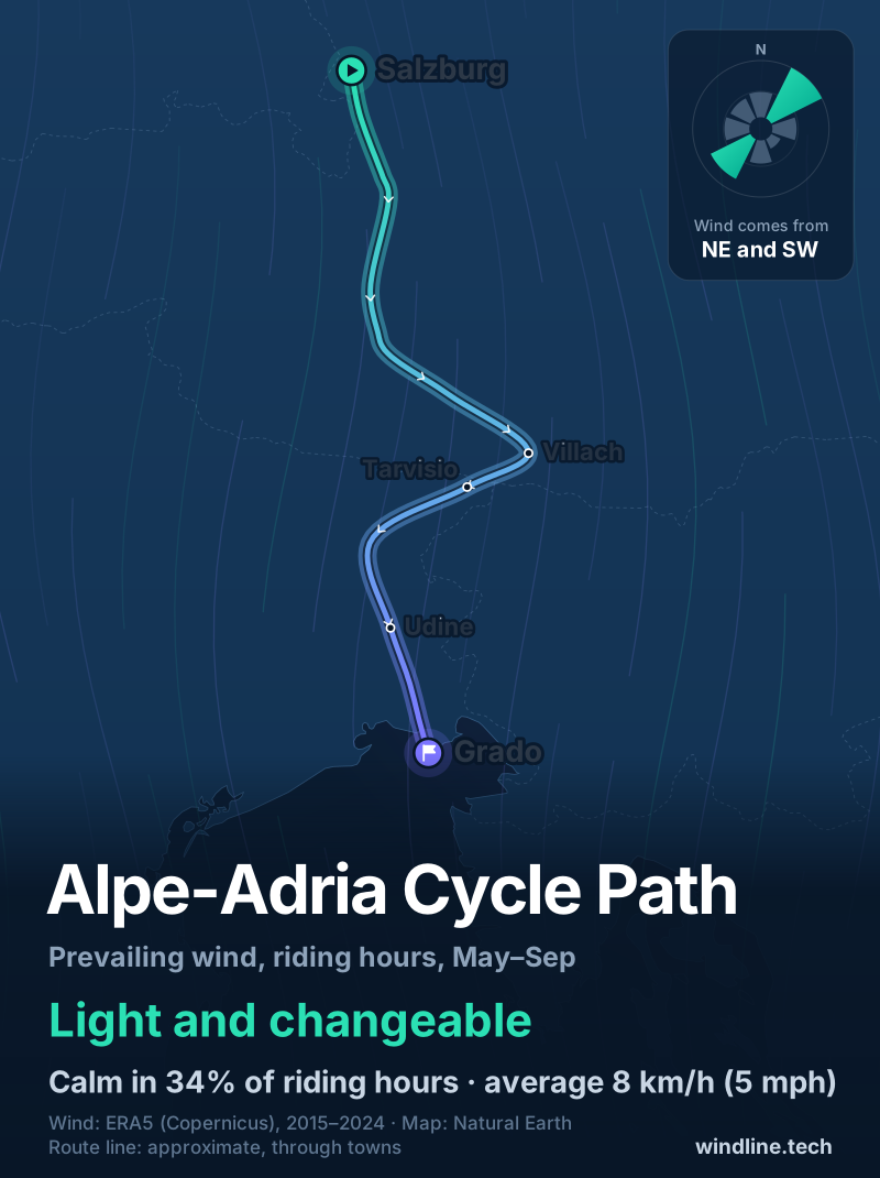
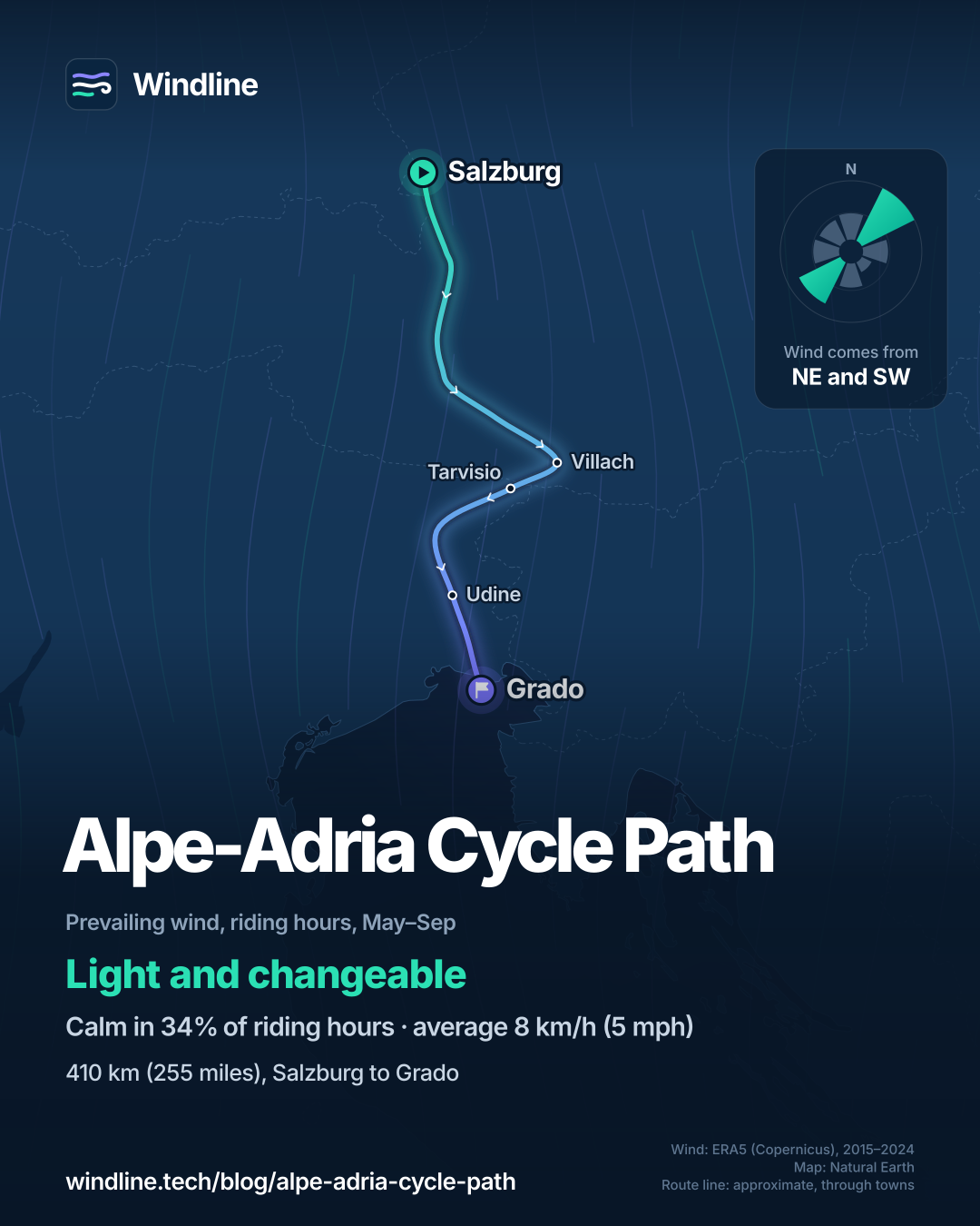
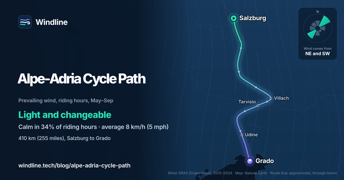
The wind gives no reason to choose. From May to September, 34% of riding hours were calm. The two commonest directions were opposites, north-east (16%) and south-west (13%), averaging 8 km/h (5 mph). Those are averages of past seasons, not a forecast. For your own dates, a gusty or wet forecast matters more.
How do you get through the Tauern tunnel and home from Grado?
By train both times. At the end of the Gastein valley, the route takes the Tauernschleuse from Böckstein to Mallnitz, south of the main Alpine ridge: 11 minutes, usually hourly, 50 bikes a train.
The 2027 closure. The official site says the Tauern line between Salzburg and Carinthia is completely closed from 8 February to 9 July 2027. An extra shuttle for cyclists is planned, with ÖBB publishing its timetable and booking details before the closure.
Getting home. In summer 2026 the BiciBus carried riders and bikes from Grado to Udine. It ran weekends and holidays from late April to mid-September, and daily in July and August. From Udine, the MICOTRA train runs to Villach, with changed times until 11 December 2026. The Canal Valley path from Malborghetto to Carnia is closed from November until spring 2027.
Then plan the stages around the trains, using how far you can cycle in a day.
Frequently asked questions
Can you ride the Alpe-Adria in spring 2027?
Yes, with a detour around the rail closure. The Tauern line between Salzburg and Carinthia is closed from 8 February to 9 July 2027. The official route site says replacement buses run hourly between Bischofshofen and Spittal-Millstättersee, and an extra cyclist shuttle will run. ÖBB will publish its timetable, capacity and booking before the closure begins. The car-carrying shuttle should restart from 10 July 2027.
Is the Alpe-Adria Cycle Path suitable for families?
Mostly. SalzburgerLand Tourism says it suits families as well as seasoned cyclists, with easy sections and public transport around the tough ones. The Alpine crossing is the hard part, where e-bikes help. Between Pass Lueg and Tenneck there is no dedicated cycle path, so the official site suggests families take the train from Golling to Werfen.
Can you ride the Alpe-Adria in winter?
Only the southern end. The official site says the path from Venzone to Grado is open all year, but the Canal Valley section from Malborghetto to Carnia is closed from November 2026 to spring 2027. The Tauern shuttle's own bike wagon runs only from the end of April to mid-October, and our data puts January highs at 4°C (38°F).
Get the wind for your ride.
Upload a GPX, add your start time and pace, and see the headwind, gusts, rain and heat for every stretch of the route, timed to when you’ll be there. Free for riders.
Make a free ride page →Sources and method
- Austrian National Tourist Office (2026). Alpe Adria Radweg
- Ciclovia Alpe Adria Radweg (official route site) (2026). Ciclovia Alpe Adria Radweg
- Ciclovia Alpe Adria Radweg (official route site) (2026). Packages and offers, with all eight stages
- Ciclovia Alpe Adria Radweg (official route site) (2026). Tauernschleuse Böckstein–Mallnitz
- Ciclovia Alpe Adria Radweg (official route site) (2026). Bike tour planning 2027 (Tauern Tunnel closure spring 2027)
- Ciclovia Alpe Adria Radweg (official route site) (2026). Changes to the MICOTRA service schedule from 28 September to 11 December 2026
- Ciclovia Alpe Adria Radweg (official route site) (2026). BiciBus summer 2026
- Ciclovia Alpe Adria Radweg (official route site) (2024). New Salzburg to Carinthia bike train
- Ciclovia Alpe Adria Radweg (official route site) (2023). Rail transfer Golling–Werfen
- SalzburgerLand Tourismus (2026). Alpe Adria Cycle Path
- Copernicus Climate Change Service (ECMWF) (2026). ERA5 hourly time-series data on single levels from 1940 to present
Route facts come from the official Ciclovia Alpe Adria Radweg site, the Austrian National Tourist Office and SalzburgerLand Tourismus, all opened on 10 October 2026. The length is 410 km, as given by the Austrian National Tourist Office and the official site's stage listing (the official home page gives 415 km). The shaded best months, May to September, are the whole months inside the Tauern shuttle's bike-wagon season (end of April to mid-October), the only season the route's official sources give. The weather table and every weather figure in the text are Windline's own analysis of ERA5 reanalysis (Copernicus Climate Change Service, ECMWF), 1 January 2015 to 31 December 2024, downloaded from the Copernicus Climate Data Store, for riding hours 08:00 to 17:00 local time, pooled over three sample points along the route (Salzburg, Villach and Grado) using the nearest 0.25° grid cell. Average wind is the 10 m (33 ft) wind. A gusty day has a riding-hour gust of 50 km/h (31 mph) or more; a wet day has 1 mm or more of rain; start is the 08:00 temperature and high is the warmest riding hour. The May–September wind (34% calm, north-east 16% and south-west 13% of riding hours, averaging 8 km/h or 5 mph) uses the same data and points; hours under 5 km/h (3 mph) count as calm. When the two commonest of eight compass directions are not neighbours and the hours barely agree on a direction, as in every month here, we call the wind light and changeable. These are averages of past years, not forecasts, and the sample points do not include the high ground around Bad Gastein. Contains modified Copernicus Climate Change Service information (ERA5, 2015–2024); neither the European Commission nor ECMWF is responsible for any use of this information. The route line on the map joins towns in riding order and is approximate, not an official route. Conversions use 1 mile = 1.609 km and 1 ft = 0.3048 m, rounded.
About the author
Wes Thomson, Founder, Windline. Wes Thomson builds Windline, live wind and weather forecasts timed to when riders reach each stretch of road. He built it for his own 2,093 km tour from Pont Drift to Cape Town, and writes these guides with the same focus: what the wind will do to your ride, and how to plan around it.