Hebridean Way cycling: the route, ferries, wind and which way to ride
The six sections, the two ferries, ten years of weather month by month, and which way the wind says to ride.
The short answer
Hebridean Way cycling means riding National Cycle Network Route 780 for 297 km (185 miles) from Vatersay to the Butt of Lewis, across 10 islands linked by 6 causeways and 2 ferries. Most riders take about a week and go northbound, because the summer wind blows most often from the south or south-west.
Key takeaways
- The route is 297 km (185 miles), signposted as NCN 780, in six day-sized sections.
- Ride it northbound; from May to September the wind came most often from the south or south-west.
- Book your bike on every CalMac ferry. It travels free, but space isn't guaranteed.
- July had the fewest gusty days in our data; February had the most.
Definitions
- Machair
- The low, grassy coastal plain behind the Atlantic beaches of the Outer Hebrides, open to the wind from the sea.
- Causeway
- A raised road across shallow water or sand; six of them join the islands on the Hebridean Way.
What is the Hebridean Way?
Hebridean Way cycling means riding National Cycle Network Route 780 the length of the Outer Hebrides, from Vatersay in the south to the lighthouse at the Butt of Lewis. It's one of Europe's most popular cycling routes, in our guide to the world's great cycling routes.
| At a glance | Hebridean Way |
|---|---|
| Length | 297 km (185 miles) |
| Country | Scotland, UK |
| Islands | 10, joined by 6 causeways and 2 ferries |
| Usual days | About a week, in 6 sections |
| Surface | Roads, some single-track with passing places |
| Signage | NCN Route 780, all the way |
| Best months | April to September |
All figures are from Visit Outer Hebrides, checked in October 2026.
What are the sections of the route?
Visit Outer Hebrides splits the route into six sections, each a typical day's ride. Barra to Benbecula is rated easy; Harris and Lewis are moderate to difficult.
| Section | From–to | Distance, km (miles) | Ferry |
|---|---|---|---|
| A | Vatersay–Daliburgh | 41 (26) | Sound of Barra, 40 min |
| B | Daliburgh–Clachan | 59 (37) | – |
| C | Clachan–Berneray | 44 (27) | – |
| D | Berneray–Tarbert | 34 (21) | Sound of Harris, 1 hour |
| E | Tarbert–Callanish | 61 (38) | – |
| F | Callanish–Butt of Lewis | 58 (36) | – |
In the south the road crosses causeways and loops onto the machair; Harris brings the climbs. The start is 8–10 km (5–6 miles) from Castlebay.
Want this for your own route? Windline shows the wind for every stretch, timed to your pace. Free. Make a free ride page →
What's the weather like through the year?
Windy and often wet in every month, with the calmest spell from May to July.
Weather across the year on the Hebridean Way, 2015–2024
| Month | Wind from | Average wind, km/h (mph) | Gusty days | Start → high, °C (°F) | Wet days |
|---|---|---|---|---|---|
| Jan | SW, W | 36 (23) | 66% | 7° (44°) → 8° (46°) | 77% |
| Feb | SW, W | 37 (23) | 68% | 7° (44°) → 7° (45°) | 73% |
| Mar | SW, S | 31 (19) | 49% | 7° (44°) → 8° (46°) | 62% |
| Apr | ~Changeable | 27 (16) | 32% | 7° (45°) → 9° (47°) | 48% |
| May | ~Changeable | 25 (15) | 24% | 10° (49°) → 11° (51°) | 48% |
| Jun | S, SW | 24 (15) | 25% | 12° (53°) → 13° (55°) | 52% |
| Jul | W, SW | 22 (14) | 18% | 13° (55°) → 14° (57°) | 58% |
| Aug | SW, S | 25 (16) | 29% | 14° (56°) → 14° (58°) | 62% |
| Sep | S, SW | 28 (18) | 43% | 13° (55°) → 14° (56°) | 65% |
| Oct | SW, W | 32 (20) | 57% | 11° (52°) → 12° (53°) | 72% |
| Nov | SW, S | 33 (21) | 58% | 9° (48°) → 10° (50°) | 76% |
| Dec | SW, W | 35 (22) | 63% | 8° (46°) → 9° (47°) | 81% |
Average riding-hour wind runs from 22 km/h (14 mph) in July to 37 km/h (23 mph) in February. Gusty days fall from 68% in February to 18% in July, then climb to 43% in September. Wet days are fewest in April and May (48%) and most frequent in December (81%). The day barely warms: in July it's 13°C (55°F) at 08:00 and 14°C (57°F) at the warmest hour, so pack for wind chill. April and May are changeable in direction, with no direction that dominates.
Which way should you ride the Hebridean Way?
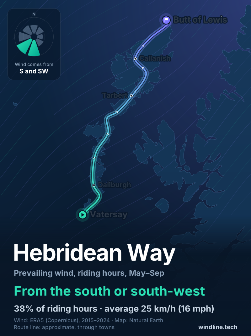
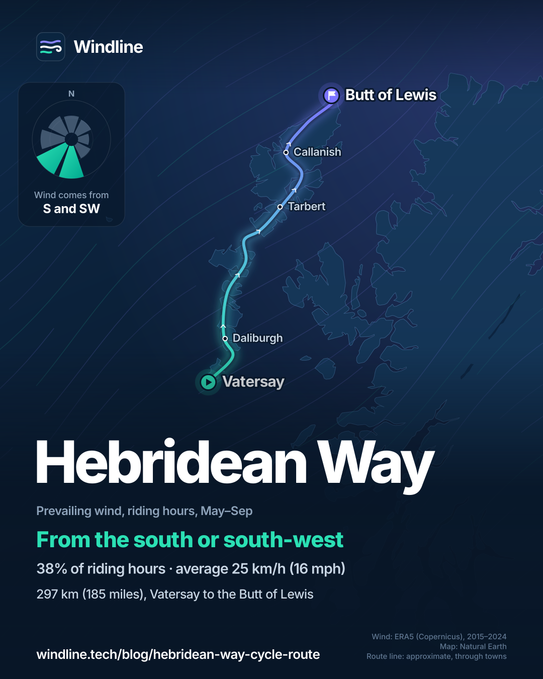
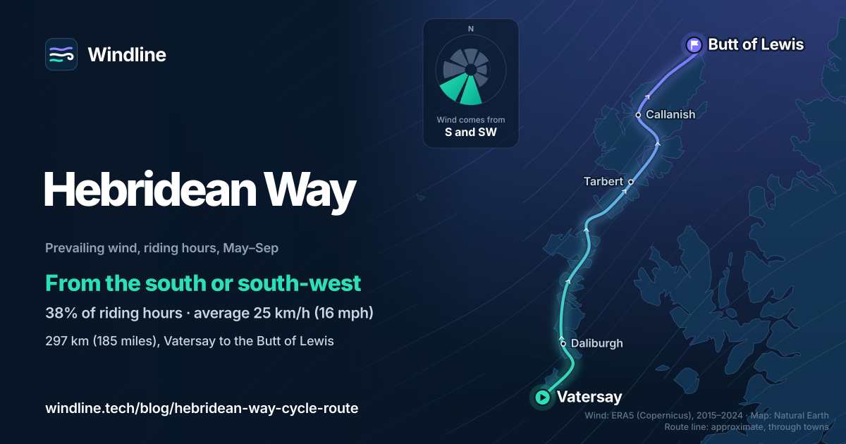
Northbound, from Vatersay to the Butt of Lewis. From May to September, the riding-hours wind came most often from the south or south-west (38% of hours), averaging 25 km/h (16 mph).
The south and south-west each took 19% of riding hours, against 10% from the north and 9% from the north-east. Visit Outer Hebrides gives the same advice. West winds (14%) hit the route side-on, and that's when the causeways and open machair feel most exposed; see how windy is too windy and riding in crosswinds.
These are averages of past seasons, not a forecast. Northerly days still happen, so check the forecast for your dates. Iceland's Ring Road asks the same question on a bigger island, while Japan's Shimanami Kaido is a far more sheltered island hop.
How do the ferries work, and how do you get there and back?
CalMac runs both crossings and the mainland links. Bikes travel free, but add them to every booking: CalMac says it can't guarantee space on busy sailings.
- Getting there: CalMac sails from Oban to Castlebay on Barra. You can also fly to Barra.
- Book ahead: CalMac asks everyone to book online in advance, even foot passengers.
- Check-in: bikes count as vehicles. That means 20 minutes before departure on the Sound of Barra and Sound of Harris crossings, and 45 minutes at Oban and Stornoway.
- Sundays: both island crossings run on Sundays, with fewer sailings. Summer 2026 cut Sunday-morning sailings across the Sound of Barra, and the Sound of Harris has no service on five Sundays in winter 2026–27, for maintenance.
- Going home: Visit Outer Hebrides puts Stornoway, for the ferry to Ullapool, 42 km (26 miles) back from the Butt of Lewis. Local buses on Lewis and Harris have little room for bikes.
Timetables change with season and tide, so check CalMac's service status before each crossing, and book beds early.
Frequently asked questions
How hard is the Hebridean Way by bike?
The south is the easy part. Visit Outer Hebrides rates Barra to Benbecula easy and North Uist easy to moderate, while Harris and Lewis are moderate to difficult, with a climb through the hills of North Harris. At its planning pace of 10 km/h (6 mph), each of its six sections takes about three and a half to six and a quarter hours.
What's open on a Sunday in the Outer Hebrides?
Less than you might expect. Visit Outer Hebrides says most shops, cafés, filling stations and attractions on Lewis and Harris close on Sundays, while Uist and Barra keep a selection open, sometimes with shorter hours. Hotels serve food everywhere, but there are no public buses on any island on a Sunday. Plan food and the final days around it.
Can you wild camp on the Hebridean Way?
Yes, with a lightweight tent. Visit Outer Hebrides says wild camping is legal under the Scottish Outdoor Access Code if you pitch responsibly and leave no trace. Motorhomes, campervans and cars with tent boxes don't count as wild camping and must use official sites. See our guide to [wild camping rules by country](/blog/wild-camping-rules-by-country/).
Get the wind for your ride.
Upload a GPX, add your start time and pace, and see the headwind, gusts, rain and heat for every stretch of the route, timed to when you’ll be there. Free for riders.
Make a free ride page →Sources and method
- Visit Outer Hebrides (2026). Cycling the Hebridean Way (route leaflet)
- Visit Outer Hebrides (2026). The Hebridean Way
- Visit Outer Hebrides (2026). Hebridean Way: advice and safety tips
- Visit Outer Hebrides (2026). Hebridean Way: travelling with your bike
- Visit Outer Hebrides (2026). Outer Hebrides FAQs
- CalMac (Caledonian MacBrayne) (2026). Bicycles and equipment tickets
- CalMac (Caledonian MacBrayne) (2026). Travelling with my bike
- CalMac (Caledonian MacBrayne) (2026). Ardmhor (Barra) – Eriskay route information
- CalMac (Caledonian MacBrayne) (2026). Ardmhor (Barra) – Eriskay summer 2026 timetable
- CalMac (Caledonian MacBrayne) (2026). Berneray – Leverburgh route information
- CalMac (Caledonian MacBrayne) (2026). Berneray – Leverburgh winter 2026–2027 timetable
- CalMac (Caledonian MacBrayne) (2026). Oban – Castlebay route information
- CalMac (Caledonian MacBrayne) (2026). Stornoway – Ullapool route information
- Copernicus Climate Change Service (ECMWF) (2026). ERA5 hourly time-series data on single levels from 1940 to present
Route facts (length, islands, causeways, ferries, signage, sections, section distances and difficulty, best months, Sunday opening and camping) come from Visit Outer Hebrides, and ferry facts (bikes, booking, check-in, Sunday sailings) from CalMac's own route pages, FAQs and timetables, all opened on 10 October 2026. Ferry timetables change by season and tide, so treat them as a guide and check CalMac before each crossing. The weather table and wind figures are Windline's own analysis of hourly ERA5 reanalysis data (Copernicus Climate Change Service, ECMWF), 1 January 2015 to 31 December 2024, downloaded from the Copernicus Climate Data Store, for riding hours 08:00 to 17:00 local time at three sample points along the route (Vatersay, Lochmaddy and the Butt of Lewis), using the nearest 0.25° grid cell and pooling the points. Wind direction is the commonest two of eight compass sectors (hours under 5 km/h (3 mph) count as calm); months with no settled direction are shown as changeable in direction. A gusty day has a riding-hour gust of 50 km/h (31 mph) or more; a wet day has 1 mm or more of rain; start is the temperature at 08:00 and high is the warmest riding hour. The direction advice uses May to September riding hours. These are averages of past seasons, not forecasts. Contains modified Copernicus Climate Change Service information (ERA5, 2015–2024); neither the European Commission nor ECMWF is responsible for any use of this information. The map's line joins places along the route in riding order; it is approximate and not an official route map. Conversions use 1 mile = 1.609 km, rounded.
About the author
Wes Thomson, Founder, Windline. Wes Thomson builds Windline, live wind and weather forecasts timed to when riders reach each stretch of road. He built it for his own 2,093 km tour from Pont Drift to Cape Town, and writes these guides with the same focus: what the wind will do to your ride, and how to plan around it.