Cycling the Great Ocean Road: route, traffic, wind and which way
Plan the 243 km ride from Torquay to Allansford, see the weather for every month, and choose your direction from past winds.
The short answer
Great Ocean Road cycling means riding 243 km (151 miles) of sealed coast road from Torquay to Allansford, near Warrnambool, in Victoria, Australia, usually over three or four days. Ride early to avoid traffic and aim for spring or autumn. In past seasons, summer winds favoured riding west and spring winds favoured riding east.
Key takeaways
- Torquay to Allansford is 243 km (151 miles) of sealed road, usually ridden in three or four days.
- The region's cycling guide favours spring and autumn; summer brings the heaviest traffic.
- Summer winds leaned south-easterly, helping westbound riders; spring westerlies helped eastbound ones.
- Riding west keeps you on the ocean side, because Australia drives on the left.
- In summer, check fire danger ratings and VicEmergency before every day's ride.
What is the Great Ocean Road by bike?
The Great Ocean Road, the B100, runs 243 km (151 miles) along Victoria's south coast from the surf town of Torquay to Allansford, near Warrnambool. It's one of our 10 most popular cycling tours in Australia and New Zealand, part of our guide to the world's great cycling routes.
| The route at a glance | |
|---|---|
| Length | 243 km (151 miles), Torquay to Allansford |
| State | Victoria, Australia |
| Usual days | 3–4 (our estimate) |
| Surface | Sealed road, shared with traffic |
| Signage | Road signs for the B100 |
| Best months | Spring (Sep–Nov) and autumn (Mar–May) |
Which stretches do people ride?
Most riders split it into coast, forest and cliff-top sections, and many ride only Torquay to Apollo Bay.
- Torquay to Lorne: the surf coast, via Anglesea.
- Lorne to Apollo Bay: the road clings to the coast; the region's official cycling guide includes it in its Lorne to Apollo Bay Otways tour.
- Apollo Bay to Allansford: inland through the Otways to Lavers Hill, which Visit Great Ocean Road places at the road's highest point, then back to the coast past the Twelve Apostles and Port Campbell.
The Twelve Apostles draw crowds: Parks Victoria has recorded daily summer peaks of 15,000 visitors at Port Campbell National Park and asks visitors to arrive early.
At 243 km it's under a third of the North Coast 500's 830 km (516-mile) loop.
Want this for your own route? Windline shows the wind for every stretch, timed to your pace. Free. Make a free ride page →
What's the weather like through the year?
Mild all year, but winter is windier, gustier and wetter than summer.
Weather across the year on the Great Ocean Road, 2015–2024
| Month | Wind from | Average wind, km/h (mph) | Gusty days | Start → high, °C (°F) | Wet days |
|---|---|---|---|---|---|
| Jan | SE, S | 17 (11) | 16% | 16° (61°) → 21° (70°) | 23% |
| Feb | S, SE | 17 (11) | 17% | 16° (60°) → 21° (69°) | 20% |
| Mar | SE, S | 17 (10) | 17% | 15° (59°) → 20° (68°) | 25% |
| Apr | W, SW | 16 (10) | 16% | 14° (57°) → 18° (64°) | 32% |
| May | W, NW | 19 (12) | 30% | 12° (53°) → 15° (59°) | 43% |
| Jun | NW, N | 17 (11) | 24% | 10° (50°) → 13° (55°) | 41% |
| Jul | NW, W | 20 (13) | 33% | 9° (49°) → 13° (55°) | 49% |
| Aug | W, NW | 20 (13) | 35% | 10° (49°) → 13° (56°) | 52% |
| Sep | W, NW | 20 (12) | 32% | 11° (52°) → 14° (58°) | 45% |
| Oct | W, SW | 18 (11) | 27% | 12° (53°) → 16° (61°) | 41% |
| Nov | W, SW | 18 (11) | 22% | 13° (56°) → 18° (64°) | 35% |
| Dec | SE, W | 18 (11) | 23% | 15° (59°) → 20° (67°) | 27% |
From January to March, 16–17% of days were gusty, 20–25% were wet, and highs reached 20–21°C (68–70°F). Through spring the wind averaged 18–20 km/h (11–12 mph), while gusty days fell from 32% in September to 22% in November and wet days from 45% to 35%. These figures pool three points, so open headlands and cliff tops can feel rougher; see riding in crosswinds.
Which way should you ride it?
West in summer, east in spring, if past winds decide it. The road runs broadly east–west, though Torquay to Apollo Bay heads south-west.
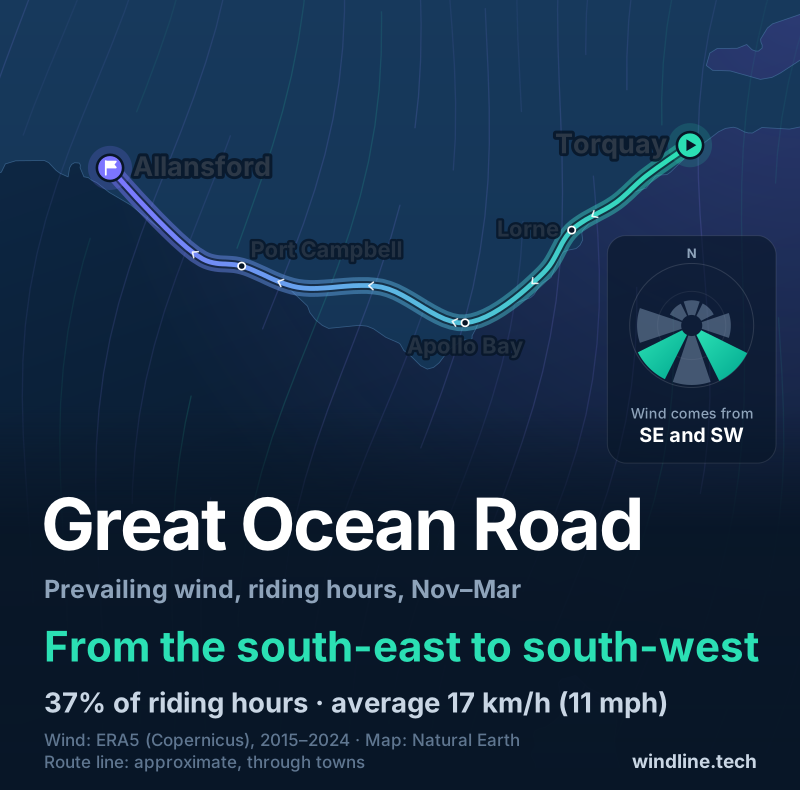
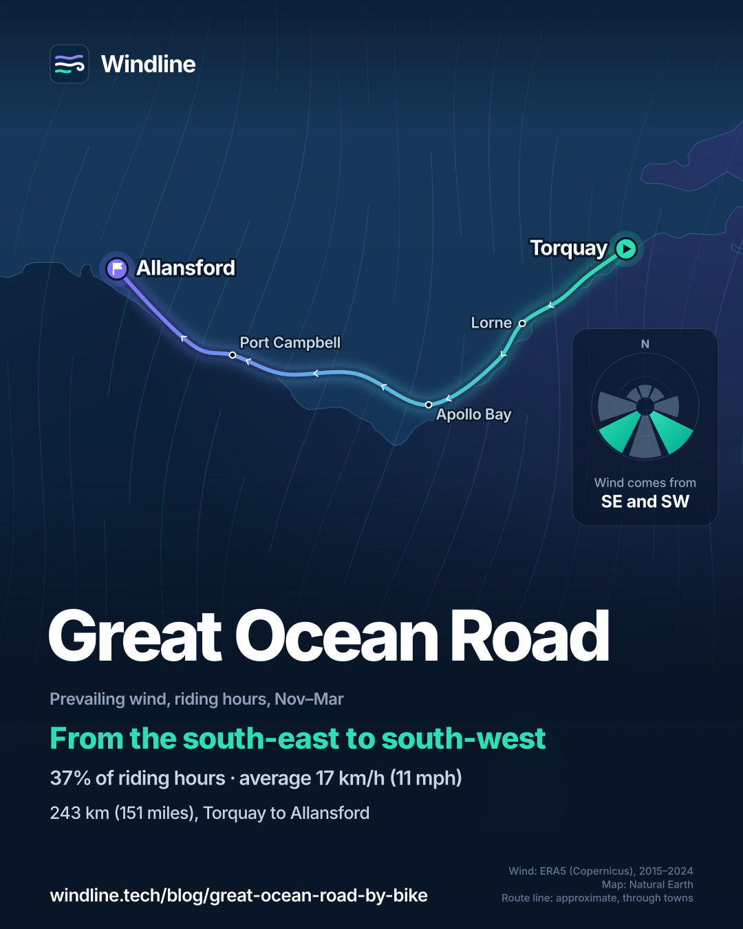
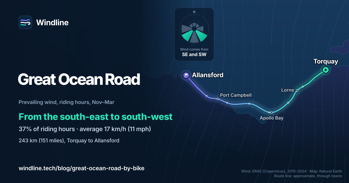
From November to March, riding-hour wind came from between south-east and south-west in 54% of hours, averaging 17 km/h (11 mph). Overall it was close to even: westerly winds made up 39% of hours and easterly ones 34%. The month matters more. From December to March, south-easterlies were commonest, behind or across westbound riders. From April to November, westerlies led, favouring eastbound riders.
Riding west also keeps you on the ocean side, because Australia drives on the left, just as southbound riders do on the Pacific Coast. These are past averages, not a forecast, and even a light headwind adds up (see how much a headwind slows you down).
How do you get there, and what should you know?
By train. Visit Great Ocean Road lists V/Line trains from Melbourne's Southern Cross to Geelong and Warrnambool. V/Line carries bikes when there's space, first come, first served, and warns that space on these lines is limited. Its coaches take only small folding bikes, so plan to ride back or take the train.
- Traffic: the official cycling guide calls early morning safest and says to avoid weekday peak times and weekend midday onwards. Book beds early for late December to January and Easter, the busiest times.
- Bushfires: CFA advises reconsidering travel through bushfire risk areas on Extreme days and not travelling to them on Catastrophic days. Set VicEmergency watch zones for your route.
- Heat: Victoria's health department says to move strenuous activity to a cooler time and drink before you're thirsty. See cycling in the heat.
Frequently asked questions
When is the safest time to cycle the Great Ocean Road?
Early morning. The region's official road cycling guide calls it the safest time to ride, and advises avoiding weekday peak traffic and riding from midday on weekends and public holidays. You may ride two abreast, but it suggests single file when traffic is heavy or the road winds. Visit Great Ocean Road names late December to January and Easter as the busiest times.
How long does it take to cycle the Great Ocean Road?
Three or four days for the whole 243 km (151 miles), by our estimate at 60–80 km (37–50 miles) a day. Many riders do a shorter piece, such as Torquay to Apollo Bay, which the region's cycling guide covers in stages. To set a daily distance you can enjoy, see [how far you can cycle in a day](/blog/how-far-can-you-cycle-in-a-day/).
Can you cycle the Great Ocean Road in winter?
You can, but expect wind and rain. In our 2015–2024 data, July and August averaged 20 km/h (13 mph) in riding hours, with a gusty day one time in three (33–35%) and rain on about half of days (49–52%). Highs were around 13°C (55°F). The region's cycling guide still recommends mild winter days.
Get the wind for your ride.
Upload a GPX, add your start time and pace, and see the headwind, gusts, rain and heat for every stretch of the route, timed to when you’ll be there. Free for riders.
Make a free ride page →Sources and method
- Visit Great Ocean Road (2026). Frequently asked questions
- Visit Great Ocean Road (2026). Getting here
- Visit Great Ocean Road (2026). The Perch at Lavers Hill
- Surf Coast Shire (Geelong, the Bellarine and Surf Coast) (2017). Great Ocean Rides, the region's official road cycling guide
- Parks Victoria (2023). Twelve Apostles summer traffic and visitor changes
- V/Line (2026). Bikes, luggage and pets
- Country Fire Authority (CFA) (2026). About Fire Danger Ratings
- Country Fire Authority (CFA) (2023). Travellers warned to stay informed this summer
- Department of Health, Victoria (2026). Simple steps to stay safe during extreme heat this summer
- Copernicus Climate Change Service (ECMWF) (2026). ERA5 hourly time-series data on single levels from 1940 to present
Route facts are from the official bodies in the sources, as checked on 10 October 2026. The length, 243 km from Torquay to Allansford, is Visit Great Ocean Road's figure. The three to four days are our estimate, as in our Australia and New Zealand list: 60–80 km (37–50 miles) a day. Best months follow the region's official road cycling guide, which says some of the best riding is in autumn and spring; we read these as Australia's calendar seasons, autumn March to May and spring September to November. Weather across the year: Windline's own analysis of hourly ERA5 reanalysis (Copernicus Climate Change Service, ECMWF), 1 January 2015 to 31 December 2024, downloaded from the Copernicus Climate Data Store, at three sample points along the route (Torquay, Apollo Bay and Allansford, nearest 0.25° grid cell), pooled. Riding hours are 08:00 to 17:00 local time. Wind is 10 m (33 ft) wind; the directions shown are the two commonest of eight compass sectors, and months when the hours barely agree on a direction would be shown as changeable; hours under 5 km/h (3 mph) count as calm. A gusty day has a riding-hour gust of 50 km/h (31 mph) or more; a wet day has 1 mm or more of rain; start is the 08:00 temperature and high is the warmest riding hour. The direction figures use November to March riding hours; westerly means the south-west, west and north-west sectors, easterly the north-east, east and south-east sectors. The road's broad east–west line comes from the sample points: Torquay and Allansford lie within 0.1° of latitude of each other. These are averages of past seasons, not forecasts. Contains modified Copernicus Climate Change Service information (ERA5, 2015–2024); neither the European Commission nor ECMWF is responsible for any use of this information. The map's route line joins towns in riding order; it is approximate and not an official route. Conversions use 1 mile = 1.609 km, rounded; °F = °C × 1.8 + 32.
About the author
Wes Thomson, Founder, Windline. Wes Thomson builds Windline, live wind and weather forecasts timed to when riders reach each stretch of road. He built it for his own 2,093 km tour from Pont Drift to Cape Town, and writes these guides with the same focus: what the wind will do to your ride, and how to plan around it.