Cycling Tasmania's east coast: the Great Eastern Drive by bike
Plan the Great Eastern Drive town by town, see the weather for every month, and choose a direction and a way there.
The short answer
Cycling Tasmania's east coast means riding the Great Eastern Drive, about 220 km (137 miles) of sealed road from Orford to St Helens via Swansea, Coles Bay and Bicheno. East Coast Tasmania suggests at least a week from Hobart or Launceston, at about 60 km (37 miles) a day. December to May is the best season.
Key takeaways
- Allow a week from Hobart or Launceston at 60 km (37 miles) a day, or two with rest days.
- In past summers the riding-hour wind averaged 19 km/h (12 mph) and often changed direction.
- From November to March, northerly winds blew more often than southerly ones.
- Freycinet National Park needs a park pass; a two-month Holiday Person Pass covers riders.
What is the Great Eastern Drive?
It's the touring road along Tasmania's east coast, about 220 km (137 miles) from Orford in the south to St Helens in the north. East Coast Tasmania, the regional tourism body, promotes cycling it as a tour, and it's one of our 10 most popular cycling tours in Australia and New Zealand. It sits in our guide to the world's great cycling routes.
| The route at a glance | |
|---|---|
| Length | About 220 km (137 miles), Orford to St Helens |
| State | Tasmania, Australia |
| Usual days | 7–14, starting and finishing in Hobart or Launceston |
| Surface | Sealed road, shared with traffic |
| Signage | Ordinary road signs: it's a road trip, not a waymarked cycle path |
| Best months | December to May |
Which stages do people ride?
Most riders go town to town, using the distances East Coast Tasmania publishes, with Coles Bay and Freycinet National Park as a side trip.
| Leg | Distance, km (miles) |
|---|---|
| Orford to Triabunna | 7.5 (5) |
| Triabunna to Swansea | 50 (31) |
| Swansea to Coles Bay | 58 (36) |
| Coles Bay to Bicheno | 38 (24) |
| Bicheno to Scamander | 58 (36) |
| Scamander to St Helens | 19 (12) |
Those legs add to about 230 km (143 miles). Riding from Hobart and on to Launceston makes about 475 km (295 miles), hence the tourism body's advice: at least a week at about 60 km (37 miles) a day, or two with rest days.
Want this for your own route? Windline shows the wind for every stretch, timed to your pace. Free. Make a free ride page →
What's the weather like through the year?
Plan for wind more than heat: the coast is breezy all year, and summer riding hours stay mild.
Weather across the year on the Great Eastern Drive, 2015–2024
| Month | Wind from | Average wind, km/h (mph) | Gusty days | Start → high, °C (°F) | Wet days |
|---|---|---|---|---|---|
| Jan | NE, N | 19 (11) | 25% | 16° (60°) → 20° (67°) | 32% |
| Feb | ~Changeable | 18 (11) | 22% | 15° (59°) → 19° (67°) | 33% |
| Mar | N, NW | 18 (11) | 22% | 14° (57°) → 18° (65°) | 31% |
| Apr | NW, W | 17 (11) | 20% | 13° (55°) → 16° (62°) | 23% |
| May | NW, W | 19 (12) | 30% | 11° (51°) → 14° (57°) | 27% |
| Jun | NW, W | 18 (11) | 24% | 9° (48°) → 12° (54°) | 29% |
| Jul | NW, W | 19 (12) | 32% | 8° (47°) → 12° (53°) | 28% |
| Aug | NW, W | 20 (12) | 33% | 9° (47°) → 12° (53°) | 30% |
| Sep | NW, N | 20 (12) | 35% | 10° (50°) → 13° (56°) | 31% |
| Oct | NW, N | 20 (12) | 32% | 11° (51°) → 15° (58°) | 37% |
| Nov | N, NW | 19 (12) | 28% | 12° (54°) → 16° (61°) | 38% |
| Dec | ~Changeable | 19 (12) | 28% | 14° (57°) → 18° (64°) | 32% |
From December to May, the average riding-hour wind was 17–19 km/h (11–12 mph), and 20–30% of days had a gust of 50 km/h (31 mph) or more. January mornings started at 16°C (60°F) and warmed to only 20°C (67°F). July to September had the most gusty days, 32–35%, and October and November the most wet days, 37–38%.
Which way should you ride it?
In past summers, heading south from St Helens to Orford had the wind behind it a little more often. The margin is small, and East Coast Tasmania says you can start from either end.
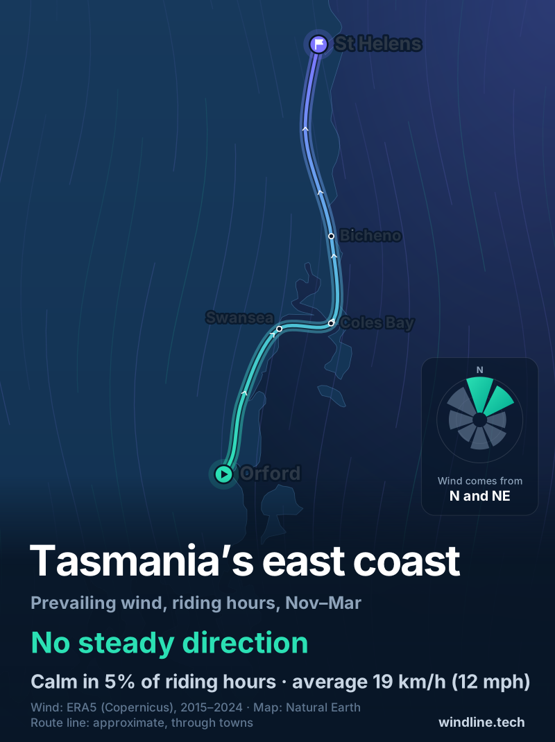
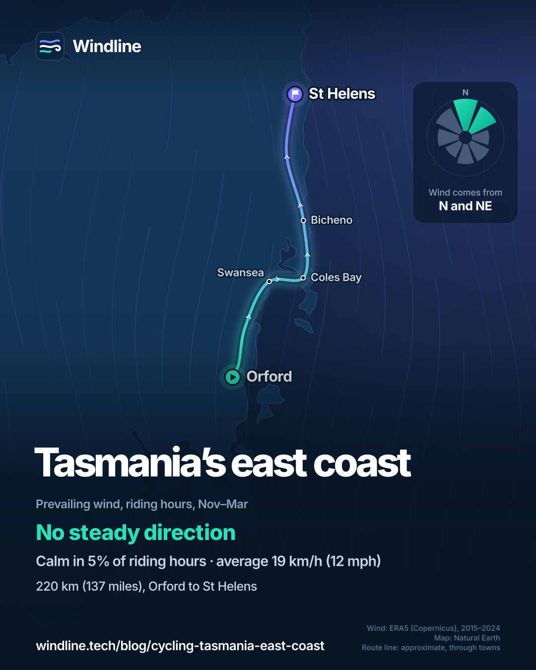
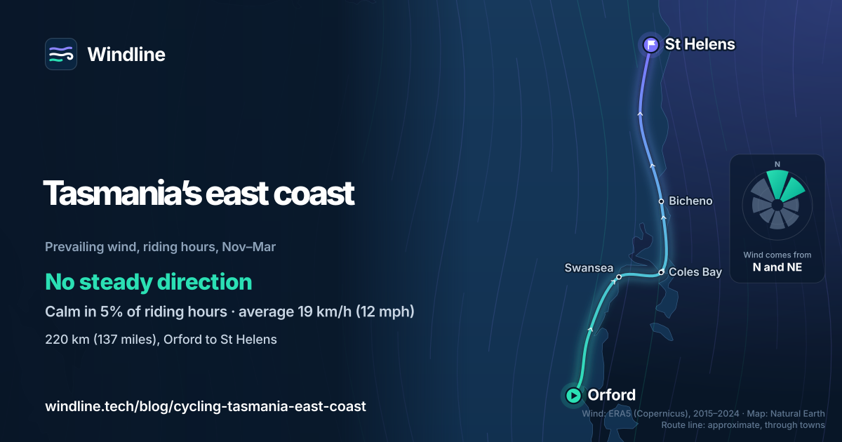
In our November–March riding hours for 2015–2024, the wind came from the north-west, north or north-east 46% of the time, and from the south-west, south or south-east 30%. The commonest two directions made up only 32% of hours, so it's changeable in direction. It averaged 19 km/h (12 mph).
The road runs mostly north from Orford, so riders going that way met northerly headwinds more often. These are past averages, not a forecast: pick the direction that fits your transport, then check the wind for your dates. At 19 km/h (12 mph), a headwind noticeably slows you down. Our prevailing winds guide compares other routes.
How do you get there and back?
Fly into Hobart or Launceston, or sail from Geelong, Victoria, to Devonport on the Spirit of Tasmania, which takes bikes.
Orford is 77 km (48 miles) by road from Hobart, and St Helens 167 km (104 miles) from Launceston. East Coast Tasmania lists coaches: Tassielink from Hobart to Bicheno daily, and Calows Coaches from Bicheno to Hobart via Swansea and from St Helens to Launceston. Ask about bike space when you book.
Freycinet is one of Tasmania's 19 national parks that need a park pass. The Holiday Person Pass covers one person on a bike for up to two months; buy it online, at visitor centres or on the ferry. Before a gusty day, read how windy is too windy to cycle.
Frequently asked questions
Is Tasmania's east coast good for a first cycle tour?
It suits riders who are happy on open roads. Most towns sit 19–58 km (12–36 miles) apart, so short days are easy to plan. But you share the road with holiday traffic, and in our 2015–2024 data, 22–28% of summer days had a gust of 50 km/h (31 mph) or more. Want a car-free first tour? Try New Zealand's [Otago Central Rail Trail](/blog/otago-central-rail-trail/).
Can you take a bike to Maria Island?
Yes. A passenger ferry runs from Triabunna to Darlington on Maria Island in about 45 minutes, and the Parks and Wildlife Service says bikes can travel on it for a fee. There's no vehicle access, so you explore on foot or by bike. Hire bikes on the island are limited, so book the ferry ahead.
When is the Great Eastern Drive busiest?
In summer, December to February. Discover Tasmania calls it the busiest time of the year and says to book well ahead; it's also sunny and dry, with daylight past 9 pm. Autumn, March to May, brings what it calls calm sunny days and cool crisp evenings, and it names autumn the best touring season.
Get the wind for your ride.
Upload a GPX, add your start time and pace, and see the headwind, gusts, rain and heat for every stretch of the route, timed to when you’ll be there. Free for riders.
Make a free ride page →Sources and method
- East Coast Tasmania (regional tourism) (2026). Cycling and mountain biking
- East Coast Tasmania (regional tourism) (2026). Travel times
- East Coast Tasmania (regional tourism) (2026). Getting here and getting around
- Tourism Tasmania (Discover Tasmania) (2026). Best time to visit Tasmania
- Tasmania Parks and Wildlife Service (2026). Park pass frequently asked questions
- Tasmania Parks and Wildlife Service (2026). Maria Island National Park
- Spirit of Tasmania (2026). Travelling with a vehicle
- Copernicus Climate Change Service (ECMWF) (2026). ERA5 hourly time-series data on single levels from 1940 to present
Route facts are from the official bodies in the sources, as checked on 10 October 2026. The length, 220 km (137 miles), is East Coast Tasmania's figure for the Great Eastern Drive, as in our Australia and New Zealand list. The town-to-town legs are East Coast Tasmania's driving distances; via Scamander they add to about 230 km (143 miles), because Coles Bay is a side road. The 7 to 14 days are East Coast Tasmania's "at least a week" (about 60 km a day) to two weeks, starting and finishing in Hobart or Launceston; about 475 km (295 miles) for that whole trip is our sum of its driving distances (Hobart to Orford 77 km, the legs, St Helens to Launceston 167 km). Best months, December to May, join Discover Tasmania's sunny, dry summer to the autumn it calls the best touring season, as in the list. Weather across the year: Windline's own analysis of hourly ERA5 reanalysis (Copernicus Climate Change Service, ECMWF), 1 January 2015 to 31 December 2024, downloaded from the Copernicus Climate Data Store, at three sample points along the route (Orford, Coles Bay and St Helens, nearest 0.25° grid cell), pooled. Riding hours are 08:00 to 17:00 local time. Wind is 10 m (33 ft) wind; the directions shown are the two commonest of eight compass sectors, and months when the hours barely agree on a direction are shown as changeable; hours under 5 km/h (3 mph) count as calm. A gusty day has a riding-hour gust of 50 km/h (31 mph) or more; a wet day has 1 mm or more of rain; start is the 08:00 temperature and high is the warmest riding hour. The direction figures use November to March riding hours only; northerly means the north-west, north and north-east sectors, southerly the south-west, south and south-east sectors. These are averages of past seasons, not forecasts. Contains modified Copernicus Climate Change Service information (ERA5, 2015–2024); neither the European Commission nor ECMWF is responsible for any use of this information. The map's route line joins town centres in riding order; it is approximate and not an official route. Conversions use 1 mile = 1.609 km, rounded.
About the author
Wes Thomson, Founder, Windline. Wes Thomson builds Windline, live wind and weather forecasts timed to when riders reach each stretch of road. He built it for his own 2,093 km tour from Pont Drift to Cape Town, and writes these guides with the same focus: what the wind will do to your ride, and how to plan around it.