The Mawson Trail: route, sections, weather and getting home
Choose your section of South Australia's Mawson Trail, see the weather for every month, and plan water, fire bans and the trip home.
The short answer
The Mawson Trail is a mostly off-road bike route of about 900 km (559 miles) from Gorge Road in the Adelaide Hills to Blinman in South Australia's Flinders Ranges. Most riders go north and take about 14 days. Ride it from March to May or September to November; summer can bring 45°C (113°F) days.
Key takeaways
- Allow about 14 days, on a mountain bike or sturdy touring bike; road bikes aren't suitable.
- North of Burra, water sources are far apart; carry at least 4 litres in the northern sections.
- In past spring months, south-westerly and westerly winds were commonest, mostly helping northbound riders.
- National parks and forest reserves close on declared Total Fire Ban days.
What is the Mawson Trail?
The Mawson Trail is South Australia's long-distance mountain bike route, close to 900 km (559 miles) from the Adelaide Hills to the outback town of Blinman. It's one of our 10 most popular cycling tours in Australia and New Zealand, and it sits in our guide to the world's great cycling routes.
Volunteers built it in the 1990s on fire trails, farm tracks and quiet roads. It's named after the geologist and explorer Douglas Mawson.
| The route at a glance | |
|---|---|
| Length | About 900 km (559 miles), Gorge Road, Athelstone, to Blinman |
| State | South Australia, Australia |
| Usual days | About 14 by bike |
| Surface | Fire trails, farm and four-wheel-drive tracks, dirt roads, some sealed road |
| Signage | Beige and purple trilobite markers, every 1–2 km (0.6–1.2 miles) on straight sections |
| Best months | March to May, September to November |
Which sections do people ride?
Trails SA splits the trail into three sections, each a good trip on its own.
- Adelaide to Burra, about 280 km (174 miles): forests, Lobethal and Birdwood, then the Barossa and Clare Valley wine regions. Water is easy to find.
- Burra to Quorn, about 330 km (205 miles): through the Bundaleer and Wirrabara forests to Melrose and Wilmington, then down Pichi Richi Pass to Quorn.
- Quorn to Blinman, about 290 km (180 miles): the hardest and most scenic, past Hawker and Wilpena Pound on rocky, loose tracks with long gaps between towns.
Trails SA recommends a hardtail mountain bike with low gearing. The state warns that heavy rain can make unmade tracks very slow or impassable.
Want this for your own route? Windline shows the wind for every stretch, timed to your pace. Free. Make a free ride page →
What's the weather like through the year?
Autumn and spring are mild, summer is hot, and spring is windier than autumn.
Weather across the year on the Mawson Trail, 2015–2024
| Month | Wind from | Average wind, km/h (mph) | Gusty days | Start → high, °C (°F) | Wet days |
|---|---|---|---|---|---|
| Jan | SW, S | 15 (9) | 18% | 23° (74°) → 31° (87°) | 15% |
| Feb | SW, E | 14 (9) | 14% | 22° (71°) → 30° (86°) | 5% |
| Mar | ~Changeable | 13 (8) | 9% | 19° (66°) → 27° (81°) | 9% |
| Apr | ~Changeable | 13 (8) | 10% | 17° (63°) → 23° (73°) | 13% |
| May | SW, W | 14 (9) | 13% | 13° (55°) → 18° (64°) | 18% |
| Jun | NW, W | 13 (8) | 14% | 9° (49°) → 15° (58°) | 21% |
| Jul | W, NW | 15 (10) | 23% | 9° (48°) → 15° (58°) | 21% |
| Aug | W, NW | 16 (10) | 27% | 11° (52°) → 16° (61°) | 25% |
| Sep | SW, W | 17 (10) | 27% | 14° (58°) → 19° (67°) | 19% |
| Oct | SW, W | 16 (10) | 26% | 17° (62°) → 23° (74°) | 17% |
| Nov | SW, W | 16 (10) | 24% | 19° (66°) → 26° (78°) | 20% |
| Dec | SW, S | 16 (10) | 24% | 22° (72°) → 29° (84°) | 13% |
From March to May, the average riding-hour wind was 13–14 km/h (8–9 mph), and 9–13% of days were gusty. September to November averaged 16–17 km/h (10 mph), with gusty days on 24–27%. January's warmest riding hour averaged 31°C (87°F), but averages hide the extremes: Trails SA warns that 45°C (113°F) days are not uncommon in the Flinders in December and January.
Which way should you ride it?
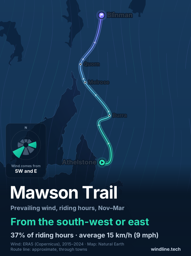
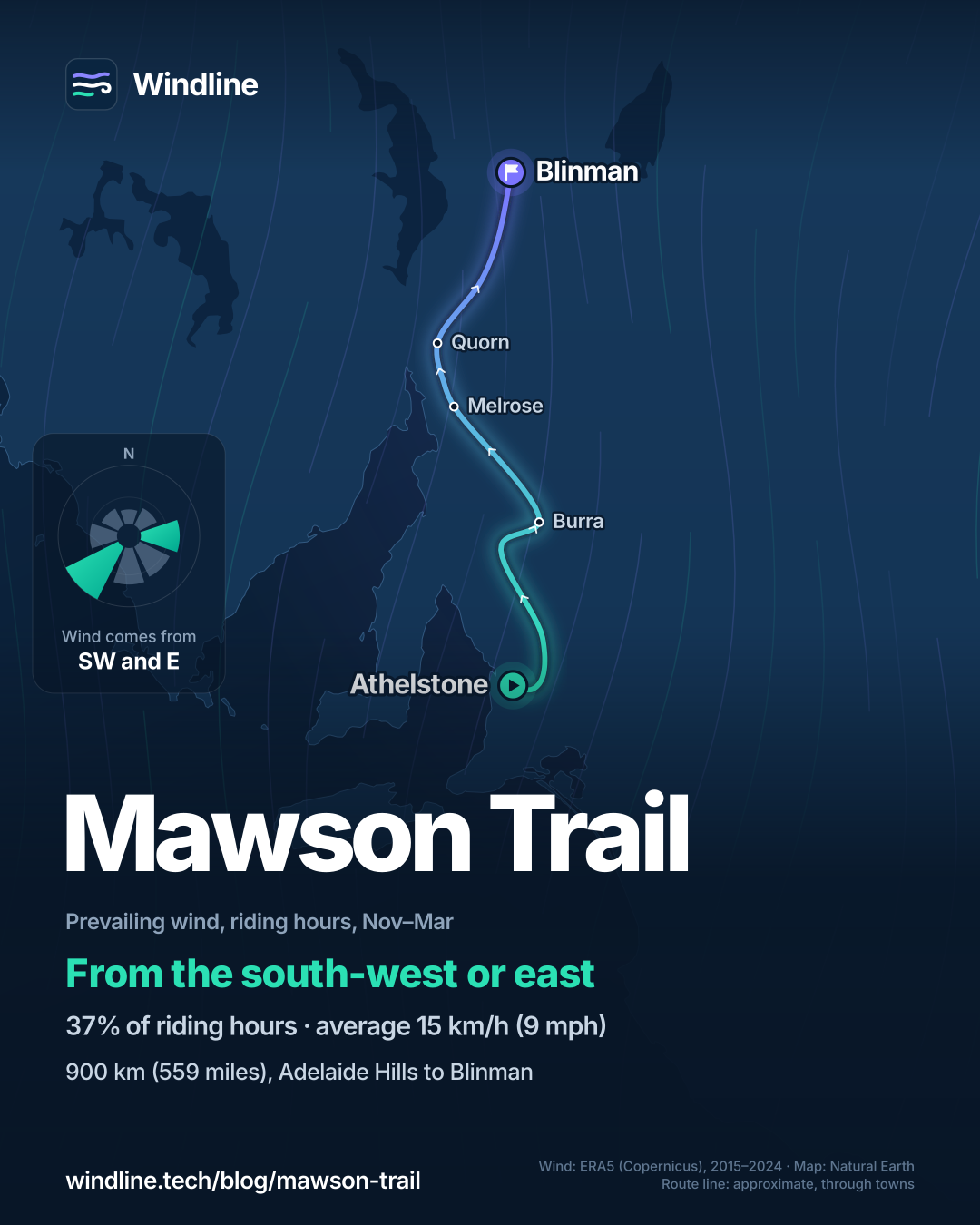
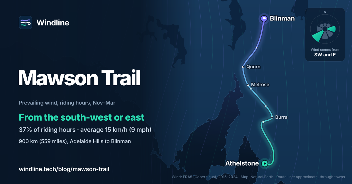
South to north, the usual way, suits the wind in most riding months. In May and from September to November, the commonest riding-hour winds came from the south-west and west, mostly behind or beside a rider heading north.
March and April were changeable in direction. Over November to March, the wind came from the south-west in 22% of riding hours and the east in 15%, averaging 15 km/h (9 mph).
These are past averages, not a forecast. The state suggests travelling to Blinman first and riding back; if you do, expect more headwind days (see how much a headwind slows you down). Our prevailing winds guide explains how to choose.
How do you get there and back?
Arrange the trip home first. The state's trail page says riders from Adelaide must organise transport from Blinman, and lists a coach to Port Augusta and private Flinders shuttles. Check each takes bikes.
In Adelaide, Adelaide Metro carries bikes on trains, free outside weekday peak hours, but not on buses or trams.
- Fire: national parks and forest reserves close on declared Total Fire Ban days. The Flinders fire danger season for 2026–27 runs from 15 October to 15 April, so it overlaps spring riding.
- Water: Trails SA says to carry at least 4 litres (about 1 US gallon) at all times in the north. Resupply towns run from Birdwood to Hawker; Blinman has a pub and limited supplies. See bikepacking food and water.
Frequently asked questions
How hard is the Mawson Trail?
Harder the further north you go. South Australia's Office for Recreation, Sport and Racing rates the trail Easy or Intermediate on Australia's mountain bike difficulty scale, with some steep climbs. The Santos Tour Down Under atlas gives the whole ride five out of five. Trails SA says the Flinders Ranges bring loose shale, creek crossings and exposed ridges, and recommends riding in a group of three or more.
Can you ride the Mawson Trail in summer?
It's open all year, but the state's trail page says January to March can be fiercely hot and are best avoided. Trails SA warns that 45°C (113°F) days are not uncommon in the Flinders Ranges in December and January, with no shelter on remote sections. Summer also falls in the fire danger season, when parks and forests close on Total Fire Ban days.
Do you need maps for the Mawson Trail?
Yes. The trail is waymarked, but Trails SA calls a good set of maps essential, because phone reception is limited or absent for long stretches. The state publishes nine maps of about 100 km (62 miles) each, from Adelaide to Tanunda through to Black Gap to Blinman. They're in the Avenza map app, and printed copies are sold by Bicycle SA and Mapland in Adelaide.
Get the wind for your ride.
Upload a GPX, add your start time and pace, and see the headwind, gusts, rain and heat for every stretch of the route, timed to when you’ll be there. Free for riders.
Make a free ride page →Sources and method
- Office for Recreation, Sport and Racing (Government of South Australia) (2026). Mawson Trail
- Trails SA (2026). Mawson Trail: full trail, Adelaide Hills to Blinman
- Santos Tour Down Under (South Australian Tourism Commission) (2026). Grand Tour: Mawson Trail
- ForestrySA (2026). Bike riding
- SA Country Fire Service (2026). Fire Danger Season dates and permits
- Adelaide Metro (Government of South Australia) (2026). Taking items on board
- Copernicus Climate Change Service (ECMWF) (2026). ERA5 hourly time-series data on single levels from 1940 to present
Route facts are from the official sources listed, opened on 10 October 2026: the length, sections, usual days, best months, surfaces, water and resupply advice from Trails SA; the markers, maps, difficulty rating, transport advice and fire-ban closures from the Government of South Australia's Office for Recreation, Sport and Racing; the five-out-of-five rating from the Santos Tour Down Under atlas (which measures the route at 896.9 km). The two pages describe the markers differently (Trails SA says green and white); we use the state government's description. Best months are Trails SA's, as in our Australia and New Zealand list; the state government says January to March are best avoided. Weather across the year: Windline's own analysis of hourly ERA5 reanalysis (Copernicus Climate Change Service, ECMWF), 1 January 2015 to 31 December 2024, downloaded from the Copernicus Climate Data Store, at three sample points along the route (Athelstone, Melrose and Blinman, nearest 0.25° grid cell), pooled. Riding hours are 08:00 to 17:00 local time. Wind is 10 m (33 ft) wind; the directions shown are the two commonest of eight compass sectors, months when the hours barely agree on a direction are shown as changeable, and hours under 5 km/h (3 mph) count as calm. A gusty day has a riding-hour gust of 50 km/h (31 mph) or more; a wet day has 1 mm or more of rain; start is the 08:00 temperature and high is the warmest riding hour. The November to March direction shares use that season's riding hours only, as in our list. These are averages of past seasons, not forecasts. Contains modified Copernicus Climate Change Service information (ERA5, 2015–2024); neither the European Commission nor ECMWF is responsible for any use of this information. The map's route line joins towns in riding order; it is approximate and not an official route. Conversions use 1 mile = 1.609 km and 1 US gallon = 3.785 litres, rounded; °F = °C × 1.8 + 32.
About the author
Wes Thomson, Founder, Windline. Wes Thomson builds Windline, live wind and weather forecasts timed to when riders reach each stretch of road. He built it for his own 2,093 km tour from Pont Drift to Cape Town, and writes these guides with the same focus: what the wind will do to your ride, and how to plan around it.