The Murray to Mountains Rail Trail: sections, weather and transport
Choose your sections of Victoria's sealed rail trail, see the weather for every month, and plan the train and bus with your bike.
The short answer
The Murray to Mountains Rail Trail is a fully sealed bike-path network of about 185 km (115 miles) in north-east Victoria, Australia, linking Wangaratta with Bright, Harrietville, Beechworth and Yackandandah. The main ride, Wangaratta to Bright up the Ovens Valley, splits easily over three days. It's rideable all year, and the wind is usually light.
Key takeaways
- Wangaratta to Bright climbs gently up the Ovens Valley; the Beechworth branch climbs steeply.
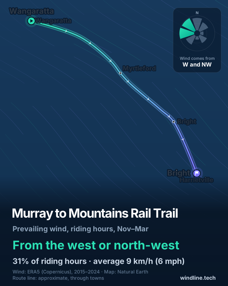
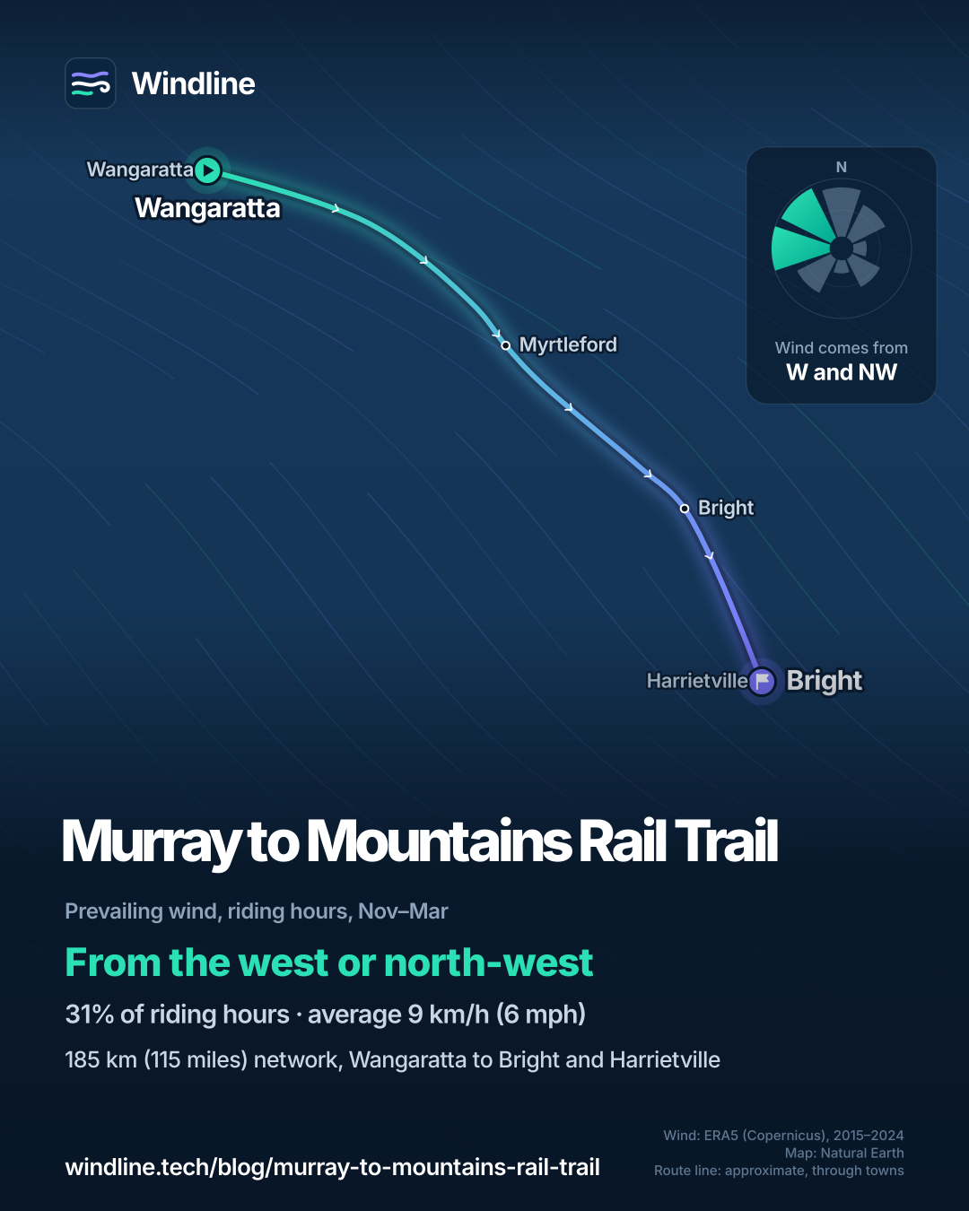
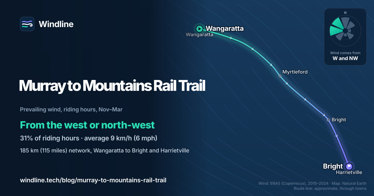
- In past summers, wind from the west or north-west was commonest, behind riders heading for Bright.
- March and April had few gusty days and mild highs; July and August were the wettest.
- V/Line coaches from Wangaratta to Bright and Beechworth carry full-size bikes when there's space.
What is the Murray to Mountains Rail Trail?
The Murray to Mountains Rail Trail is a sealed path network, mostly on old railway lines, in north-east Victoria, Australia, about 250 km (155 miles) from Melbourne. Its spine runs up the Ovens Valley from Wangaratta to Bright. It's one of our 10 most popular cycling tours in Australia and New Zealand and part of our guide to the world's great cycling routes.
| The route at a glance | |
|---|---|
| Length | 185 km (115 miles) network (Visit Bright); 137 km (85 miles) on old railway (Rail Trails Australia) |
| State | Victoria, Australia |
| Usual days | 3–4 for the network (our estimate); Wangaratta to Bright in about three |
| Surface | Sealed throughout; gentle grades except the Beechworth branch |
| Signage | "Rail Trail" signs, including through Myrtleford; emergency marker posts along the trail |
| Best months | All year |
Which sections do people ride?
Most riders take the spine from Wangaratta to Bright, then add a branch or the extension to Harrietville. Some links between sections use roads.
- Wangaratta to Bright: 82 km (51 miles) by the count of Rail Trails Australia, a national non-profit, or 97 km (60 miles) by Visit Bright's, via Everton and Myrtleford, past hop, berry, nut and grape farms.
- Bright to Harrietville: the Great Valley Trail, 27 km (17 miles) along the Ovens River, flat and fully sealed, says Visit Bright.
- Everton to Yackandandah: 38 km (24 miles). It climbs steeply to Beechworth, then drops 240 m (787 ft) to Yackandandah.
- Short flat spurs: Wangaratta to Oxley, towards the Milawa food region, and Rutherglen to Wahgunyah, among the wineries by the Murray River.
The Rural City of Wangaratta says there are sections for all ages and abilities. On the spine, stops are 26–30 km (16–19 miles) apart. Set your days with how far you can cycle in a day.
Want this for your own route? Windline shows the wind for every stretch, timed to your pace. Free. Make a free ride page →
What's the weather like through the year?
The average wind was light in every month; gusts and rain changed more with the seasons.
Weather across the year on the Murray to Mountains Rail Trail, 2015–2024
| Month | Wind from | Average wind, km/h (mph) | Gusty days | Start → high, °C (°F) | Wet days |
|---|---|---|---|---|---|
| Jan | NW, N | 9 (6) | 9% | 17° (63°) → 28° (83°) | 28% |
| Feb | NW, W | 9 (6) | 9% | 15° (59°) → 27° (81°) | 17% |
| Mar | ~Changeable | 9 (5) | 7% | 13° (55°) → 25° (76°) | 17% |
| Apr | ~Changeable | 8 (5) | 6% | 11° (52°) → 19° (67°) | 21% |
| May | W, NW | 8 (5) | 9% | 7° (45°) → 14° (58°) | 33% |
| Jun | N, NW | 8 (5) | 6% | 4° (40°) → 11° (51°) | 38% |
| Jul | N, NW | 9 (5) | 10% | 4° (40°) → 10° (51°) | 43% |
| Aug | W, NW | 9 (6) | 12% | 5° (42°) → 12° (53°) | 43% |
| Sep | W, NW | 10 (6) | 16% | 9° (48°) → 15° (59°) | 34% |
| Oct | NW, N | 10 (6) | 15% | 10° (50°) → 19° (66°) | 33% |
| Nov | W, NW | 10 (6) | 14% | 13° (56°) → 22° (72°) | 32% |
| Dec | W, NW | 10 (6) | 14% | 16° (61°) → 26° (79°) | 23% |
The average riding-hour wind was 8–10 km/h (5–6 mph) all year, and March and April were changeable in direction. From September to December, 14–16% of days had a gust of 50 km/h (31 mph) or more. July and August were the wettest, with rain on 43% of days and highs of 10–12°C (51–53°F). March and April paired few gusty days, 6–7%, with highs of 19–25°C (67–76°F).
Which way should you ride it?
From Wangaratta towards Bright, if you can choose: in past summers the wind more often came from behind you that way.
From November to March, riding-hour wind came from the west or north-west 31% of the time. Westerly winds (south-west, west and north-west) made up 41% of hours, easterly ones 22%, and 20% were calm. The average was just 9 km/h (6 mph).
The spine runs roughly south-east from Wangaratta to Bright, so a north-westerly is mostly a tailwind. Rail Trails Australia says the trail rises gently towards Bright, and suggests some riders may prefer the Beechworth climb the other way, descending to Everton.
These are past averages, not a forecast; see how much a headwind slows you down and our prevailing winds guide.
How do you get there and back?
By train to Wangaratta, then by bike or coach. V/Line's Melbourne–Albury trains stop at Wangaratta and carry bikes when there's space, first come, first served. Converted e-bikes aren't allowed on Victoria's regional trains.
- Coaches: V/Line carries full-size bikes free, when there's space, on its Bright–Wangaratta and Beechworth–Wangaratta coaches. Visit Bright says the Bright bus runs daily, so you can ride one way and take the bus back.
- Trailhead: Wangaratta's is in Apex Park on Clements Road. Rail Trails Australia warns the route from the station is poorly marked, so check a map first.
- Hire: Rail Trails Australia lists bike hire in Myrtleford and Beechworth, and operators offering luggage transfers.
- Emergencies: call 000 and quote the code on the nearest marker post, such as MTM111.
For a gentle rail trail on another continent, try the Katy Trail in Missouri, US.
Frequently asked questions
Can you ride the Murray to Mountains Rail Trail on a road bike?
Yes. Rail Trails Australia lists the surface as asphalt and the trail as suitable for touring, hybrid and mountain bikes, and Visit Bright says the Great Valley Trail to Harrietville suits road bikes too. The grades are gentle, apart from the branch over the hill to Beechworth.
How hard is the ride from Everton to Beechworth?
It's the steepest part of the network. Rail Trails Australia says the line to Beechworth had one of the steepest grades allowed on a broad-gauge branch line, and the trail then drops 240 m (787 ft) to Yackandandah. It suggests staying the night in Yackandandah rather than riding back the same day, unless you're fit or have a charged e-bike.
Is the Murray to Mountains Rail Trail too hot in summer?
Not on average. In our 2015–2024 data, January mornings began at 17°C (63°F) and the warmest riding hour averaged 28°C (83°F), with rain on 28% of days. Single days can be much hotter than the average, so carry plenty of water and follow official fire and heat warnings for north-east Victoria.
Get the wind for your ride.
Upload a GPX, add your start time and pace, and see the headwind, gusts, rain and heat for every stretch of the route, timed to when you’ll be there. Free for riders.
Make a free ride page →Sources and method
- Visit Bright (Alpine Shire) (2026). Rail trails
- Visit Bright (Alpine Shire) (2026). Frequently asked questions
- Visit Bright (Alpine Shire) (2026). Bright to Harrietville, Great Valley Trail
- Rural City of Wangaratta (2026). Murray to Mountains Rail Trail
- Rail Trails Australia (2026). Murray to Mountains Rail Trail
- V/Line (2026). Bikes, luggage and animals
- Copernicus Climate Change Service (ECMWF) (2026). ERA5 hourly time-series data on single levels from 1940 to present
- Copernicus Climate Change Service (ECMWF) (2026). ERA5 hourly data on single levels from 1940 to present
- Natural Earth (2026). Terms of use (public domain map data)
Route facts come from Visit Bright (Alpine Shire), the Rural City of Wangaratta, Rail Trails Australia and V/Line, read on 10 October 2026; Victoria's High Country tourism site could not be opened from our location. The 185 km network length is Visit Bright's, as in our Australia and New Zealand list; the 137 km of former railway and the section lengths (Wangaratta to Bright 82 km, Everton to Yackandandah 38 km) are Rail Trails Australia's. Visit Bright's FAQ gives 97 km for Bright to Wangaratta; we show both figures. Best months: Visit Bright says the area offers good experiences in all four seasons, which we summarise as all year. Usual days are our estimate, as in the list: 50–70 km (31–43 miles) a day, so 185 km takes three to four days; Rail Trails Australia says Wangaratta to Bright splits easily over three days. Conversions use 1 mile = 1.609 km and 1 m = 3.281 ft, rounded; °F = °C × 1.8 + 32. Weather across the year: Windline's own analysis of hourly ERA5 reanalysis (Copernicus Climate Change Service, ECMWF), 1 January 2015 to 31 December 2024, downloaded from the Copernicus Climate Data Store, at three sample points along the route (Wangaratta, Myrtleford and Bright, nearest 0.25° grid cell), pooled. Riding hours are 08:00 to 17:00 local time. Wind is 10 m (33 ft) wind; the directions shown are the two commonest of eight compass sectors, and months when the hours barely agree on a direction are shown as changeable; hours under 5 km/h (3 mph) count as calm. A gusty day has a riding-hour gust of 50 km/h (31 mph) or more; a wet day has 1 mm or more of rain; start is the 08:00 temperature and high is the warmest riding hour. The direction figures use November to March riding hours only, as in our list; westerly means the south-west, west and north-west sectors, easterly the north-east, east and south-east sectors. These are averages of past seasons, not forecasts. Contains modified Copernicus Climate Change Service information (ERA5, 2015–2024); neither the European Commission nor ECMWF is responsible for any use of this information. The map's route line joins town waypoints from Wangaratta to Harrietville; it is approximate, leaves out the branches and is not an official route map; basemap from Natural Earth (public domain).
About the author
Wes Thomson, Founder, Windline. Wes Thomson builds Windline, live wind and weather forecasts timed to when riders reach each stretch of road. He built it for his own 2,093 km tour from Pont Drift to Cape Town, and writes these guides with the same focus: what the wind will do to your ride, and how to plan around it.