The Hauraki Rail Trail by bike: sections, weather and getting there
Pick your sections of the Hauraki Rail Trail, see the weather for every month, and plan buses, shuttles and bike hire.
The short answer
The Hauraki Rail Trail is an easy, mostly flat ride of about 160 km (99 miles) on New Zealand's North Island, linking Kaiaua, Thames, Paeroa, Waihi, Te Aroha and Matamata, largely on old railway lines. Most riders take three to five days. Almost all of it is Grade 1, the easiest level, and it suits any season.
Key takeaways
- Five sections of 23–55 km (14–34 miles) let you ride short days or one stretch.
- The Karangahake Gorge section has a 1,100 m (3,610 ft) railway tunnel, so take a torch.
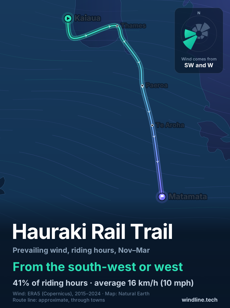
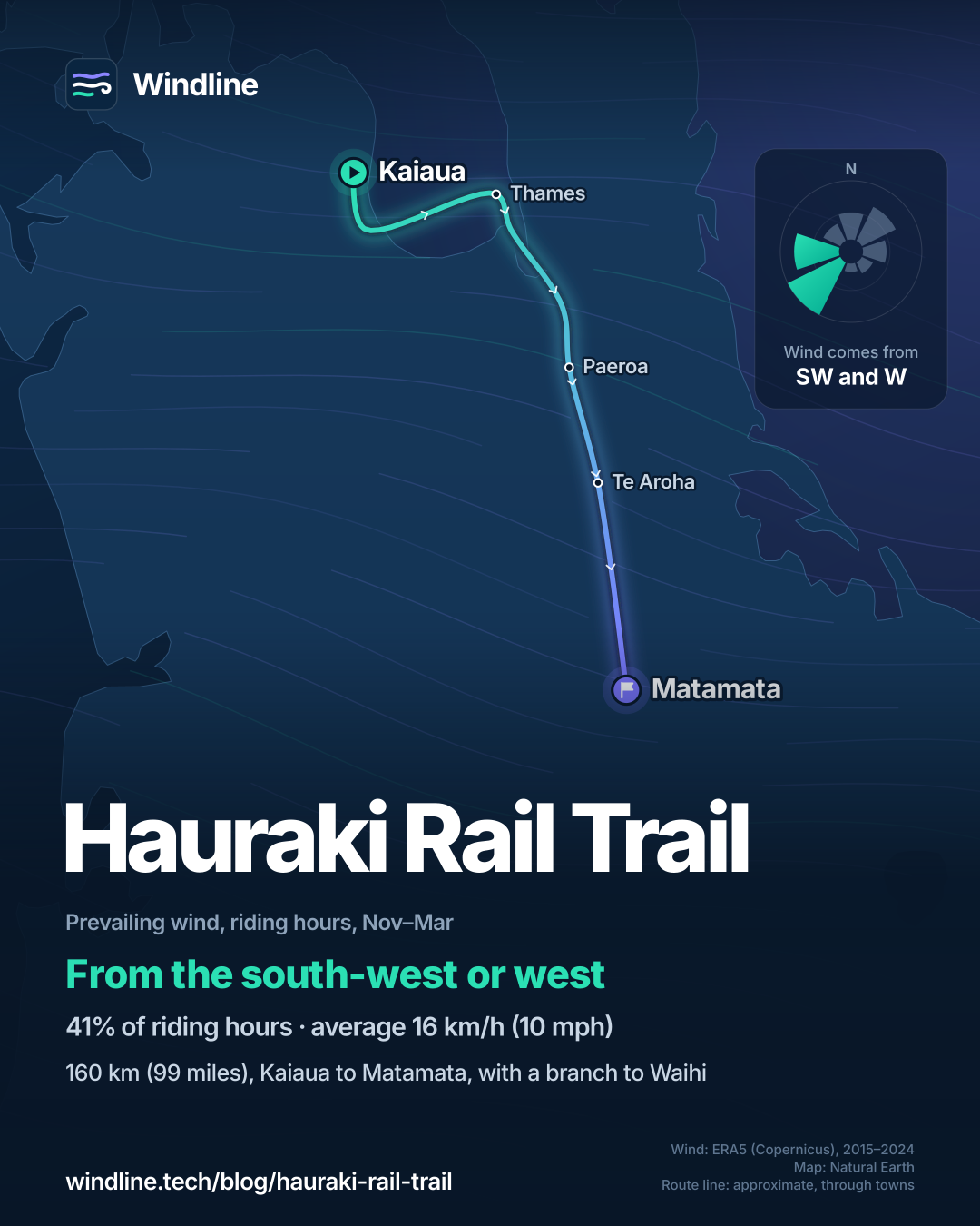
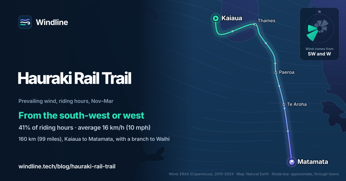
- Past summer winds came most often from the south-west or west, averaging 16 km/h (10 mph).
- Book bikes, shuttles and beds early for the December to March peak season.
What is the Hauraki Rail Trail?
The Hauraki Rail Trail is one of New Zealand's 23 Great Rides: about 160 km (99 miles) of mostly flat trail south-east of Auckland, much of it on old railway lines. It's one of our 10 most popular cycling tours in Australia and New Zealand, in our guide to the world's great cycling routes.
| The route at a glance | |
|---|---|
| Length | About 160 km (99 miles), Kaiaua to Matamata, with a branch to Waihi |
| Region | Hauraki and Waikato, North Island, New Zealand |
| Usual days | 3–5 |
| Surface | Wide, flat and smooth for most of the way |
| Grade | 98% Grade 1 (easiest), 2% Grade 2 |
| Signage | Well signposted, with official maps and the free Great Rides app |
| Best months | All year; peak season December to March |
Which sections do people ride?
The trail has five official sections. From Paeroa it splits: one arm runs east to Waihi, the other south to Matamata.
- Kaiaua to Thames, 55 km (34 miles): around the shallow Firth of Thames, past wetlands and the Pūkorokoro–Miranda Shorebird Centre.
- Thames to Paeroa, 34 km (21 miles): farmland beside the Waihou River, ending at Paeroa's giant L&P bottle.
- Paeroa to Waihi, 24 km (15 miles): the Karangahake Gorge, with its bridges, gold-mining relics and the 1,100 m (3,610 ft) tunnel. A vintage train runs between Waikino and Waihi.
- Paeroa to Te Aroha, 23 km (14 miles): across the Ohinemuri River and along the old railway line.
- Te Aroha to Matamata, 37 km (23 miles): horse studs, Wairere Falls and Firth Tower, ending at Matamata, home of the Hobbiton Movie Set.
Want this for your own route? Windline shows the wind for every stretch, timed to your pace. Free. Make a free ride page →
What's the weather like through the year?
Mild all year, but often wet, and late winter and spring are the windiest.
Weather across the year on the Hauraki Rail Trail, 2015–2024
| Month | Wind from | Average wind, km/h (mph) | Gusty days | Start → high, °C (°F) | Wet days |
|---|---|---|---|---|---|
| Jan | ~Changeable | 16 (10) | 16% | 18° (64°) → 23° (73°) | 32% |
| Feb | ~Changeable | 14 (9) | 9% | 17° (63°) → 23° (73°) | 37% |
| Mar | ~Changeable | 14 (9) | 11% | 16° (60°) → 21° (71°) | 34% |
| Apr | SW, W | 15 (9) | 17% | 15° (59°) → 19° (66°) | 38% |
| May | SW, W | 15 (9) | 21% | 13° (55°) → 17° (62°) | 40% |
| Jun | ~Changeable | 16 (10) | 19% | 11° (51°) → 15° (58°) | 41% |
| Jul | SW, W | 17 (10) | 28% | 10° (49°) → 14° (56°) | 45% |
| Aug | W, SW | 16 (10) | 21% | 10° (50°) → 14° (57°) | 45% |
| Sep | W, SW | 18 (11) | 28% | 12° (53°) → 15° (59°) | 51% |
| Oct | SW, W | 18 (11) | 23% | 12° (54°) → 17° (62°) | 45% |
| Nov | W, SW | 17 (10) | 20% | 15° (58°) → 19° (66°) | 44% |
| Dec | SW, W | 16 (10) | 17% | 17° (62°) → 21° (70°) | 39% |
Summer was kindest: from December to February, mornings started at 17–18°C (62–64°F) and the warmest riding hour reached 21–23°C (70–73°F), with rain on 32–39% of days. From January to March, and in June, the wind was changeable in direction, averaging 14–16 km/h (9–10 mph). September was the windiest and wettest month: 18 km/h (11 mph) on average, gusty on 28% of days and wet on 51%. July and August highs reached only 14°C (56–57°F).
Which way should you ride it?
Neither direction wins outright, because the trail turns. NZ Cycle Trail notes that the wind direction "can greatly affect the enjoyment of the ride".
From November to March, our riding-hour data had the wind from the south-west or west in 41% of hours, averaging 16 km/h (10 mph); 8% of hours were calm. The coast from Kaiaua runs mostly east towards Kōpū, so those winds are usually behind riders leaving Kaiaua. From Thames to Matamata the trail heads south, where a south-westerly is partly against you and a westerly is side-on. Riding north from Matamata reverses both.
But the north-east, the opposite way, had 15% of hours. These are past averages, not a forecast, so read a route-timed forecast for your days. Other routes are in our prevailing winds guide.
How do you get there and back?
Auckland Airport is about 90 minutes' drive away, and NZ Cycle Trail says InterCity buses serve all the towns along the trail.
- Bikes on the bus: InterCity takes a bike as checked luggage if both wheels are off, the handlebars are turned and the chain is covered. Otherwise it charges NZ$10 per bike per bus, as of October 2026, and space isn't guaranteed.
- Shuttles and hire: Thames, Paeroa and Waihi are the hubs for bike hire, shuttles and luggage transfers. Book shuttles ahead, and beds from December to March.
For a longer rail trail on the South Island, see the Otago Central Rail Trail, and plan with our multi-day tour guide.
Frequently asked questions
Is the Hauraki Rail Trail suitable for children and beginners?
Yes. NZ Cycle Trail rates 98% of it Grade 1, the easiest level, and the rest Grade 2. Matamata-Piako District Council says it suits everything from children's bikes and upright bikes to touring bikes, mountain bikes and e-bikes. Take extra care on the short road sections and crossings, and at cattle grids, where NZ Cycle Trail warns wheels can get wedged.
Can you take a dog on the Hauraki Rail Trail?
Only on part of it. The official trail map allows dogs on leads in the Karangahake Gorge, from Waikino Station to the old Karangahake Hall site, and says dogs are not permitted on any other section. The one exception is gun dogs, which may use the Kaiaua to Thames section during duck hunting season. Check the latest trail map before you bring one.
Can you ride the Hauraki Rail Trail on an e-bike?
Yes. NZ Cycle Trail says e-bikes are permitted and that most bike-hire companies on the trail have them. Before you book a bed, ask whether you can recharge the battery overnight, and plan for long sections and headwinds, which drain it faster.
Get the wind for your ride.
Upload a GPX, add your start time and pace, and see the headwind, gusts, rain and heat for every stretch of the route, timed to when you’ll be there. Free for riders.
Make a free ride page →Sources and method
- Ngā Haerenga New Zealand Cycle Trails (2026). Hauraki Rail Trail
- Ngā Haerenga New Zealand Cycle Trails (2026). Hauraki Rail Trail map (sections A to E)
- Matamata-Piako District Council (2026). Hauraki Rail Trail
- Hauraki Rail Trail (2026). Hauraki Rail Trail (official site)
- InterCity (2026). Oversized items (bicycles)
- Copernicus Climate Change Service (ECMWF) (2026). ERA5 hourly time-series data on single levels from 1940 to present
Route facts are from the official bodies in the sources, as checked on 10 October 2026. The length is NZ Cycle Trail's "approximately 160km", as in our Australia and New Zealand list; Matamata-Piako District Council gives 197 km, and the five official section lengths (55, 34, 24, 23 and 37 km) add to 173 km, because Paeroa to Waihi is a branch rather than part of the line from Kaiaua to Matamata. The 3–5 days and the grades (98% Grade 1, 2% Grade 2) are NZ Cycle Trail's. Best months: NZ Cycle Trail says the region's temperate climate makes for great riding at any time of year, so every month is shaded; December to March is its peak season. Weather across the year: Windline's own analysis of hourly ERA5 reanalysis (Copernicus Climate Change Service, ECMWF), 1 January 2015 to 31 December 2024, downloaded from the Copernicus Climate Data Store, at three sample points along the route (Kaiaua, Paeroa and Matamata, nearest 0.25° grid cell), pooled. Riding hours are 08:00 to 17:00 local time. Wind is 10 m (33 ft) wind; the directions shown are the two commonest of eight compass sectors, and months when the hours barely agree on a direction are shown as changeable; hours under 5 km/h (3 mph) count as calm. A gusty day has a riding-hour gust of 50 km/h (31 mph) or more; a wet day has 1 mm or more of rain; start is the 08:00 temperature and high is the warmest riding hour. The direction figures use November to March riding hours, the southern touring summer. These are averages of past seasons, not forecasts. Contains modified Copernicus Climate Change Service information (ERA5, 2015–2024); neither the European Commission nor ECMWF is responsible for any use of this information. The map's route line joins towns in riding order from Kaiaua to Matamata and does not show the Waihi branch; it is approximate and not an official route. Conversions use 1 mile = 1.609 km and 1 m = 3.281 ft, rounded; °F = °C × 1.8 + 32. InterCity's bike fee is in New Zealand dollars, as of October 2026.
About the author
Wes Thomson, Founder, Windline. Wes Thomson builds Windline, live wind and weather forecasts timed to when riders reach each stretch of road. He built it for his own 2,093 km tour from Pont Drift to Cape Town, and writes these guides with the same focus: what the wind will do to your ride, and how to plan around it.