The 10 most popular cycling tours in Africa
Compare ten documented African bike tours by length, days, surface, season and wind, then pick the one that fits your trip.
The short answer
The best cycling routes in Africa, among those with a published line, are Morocco's two-part Route of Caravans, Rwanda's Congo Nile Trail, the Trans-Uganda, the Kenya Bike Odyssey, Malawi's Nyika, the Lesotho Traverse, Namibia's Namib and Kaokoveld routes and South Africa's Western Cape Passes. Most are dirt roads, ridden in a dry or cool season.
Key takeaways
- Nine of these ten routes are at least 70% unpaved, so choose wide tyres.
- Near the equator, the rainy seasons decide when you go; in Namibia and Morocco, the heat does.
- The routes run from three days in Malawi's Nyika to 40 days around Uganda.
- Read your own government's travel advice for every country and border before you book.
Definitions
- Prevailing wind
- The wind direction that blows most often at a place over many years; it tells you what to expect, not what you'll get.
- Riding hours
- In our wind figures, the hours from 08:00 to 17:00 local time, when touring riders are usually on the road.
- Dry season
- The part of the year with little rain; Rwanda and Uganda each have two.
How did we choose the best cycling routes in Africa?
Two tests: riders search for them, and the whole route is published. Africa has few signposted trails, so most of the best cycling routes in Africa were mapped by the riders who made them. This list sits under our guide to the world's great cycling routes.
- Search interest. Countries that keep appearing in today's top results.
- A documented route. Length, days, surface and season from Visit Rwanda or the route's makers on BIKEPACKING.com.
Tanzania and Madagascar are mostly ridden as guided tours, with no published route to check.
How do the ten routes compare?
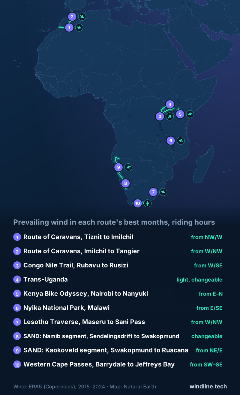
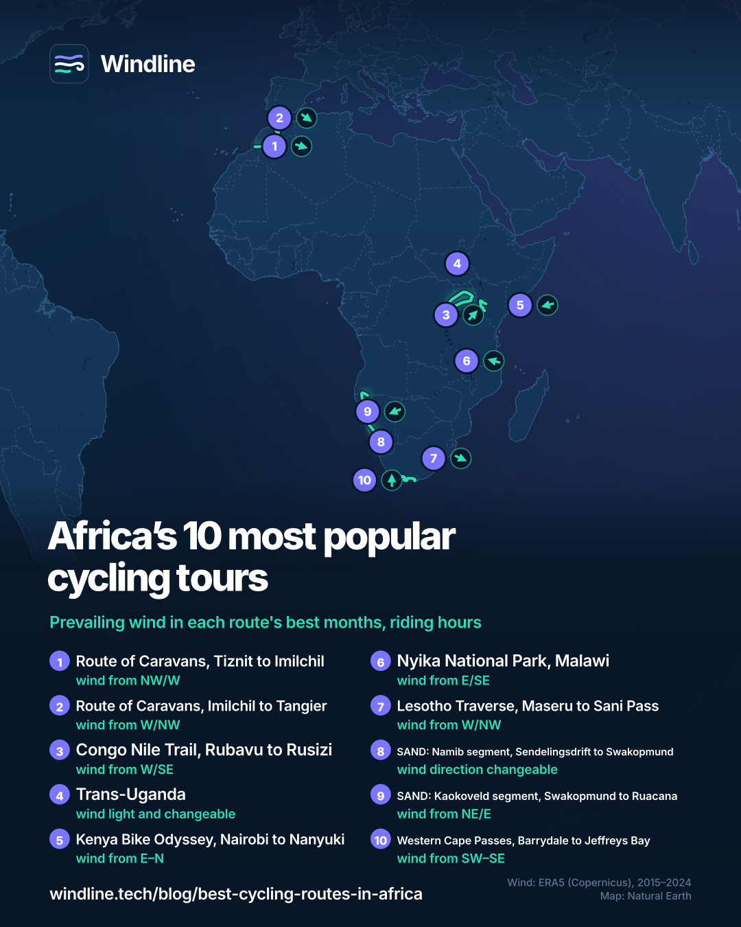
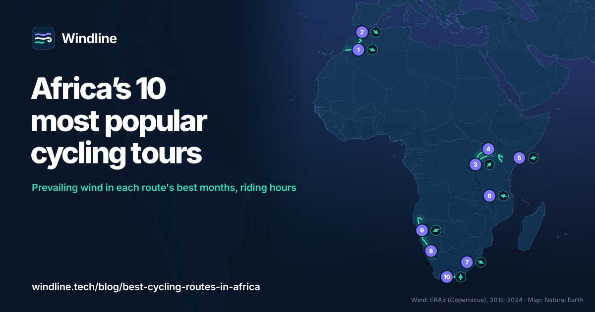
Nine are mostly dirt. Each route's wind is for its own best months, because near the equator summer means little.
| Route | Country | Length, km (miles) | Usual days | Surface | Best months | Prevailing wind (best months, riding hours) |
|---|---|---|---|---|---|---|
| Route of Caravans (South), Tiznit–Imilchil | Morocco | 1,236 (768) | 21 | 70% unpaved, some sand | Late Feb–Apr, autumn | NW or W, 11 km/h (7 mph) |
| Route of Caravans (North), Imilchil–Tangier | Morocco | 837 (520) | 14 | 55% unpaved | Spring | W or NW, 12 km/h (8 mph) |
| Congo Nile Trail | Rwanda | 227 (141) | About 5 | Dirt roads, singletrack | Mid-May–mid-Sep, Dec–Feb | W or SE, 7 km/h (4 mph) |
| Trans-Uganda (loop) | Uganda | 2,111 (1,312) | 40 | 92% unpaved | Late Dec–Feb, Jun–Sep | Light, changeable, 6 km/h (4 mph) |
| Kenya Bike Odyssey | Kenya | 1,024 (636) | 18 (3 weeks+) | 80% unpaved | Jun–Oct, Jan–Feb | E to N, 8 km/h (5 mph) |
| Nyika National Park | Malawi | 227 (141) | 3 | All unpaved | May–Nov | E or SE, 10 km/h (6 mph) |
| Lesotho Traverse | Lesotho | 502 (312) | 8 | 85% unpaved | Oct–Dec | W or NW, 12 km/h (7 mph) |
| SAND: Namib | Namibia | 1,199 (745) | 15 | 95% unpaved | Winter, shoulder seasons | Changeable, 13 km/h (8 mph) |
| SAND: Kaokoveld | Namibia | 1,336 (830) | 19 | 93% unpaved | Apr–Aug | NE or E, 13 km/h (8 mph) |
| Western Cape Passes | South Africa | 761 (473) | 9 | 81% unpaved | Mid-Sep–Nov, Apr–May | SW to SE, 14 km/h (9 mph) |
Wind: Windline's own analysis of ERA5 data, 2015–2024, 08:00–17:00 local time.
Want this for your own route? Windline shows the wind for every stretch, timed to your pace. Free. Make a free ride page →
Which routes cross Morocco's Atlas and the Sahara?
The two halves of the Route of Caravans meet at Imilchil, in the High Atlas.
Route of Caravans (South): Tiznit to Imilchil
It crosses the Anti-Atlas, rides 145 km (90 miles) of desert from Foum Zguid to M'Hamid, then follows the Draa Valley into the High Atlas, climbing 17,834 m (58,509 ft) in all.
Wind: North-west or west, averaging 11 km/h (7 mph).
Route of Caravans (North): Imilchil to Tangier
Through the Middle Atlas, Fes and Chefchaouen to the ferries for Spain. Save for two High Atlas sections, it can all be ridden on a gravel bike. Riding in Ramadan is possible, but harder.
Wind: West or north-west, averaging 12 km/h (8 mph).
Which East African routes are worth the trip?
Here the rainy seasons, not the heat, decide when you go.
Congo Nile Trail, Rwanda
Visit Rwanda's route follows Lake Kivu from Rubavu to Rusizi. BIKEPACKING.com's version climbs 5,822 m (19,100 ft). It's a step up from our beginner bikepacking routes.
Wind: West or south-east, averaging 7 km/h (4 mph).
Trans-Uganda
A loop from Kampala via Jinja, Mount Elgon, Murchison Falls and Bwindi. Water mostly comes from village pump wells, and after rain the mud can end a day's ride.
Wind: Light and changeable (calm 42% of riding hours), averaging 6 km/h (4 mph).
Kenya Bike Odyssey
A horseshoe from Nairobi past the Rift Valley lakes to Nanyuki, mostly above 1,700 m (5,500 ft). Some private land needs permission and a small fee, arranged ahead.
Wind: Between east and north, averaging 8 km/h (5 mph).
Nyika National Park, Malawi
Out and back from Rumphi to grassland at 2,390 m (7,842 ft). Elephants live near the gate, so talk to the rangers first.
Wind: East or south-east, averaging 10 km/h (6 mph).
Which desert routes cross Namibia?
Two segments of the SAND route meet at Swakopmund, almost all on gravel.
SAND: Namib, Sendelingsdrift to Swakopmund
From the Orange River, east of the Fish River Canyon, then through Sesriem. Towns are often more than 200 km (124 miles) apart, but it's the one SAND segment you can ride all year.
Wind: Changeable in direction (calm 11% of riding hours), averaging 13 km/h (8 mph).
SAND: Kaokoveld, Swakopmund to Ruacana
North past Spitzkoppe and Epupa Falls. Even winter days reach the mid-30s °C (mid-90s °F); its makers rate it 8 out of 10 for difficulty.
Wind: North-east or east, averaging 13 km/h (8 mph).
Which mountain routes suit southern Africa?
Both climb hard, on high dirt tracks or old wagon passes.
Lesotho Traverse: Maseru to Sani Pass
Via Semonkong and Mokhotlong, ending down Sani Pass into South Africa after 13,442 m (44,100 ft) of climbing. Summer storms turn the roads to mud.
Wind: West or north-west, averaging 12 km/h (7 mph).
Western Cape Passes, South Africa
From Barrydale on Route 62 over the Swartberg Pass to Knysna on the Garden Route, then through the Baviaanskloof to Jeffreys Bay. Summer can reach 43°C (110°F).
Wind: Between south-west and south-east, averaging 14 km/h (9 mph).
Which one should you pick?
- Under a week: Nyika or the Congo Nile Trail.
- Big mountains: Lesotho or the Western Cape.
- June to August: Rwanda, Uganda, Kenya or Namibia.
- Months free: the Trans-Uganda, or Morocco end to end.
Like remote dirt? Try North America's Great Divide. For signposts, see our Europe, North America and Australia and New Zealand lists.
How do you plan any of them?
Start with safety, then water and the days.
- Read your own government's travel advice for every country and border on the route.
- Plan water, food and nights with our food and water guide and wild camping rules.
- Check the forecast for your dates: prevailing wind isn't a promise. See bikepacking weather.
Frequently asked questions
Is it safe to go on a cycling tour in Africa?
It depends on the country and region, and it changes. Read your own government's travel advice for every country and border before you book, and again before you leave. Route makers adapt too: BIKEPACKING.com moved Morocco's southern Route of Caravans away from the Algerian border on police and military advice.
What tyres do you need for Africa's dirt routes?
Wide ones. BIKEPACKING.com advises plus-size tyres for Morocco's southern Route of Caravans, where you'll push through sand. Thorns are common: its riders had eight flats in 24 hours, so it recommends tubeless tyres. Carry spares and patches, as modern bike shops are scarce outside the big cities.
How much water should you carry in the Namib and the Sahara?
More than at home. BIKEPACKING.com's Namib route asks for at least 10 litres (2.6 US gallons) of capacity, as the Orange River is its only reliable perennial water. Its Route of Caravans riders carried over 8 litres (2.1 US gallons) each through the Sahara. See our [food and water guide](/blog/bikepacking-food-and-water/).
Can you cycle through Africa's national parks?
Some, with rules. BIKEPACKING.com's notes say Malawi's Nyika permits cycling, but ask its rangers about elephants first. When the Western Cape Passes route was written, South Africa's Baviaanskloof barred cyclists without a support vehicle, because of Cape buffalo. On Namibia's side of the Richtersveld you can ride freely; the facilities at Hobas need a permit.
Can you join these routes into a longer trip?
Yes, in two places. Morocco's two Route of Caravans halves meet at Imilchil, making 2,073 km (1,288 miles) from Tiznit to Tangier, where ferries cross to Spain. In Namibia, the Namib and Kaokoveld routes meet at Swakopmund, giving 2,535 km (1,575 miles) from the Orange River to Ruacana.
Get the wind for your ride.
Upload a GPX, add your start time and pace, and see the headwind, gusts, rain and heat for every stretch of the route, timed to when you’ll be there. Free for riders.
Make a free ride page →Sources and method
- BIKEPACKING.com (2026). Africa bikepacking routes (route index)
- BIKEPACKING.com (2026). Route of Caravans: Morocco Traverse (South)
- BIKEPACKING.com (2026). Route of Caravans: Morocco Traverse (North)
- Visit Rwanda (Rwanda Development Board) (2026). Cycling in Rwanda
- BIKEPACKING.com (2026). The Congo Nile Trail (bikepacker's edition)
- BIKEPACKING.com (2026). The Trans-Uganda
- BIKEPACKING.com (2026). Kenya Bike Odyssey
- BIKEPACKING.com (2026). Cycling Nyika National Park, Malawi
- BIKEPACKING.com (2026). The Lesotho Traverse
- BIKEPACKING.com (2026). SAND: Segment 4, Namib
- BIKEPACKING.com (2026). SAND: Segment 5, Kaokoveld
- BIKEPACKING.com (2026). Western Cape Passes Epic, bikepacking South Africa
- Ride with GPS (map published with the BIKEPACKING.com route) (2026). Western Cape Passes Gravel Epic
- UK Foreign, Commonwealth & Development Office (2026). Foreign travel advice
- Copernicus Climate Change Service (ECMWF) (2026). ERA5 hourly data on single levels from 1940 to present
- Copernicus Climate Change Service (ECMWF) (2026). ERA5 hourly time-series data on single levels from 1940 to present
- Natural Earth (2026). Terms of use (public domain map data)
How we chose: Africa has few long-distance routes with a managing body. We searched "best cycling routes in Africa", "cycling tours Africa" and "bike touring Africa" on 10 October 2026 and noted the countries the results name again and again (Morocco, South Africa, Namibia, Kenya, Uganda, Rwanda and Tanzania among them). In each we kept the most complete route with a published length, day count, surface and riding season: Visit Rwanda's Congo Nile Trail and, elsewhere, routes published by their makers on BIKEPACKING.com, the route index that the results and touring forums point riders to. From the same index we added Lesotho and Malawi's Nyika, the highest and the shortest documented routes we found. Morocco and Namibia have two entries each because their routes come in two documented halves. Tanzania and Madagascar are mostly ridden as guided tours, and we found no published route for either with these details, so neither is listed. South Africa has one entry, and no events are included. We did not count or estimate riders. Lengths, usual days, the share unpaved, climbing and best months are the route makers' own figures (miles and feet as they publish them), read on each route page on 10 October 2026; see the evidence file. The Congo Nile Trail's length and days are Visit Rwanda's; BIKEPACKING.com's version is 257 km (160 miles). The Kenya Bike Odyssey lists 18 days, and its makers suggest at least three weeks. The Western Cape Passes page names no start or finish: Barrydale and Jeffreys Bay are the two ends of the line on its published Ride with GPS map. The joined lengths in the FAQ are our sums: 1,236 + 837 = 2,073 km and 1,199 + 1,336 = 2,535 km. Prevailing wind: Windline's own analysis of hourly 10 m (33 ft) wind from ERA5 reanalysis (Copernicus Climate Change Service, ECMWF), 1 January 2015 to 31 December 2024, downloaded from the Copernicus Climate Data Store, for riding hours 08:00 to 17:00 local time, at three sample points along each route (near the start, middle and end; for the Trans-Uganda loop, spread around it), using the nearest 0.25° grid cell. Because near the equator "summer" means little, each route's wind is measured in its own best riding months as its maker gives them: where a season starts or ends mid-month, that month is left out; autumn is read as September to November; and for the Namib route, which recommends "winter and shoulder seasons" without naming months, we used April to August, the winter named on its sister Kaokoveld route. The months used are: Route of Caravans South, March–April and September–November; North, March–May; Congo Nile Trail, June–August and December–February; Trans-Uganda, June–September and January–February; Kenya Bike Odyssey, June–October and January–February; Nyika, May–November; Lesotho, October–December; Namib and Kaokoveld, April–August; Western Cape Passes, April–May and October–November. The two directions given are the commonest of eight compass sectors, with their combined share of riding hours; hours under 5 km/h (3 mph) count as calm. Where the two commonest directions are not neighbours and the hours barely agree on a direction, we call the wind light and changeable and draw no arrow. These are averages of past seasons, not forecasts. Credit: contains modified Copernicus Climate Change Service information (ERA5, 2015–2024); neither the European Commission nor ECMWF is responsible for any use of this information. The overview map's route lines are approximate lines through town waypoints (coordinates from Wikipedia and Wikidata), not official route maps; basemap from Natural Earth (public domain). Conversions use 1 mile = 1.609 km, 1 m = 3.281 ft, 1 US gallon = 3.785 litres and °F = °C × 1.8 + 32, rounded.
About the author
Wes Thomson, Founder, Windline. Wes Thomson builds Windline, live wind and weather forecasts timed to when riders reach each stretch of road. He built it for his own 2,093 km tour from Pont Drift to Cape Town, and writes these guides with the same focus: what the wind will do to your ride, and how to plan around it.