The Kaokoveld bikepacking route: Swakopmund to Ruacana, Namibia
Plan this remote Namibian gravel route, from the sections and water stops to the weather in every month and the way home.
The short answer
The Kaokoveld bikepacking route is the fifth and last segment of the SAND route: 1,336 km (830 miles) of mostly dirt from Swakopmund to Ruacana in northern Namibia, taking about 19 days. Its makers rate it 8 out of 10 for difficulty. Ride it from April to August, carry 10–12 litres of water and watch for elephants.
Key takeaways
- It runs 1,336 km (830 miles), 93% unpaved, through Damaraland and the Kaokoveld.
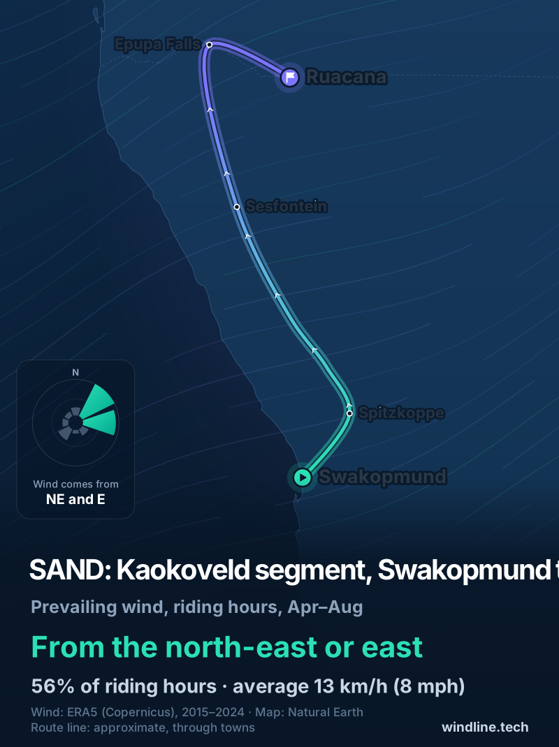
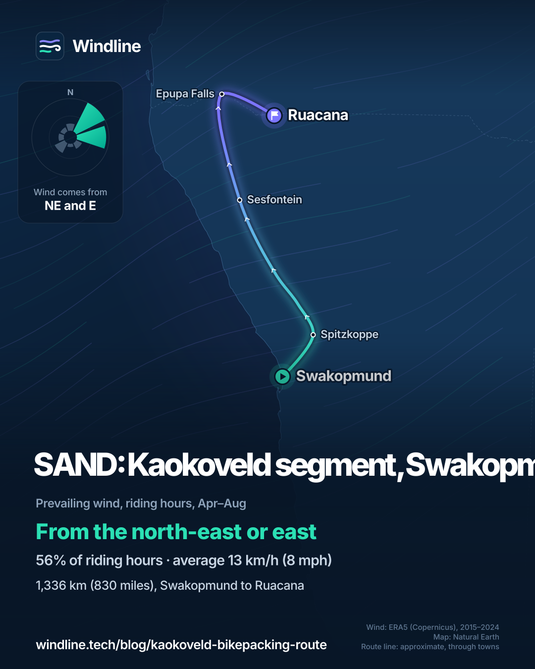
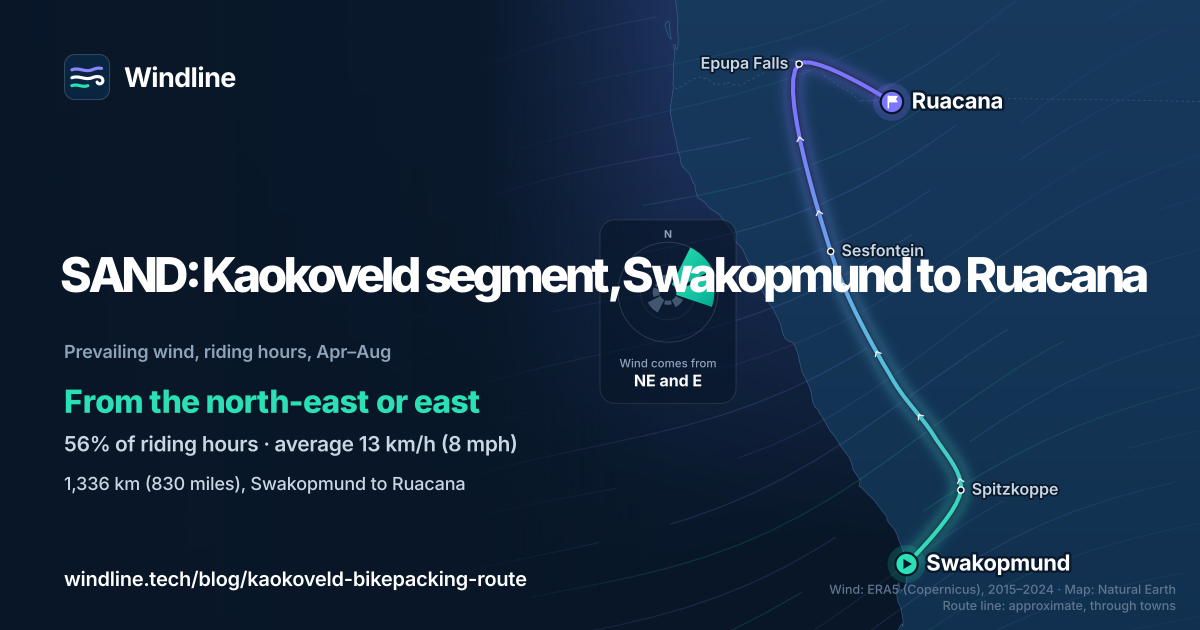
- Ride April to August; in past winters the wind blew mostly from the north-east or east.
- Carry 10–12 litres (2.6–3.2 US gallons) of water, and enough cash from Uis to reach Ruacana.
- Read your own government's travel advice for Namibia before you book.
What is the Kaokoveld bikepacking route?
The Kaokoveld bikepacking route is the fifth and final segment of the SAND route, developed by South African bikepacker Johan Wahl and his partner Jana, and published on BIKEPACKING.com. It runs north from the coast at Swakopmund to Ruacana on the Kunene River. It's one of our 10 most popular cycling tours in Africa, in our guide to the world's great cycling routes.
| The route at a glance | |
|---|---|
| Length | 1,336 km (830 miles), Swakopmund to Ruacana |
| Country | Namibia (Erongo and Kunene regions) |
| Usual days | 19 |
| Surface | 93% unpaved: gravel, 4×4 tracks, sandy river beds |
| Climbing | 10,587 m (34,734 ft); high point 1,487 m (4,880 ft) |
| Signage | Navigate with the makers' GPX |
| Best months | April to August |
Its makers rate it 8 out of 10 for difficulty, and say the terrain is arguably beyond what most people would consider safe.
Which sections do people ride?
The makers split it into six sections, from busy coast to empty desert to river.
- Swakopmund to Spitzkoppe: the Moon Landscape and the Khan River, then about 70 km (43 miles) of the narrow, busy B2 highway. The makers hitchhiked its last stretch.
- Spitzkoppe to Uis: firm, flowing double track to the Omaruru River.
- Uis to Twyfelfontein: about 110 km (68 miles) around the Brandberg to the Ugab River, then rough 4×4 tracks.
- Twyfelfontein to Sesfontein: the Otjitheka 4×4 trail, rich in wildlife, with a steep section.
- Sesfontein to Epupa: the wildest part, via Purros, Orupembe and the rocky van Zyl's Pass, which you'll partly push.
- Epupa to Ruacana: the Kunene River road, 140 km (87 miles) unpaved, then 20 km (12 miles) paved.
An easier alternative on bigger roads skips the hardest sections, but stays very remote.
Want this for your own route? Windline shows the wind for every stretch, timed to your pace. Free. Make a free ride page →
What's the weather like through the year?
In winter it's dry and warm, with the wind mostly from the north-east or east.
Weather across the year on the SAND Kaokoveld segment, 2015–2024
| Month | Wind from | Average wind, km/h (mph) | Gusty days | Start → high, °C (°F) | Wet days |
|---|---|---|---|---|---|
| Jan | SW, W | 11 (7) | 4% | 21° (70°) → 32° (90°) | 18% |
| Feb | SW, W | 10 (6) | 5% | 22° (71°) → 33° (91°) | 22% |
| Mar | ~Changeable | 10 (6) | 3% | 22° (71°) → 32° (90°) | 29% |
| Apr | NE, E | 12 (7) | 4% | 21° (70°) → 32° (90°) | 11% |
| May | NE, E | 13 (8) | 7% | 18° (64°) → 31° (87°) | 0% |
| Jun | NE, E | 14 (9) | 13% | 14° (56°) → 28° (82°) | 0% |
| Jul | NE, E | 14 (9) | 15% | 13° (55°) → 28° (82°) | 0% |
| Aug | E, NE | 12 (8) | 6% | 15° (59°) → 30° (87°) | 0% |
| Sep | ~Changeable | 12 (8) | 8% | 18° (64°) → 33° (91°) | 0% |
| Oct | SW, E | 12 (8) | 12% | 21° (71°) → 34° (94°) | 3% |
| Nov | SW, W | 12 (7) | 12% | 23° (73°) → 34° (93°) | 8% |
| Dec | SW, W | 11 (7) | 8% | 22° (72°) → 33° (91°) | 18% |
From April to August, the wind averaged 12–14 km/h (7–9 mph), and 4–15% of days were gusty, most in June and July. Days started at 13–21°C (55–70°F) and peaked at 28–32°C (82–90°F), with almost no rain. From November to February the wind swung to south-west or west, highs reached 32–34°C (90–93°F), and 18–29% of days from December to March were wet. These are averages; single days run hotter.
Which way should you ride it?
Either way works, the makers say, as there are steep climbs in both directions. In past winters the wind was mostly side-on, but riding south put it partly behind you on the first and last legs.
In our April–August riding hours for 2015–2024, the wind came from the north-east or east 56% of the time, averaging 13 km/h (8 mph); 10% of hours were calm. Riding north, that wind mostly blows across you from the right. It's partly against you on the first leg inland to Spitzkoppe and the last leg east along the Kunene. Riding south, those two legs have it partly behind you.
These are past averages, not a forecast, and even a light headwind adds up over 19 days (see how much a headwind slows you down).
How do you get there, and what should you know?
Swakopmund is easy: regular buses link it to Windhoek. Ruacana isn't, so the makers advise carrying on 150–160 km (93–99 miles) to Oshakati, which has daily buses to Windhoek, or haggling for a lift from Oshifo.
- Permits: most conservancies are free to enter, but Spitzkoppe needs a permit.
- Cash: cards are rarely accepted. Uis has an ATM, possibly the last before Ruacana.
- Heat and floods: the makers warn winter days often reach the mid-30s °C (mid-90s °F). Summer rain inland can flood the river beds you ride.
- Travel advice: read your own government's advice for Namibia, such as the UK's Namibia travel advice, before you book and again before you leave.
The SAND's Namib segment ends in Swakopmund, if you're starting further south. For off-grid planning, see bikepacking weather.
Frequently asked questions
How much water should you carry in the Kaokoveld?
The route's makers recommend 10–12 litres (2.6–3.2 US gallons) of carrying capacity. Fill up at every chance and ask locals about water ahead, as things change. A couple of sections have no food or water for several days. Most local water comes from underground and tastes strongly of minerals. See our [food and water guide](/blog/bikepacking-food-and-water/).
Are elephants a danger to cyclists on the Kaokoveld route?
They can be. Desert elephants roam freely through the conservancies. The makers' advice: if you see elephants ahead, stop, keep still and wait as long as it takes. Watch for fresh tracks and dung, ask villagers where the herds are, and avoid surprising them on bends. They also warn of hyenas near camp and crocodiles in the Kunene River.
What bike and tyres suit the Kaokoveld segment?
Something reliable that carries heavy loads on the widest tyres it takes, for soft sand. The makers felt under-biked at times on 27.5-inch rigid bikes with 2.6-inch (66 mm) tyres. Thorns are common near river beds, so run plenty of sealant and carry a repair kit. The only bike shops are at the start, in Walvis Bay and Swakopmund.
Get the wind for your ride.
Upload a GPX, add your start time and pace, and see the headwind, gusts, rain and heat for every stretch of the route, timed to when you’ll be there. Free for riders.
Make a free ride page →Sources and method
- BIKEPACKING.com (2026). SAND: Segment 5, Kaokoveld
- BIKEPACKING.com (2026). SAND: Segment 4, Namib
- UK Foreign, Commonwealth & Development Office (2026). Namibia travel advice
- Copernicus Climate Change Service (ECMWF) (2026). ERA5 hourly time-series data on single levels from 1940 to present
Route facts are the route makers' own, from the SAND Segment 5 page on BIKEPACKING.com, read on 10 October 2026 (length, days, share unpaved, climbing, difficulty, best months, water, permits, transport and section notes); see the evidence file. The section distances are the makers' approximate figures. Weather across the year: Windline's own analysis of hourly ERA5 reanalysis (Copernicus Climate Change Service, ECMWF), 1 January 2015 to 31 December 2024, downloaded from the Copernicus Climate Data Store, at three sample points along the route (Spitzkoppe, Sesfontein and Ruacana, nearest 0.25° grid cell), pooled. Riding hours are 08:00 to 17:00 local time. Wind is 10 m (33 ft) wind; the directions shown are the two commonest of eight compass sectors, and months when the hours barely agree on a direction are shown as changeable; hours under 5 km/h (3 mph) count as calm. A gusty day has a riding-hour gust of 50 km/h (31 mph) or more; a wet day has 1 mm or more of rain; start is the 08:00 temperature and high is the warmest riding hour. The direction figures use April to August riding hours only. The sample points are inland, so the coast at Swakopmund is not measured. ERA5 averages each grid cell, so single days and sheltered valleys run hotter or calmer than these figures. The way each part of the route runs is read from the map's line between towns. These are averages of past seasons, not forecasts. Contains modified Copernicus Climate Change Service information (ERA5, 2015–2024); neither the European Commission nor ECMWF is responsible for any use of this information. The map's route line joins town and place coordinates in riding order; it is approximate and not an official route. Conversions use 1 mile = 1.609 km, 1 m = 3.281 ft, 1 inch = 25.4 mm, 1 US gallon = 3.785 litres and °F = °C × 1.8 + 32, rounded.
About the author
Wes Thomson, Founder, Windline. Wes Thomson builds Windline, live wind and weather forecasts timed to when riders reach each stretch of road. He built it for his own 2,093 km tour from Pont Drift to Cape Town, and writes these guides with the same focus: what the wind will do to your ride, and how to plan around it.