Route of Caravans North: Imilchil to Tangier, Morocco, by bike
Plan Morocco's 837 km ride from the High Atlas to Tangier, with its sections, weather for every month, which way to ride and ferries.
The short answer
The Route of Caravans North is an 837 km (520 mile) bikepacking route from Imilchil in Morocco's High Atlas through the Middle Atlas, Fes and the Rif mountains to Tangier. It's 55% unpaved, usually takes 14 days and climbs 16,755 m (54,970 ft). Spring is the best season, and most of it suits a gravel bike.
Key takeaways
- Save for two High Atlas sections, its makers say a gravel bike will do.
- The first canyon out of Imilchil is only for confident mountain bikers heading north.
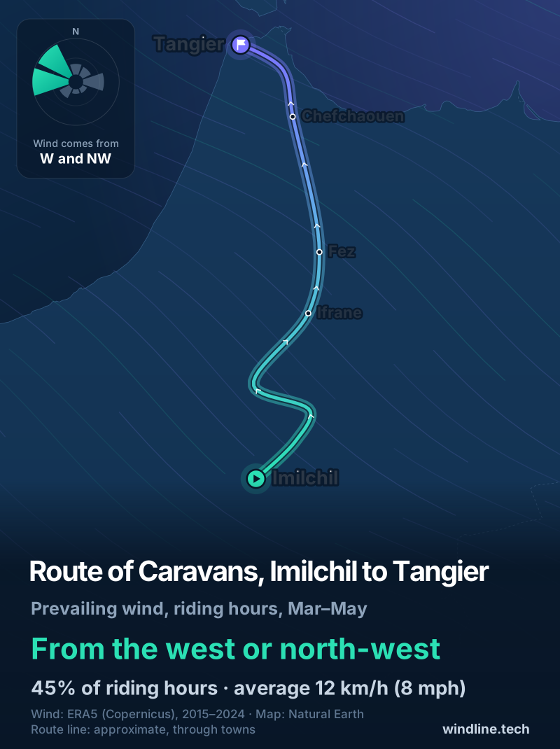
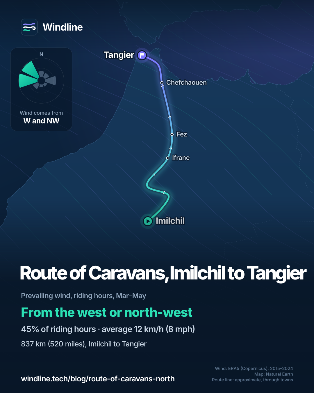
- In spring, past winds came mostly from the west or north-west, at 12 km/h (7–8 mph).
- Read your own government's travel advice for Morocco before you book.
What is the Route of Caravans North?
The Route of Caravans North is the northern half of BIKEPACKING.com's Morocco Traverse: 837 km (520 miles), mostly on dirt roads, from the High Atlas village of Imilchil to Tangier on the Strait of Gibraltar. It's one of our 10 most popular cycling tours in Africa, in our guide to the world's great cycling routes.
| The route at a glance | |
|---|---|
| Length | 837 km (520 miles), Imilchil to Tangier |
| Country | Morocco |
| Usual days | 14 |
| Surface | 55% unpaved, 5% singletrack |
| Climbing | 16,755 m (54,970 ft); high point 2,342 m (7,684 ft) |
| Signage | None described; follow the makers' GPX track |
| Best months | Spring (March to May) |
Retraced and finalised in spring 2024, it was designed to be ridden south to north, carrying on from the Route of Caravans South.
Which sections do people ride?
Three, and the landscape changes completely between them.
- Imilchil to Boumia: the hardest part, with a steep donkey-trail descent, riverbeds with many crossings, and the Jaffar Gorge.
- Boumia to Fes: easier, busier country, with dirt roads around Khenifra, singletrack near Ifrane and macaque monkeys in the pines.
- Fes to Tangier: more pavement, as Morocco is paving roads fast. Green hills lead into the Rif mountains and Chefchaouen. The author calls the river gorge from there to Tétouan the route's best riding.
The makers warn that the first canyon out of Imilchil is only for confident riders on mountain bikes, heading north, when the river is low. Otherwise, take the quiet road to Anefgou.
Want this for your own route? Windline shows the wind for every stretch, timed to your pace. Free. Make a free ride page →
What's the weather like through the year?
Spring is mild, but windier and wetter than summer.
Weather across the year on the Route of Caravans (North), 2015–2024
| Month | Wind from | Average wind, km/h (mph) | Gusty days | Start → high, °C (°F) | Wet days |
|---|---|---|---|---|---|
| Jan | W, NW | 10 (6) | 15% | 5° (41°) → 14° (57°) | 22% |
| Feb | W, NW | 12 (7) | 22% | 6° (44°) → 15° (59°) | 28% |
| Mar | W, NW | 12 (8) | 23% | 8° (47°) → 16° (62°) | 35% |
| Apr | W, NW | 12 (8) | 22% | 12° (53°) → 20° (67°) | 35% |
| May | NW, W | 12 (7) | 22% | 16° (61°) → 24° (74°) | 27% |
| Jun | NW, W | 11 (7) | 15% | 19° (66°) → 27° (80°) | 19% |
| Jul | NW, W | 11 (7) | 17% | 21° (69°) → 31° (89°) | 11% |
| Aug | NW, W | 11 (7) | 15% | 20° (68°) → 31° (88°) | 18% |
| Sep | NW, W | 11 (7) | 16% | 17° (62°) → 27° (81°) | 23% |
| Oct | ~Changeable | 11 (7) | 17% | 14° (56°) → 23° (74°) | 24% |
| Nov | W, NW | 10 (6) | 14% | 10° (49°) → 18° (65°) | 23% |
| Dec | ~Changeable | 10 (6) | 13% | 7° (44°) → 16° (60°) | 21% |
From March to May, the riding-hour wind averaged 12 km/h (7–8 mph), and 22–23% of days were gusty. In March and April, 35% of days were wet, falling to 27% in May. April days warmed from 12°C (53°F) at 08:00 to 20°C (67°F). By July and August, highs reached 31°C (88–89°F), and October and December were changeable in direction.
Its makers warn that snowmelt can raise the river crossings, and that the north turns to sticky mud when wet.
Which way should you ride the Route of Caravans North?
North, as its makers designed it. The wind is mostly side-on either way.
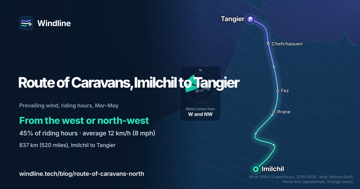
In our March–May riding hours for 2015–2024, the wind came from the west or north-west 45% of the time, with 16% calm, averaging 12 km/h (8 mph). Westerly winds (south-west, west and north-west) made up 52% of hours, easterly ones 23%.
The route heads roughly north, so a west wind is side-on and a north-west one is partly against you. Southbound riders gain slightly on paper, but the first canyon isn't meant for them. Gusts on about one spring day in five matter more: see how windy is too windy to cycle. These are past averages, not a forecast.
How do you get there and back?
By bus and taxi to Imilchil, and by ferry or plane from Tangier. First, read your own government's travel advice for Morocco.
- To Imilchil: bus from Marrakech to Beni Mellal, then a grand taxi, or ride up.
- Flights: Fes, Marrakech, Tangier, Casablanca and Rabat have international airports.
- To Spain: DFDS sails from Tanger Med, about 45 km (28 miles) from the city, to Algeciras, with up to 16 departures a day. Check which port your sailing uses.
- Nights: wild camping is easiest in the southern half and gets harder north of Fes, where guesthouses are the better bet. See wild camping rules.
- Water: taps are plentiful in the Rif; in the High Atlas, filter from streams and carry 4–6 litres (1.1–1.6 US gallons).
- Ramadan: next starts in February 2027, the UK says, so it may overlap a March start. The author found riding then harder.
Frequently asked questions
Can you ride the Route of Caravans North on a gravel bike?
Mostly, yes. Its makers say that, save for two sections in the High Atlas, it can all be ridden on a gravel bike. If you join it to the southern half, which needs bigger tyres for sand, you'll have to compromise on one bike. See [the best bike for bikepacking](/blog/best-bike-for-bikepacking/).
Is the Route of Caravans North safe to ride?
Read your own government's travel advice for Morocco before you book and again before you leave. The UK's, for example, warns that road accidents are frequent and roads often have no cycle lanes. It also says Morocco has zero tolerance for drugs, including cannabis, with long jail sentences, so turn down the hashish you may be offered in the Rif.
Can you join the Route of Caravans North to the southern half?
Yes. The southern half runs 1,236 km (768 miles) from Tiznit to Imilchil, where this one starts, making 2,073 km (1,288 miles) across Morocco. Its makers say the southern section needs winter riding, so plan dates around both. From Tangier, ferries cross to Spain, and the route was designed to connect to southern Spain's Altravesur.
Get the wind for your ride.
Upload a GPX, add your start time and pace, and see the headwind, gusts, rain and heat for every stretch of the route, timed to when you’ll be there. Free for riders.
Make a free ride page →Sources and method
- BIKEPACKING.com (2026). Route of Caravans: Morocco Traverse (North)
- BIKEPACKING.com (2026). Route of Caravans: Morocco Traverse (South)
- UK Foreign, Commonwealth & Development Office (2026). Morocco travel advice: safety and security
- DFDS (2026). Ferry from Morocco to Spain (Tanger Ville and Algeciras)
- Wikipedia (2026). Tanger Med
- Copernicus Climate Change Service (ECMWF) (2026). ERA5 hourly time-series data on single levels from 1940 to present
Route facts are from the route's makers on BIKEPACKING.com (the official source for this route, which has no managing body), read on 10 October 2026: length, days, surface, climbing, high point, sections and best season are the figures on its route page, converted from its miles and feet where needed. Its makers say "Spring is probably the nicest"; we read spring as March to May, as in our Africa list. The joined length is our sum, 1,236 + 837 = 2,073 km. Ferry details are from DFDS's own page and Ramadan and safety points from the UK government's travel advice, both read on 10 October 2026; Tanger Med's distance from Tangier is from Wikipedia. Weather across the year: Windline's own analysis of hourly ERA5 reanalysis (Copernicus Climate Change Service, ECMWF), 1 January 2015 to 31 December 2024, downloaded from the Copernicus Climate Data Store, at three sample points along the route (Imilchil, Fez and Tangier, nearest 0.25° grid cell), pooled. Riding hours are 08:00 to 17:00 local time. Wind is 10 m (33 ft) wind; the directions shown are the two commonest of eight compass sectors, and months when the hours barely agree on a direction are shown as changeable; hours under 5 km/h (3 mph) count as calm. A gusty day has a riding-hour gust of 50 km/h (31 mph) or more; a wet day has 1 mm or more of rain; start is the 08:00 temperature and high is the warmest riding hour. The direction figures use the riding hours of March to May; westerly means the south-west, west and north-west sectors, easterly the north-east, east and south-east sectors. The route's overall heading, Imilchil to Tangier, is roughly due north. ERA5 cells are about 25–30 km (16–19 miles) across, so they smooth out passes, gorges and local gusts. These are averages of past seasons, not forecasts. Contains modified Copernicus Climate Change Service information (ERA5, 2015–2024); neither the European Commission nor ECMWF is responsible for any use of this information. The map's route line joins towns in riding order; it is approximate and not an official route. Conversions use 1 mile = 1.609 km, 1 m = 3.281 ft, 1 US gallon = 3.785 litres and °F = °C × 1.8 + 32, rounded.
About the author
Wes Thomson, Founder, Windline. Wes Thomson builds Windline, live wind and weather forecasts timed to when riders reach each stretch of road. He built it for his own 2,093 km tour from Pont Drift to Cape Town, and writes these guides with the same focus: what the wind will do to your ride, and how to plan around it.