Route of Caravans South: Tiznit to Imilchil, Morocco, by bike
Plan Morocco's 1,236 km desert-and-mountain crossing, with its sections, the weather for every month, which way to ride and the buses there and back.
The short answer
The Route of Caravans South is a 1,236 km (768 mile) bikepacking route across southern Morocco, from Tiznit over the Anti-Atlas and through the Sahara to Imilchil in the High Atlas. It's 70% unpaved, usually takes 21 days, and is best ridden from late February to April or in autumn.
Key takeaways
- Its makers advise plus-size, tubeless tyres for the sand and desert thorns.
- Water is scarcest on the 145 km (90 miles) from Foum Zguid to M'Hamid.
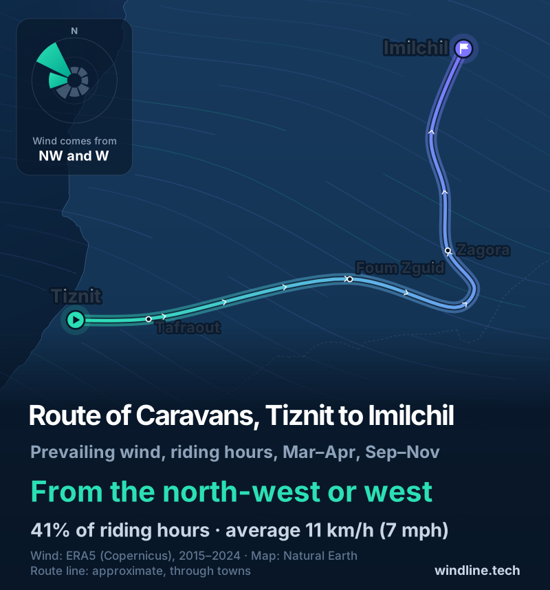
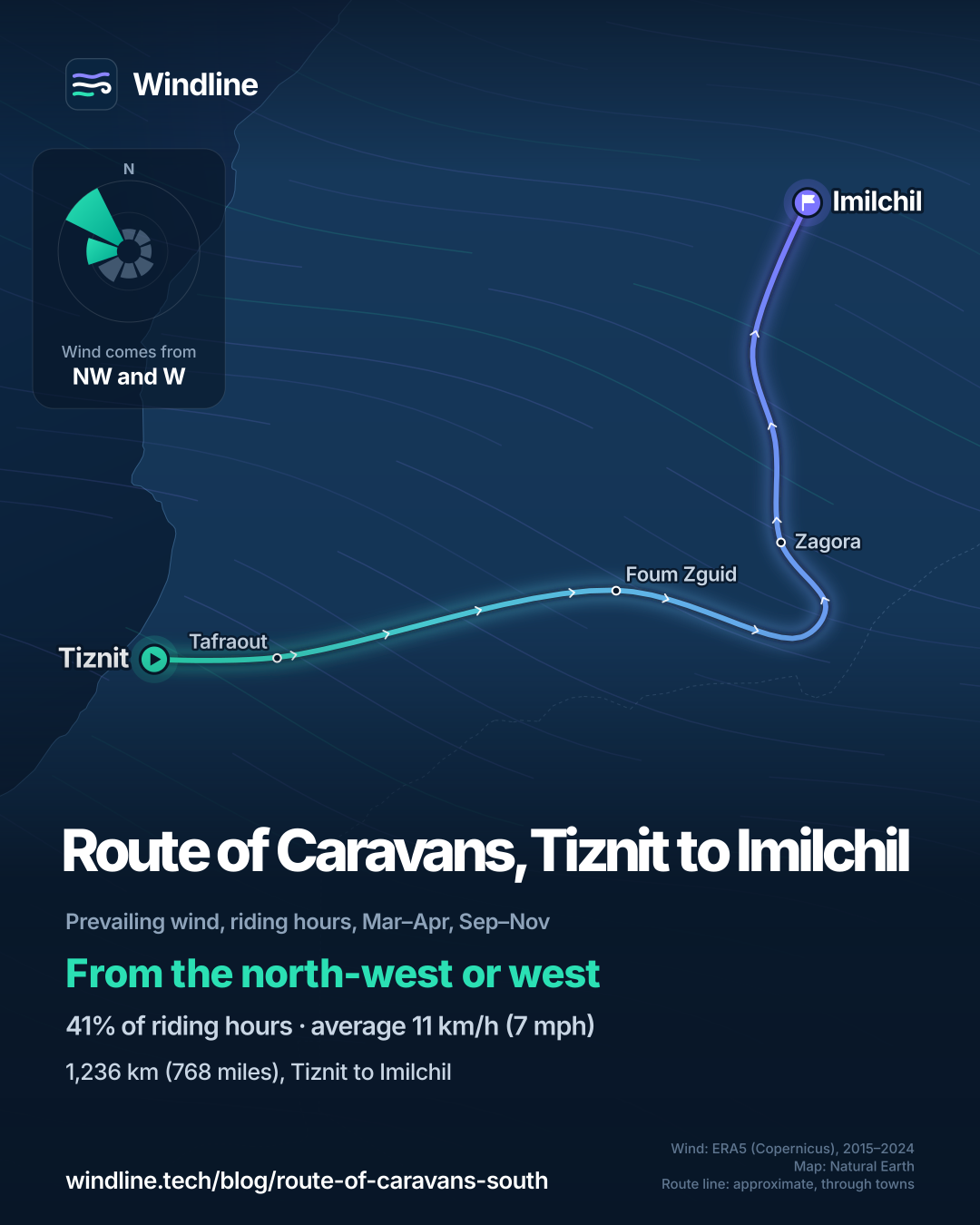
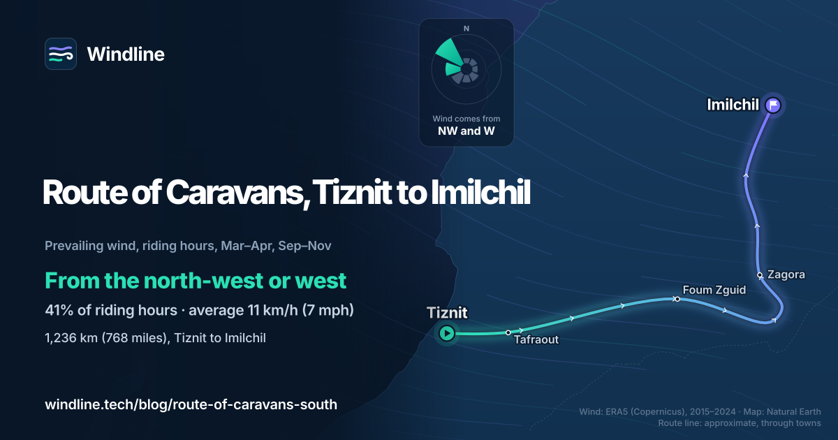
- In the best months, past winds came mostly from the north-west or west.
- Read your own government's travel advice for Morocco before you book.
What is the Route of Caravans South?
The Route of Caravans South is the southern half of BIKEPACKING.com's Morocco Traverse: 1,236 km (768 miles), mostly on dirt roads and pistes, from Tiznit's old medina to the High Atlas village of Imilchil. It's one of our 10 most popular cycling tours in Africa, in our guide to the world's great cycling routes.
| The route at a glance | |
|---|---|
| Length | 1,236 km (768 miles), Tiznit to Imilchil |
| Country | Morocco |
| Usual days | 21 |
| Surface | 70% unpaved, 3% singletrack, some sand |
| Climbing | 17,834 m (58,509 ft); high point 2,903 m (9,523 ft) |
| Signage | None described; follow the makers' GPX track |
| Best months | Late February to April, or autumn |
First scouted in 2014, it was reworked in 2024, moving north, away from the Algerian border, on police and military advice.
Which sections do people ride?
Four: the Anti-Atlas, the Colonial Road and the Sahara, the Draa Valley, and the High Atlas.
- Anti-Atlas: a hard first day off the coastal plain, then Tafraout and about 900 m (3,000 ft) of climbing in 24 km (15 miles).
- Colonial Road and the Sahara: a French-built road, now close to singletrack, with hike-a-bike where it has collapsed. Then 145 km (90 miles) of desert from Foum Zguid to M'Hamid, past the Erg Chigaga dunes.
- Draa Valley: dirt tracks upriver past palm oases and mud-brick kasbahs, with water from the river and wells.
- High Atlas: remote canyons via N'Kob, then the final climb. Food is scarce after the Dades Gorge.
Short of time? Zagora is an easy exit, with direct buses to Ouarzazate and Marrakesh.
Want this for your own route? Windline shows the wind for every stretch, timed to your pace. Free. Make a free ride page →
What's the weather like through the year?
Spring brings the most wind and gusts; autumn is calmer and still warm.
Weather across the year on the Route of Caravans (South), 2015–2024
| Month | Wind from | Average wind, km/h (mph) | Gusty days | Start → high, °C (°F) | Wet days |
|---|---|---|---|---|---|
| Jan | ~Changeable | 9 (6) | 7% | 6° (43°) → 16° (60°) | 10% |
| Feb | ~Changeable | 10 (6) | 10% | 8° (46°) → 17° (62°) | 15% |
| Mar | NW, W | 12 (7) | 15% | 11° (51°) → 19° (66°) | 20% |
| Apr | NW, W | 12 (8) | 16% | 14° (57°) → 22° (72°) | 19% |
| May | NW, W | 12 (8) | 15% | 18° (65°) → 26° (78°) | 18% |
| Jun | NW, W | 12 (7) | 13% | 21° (69°) → 29° (83°) | 13% |
| Jul | NW, W | 11 (7) | 12% | 23° (74°) → 33° (91°) | 10% |
| Aug | NW, W | 10 (6) | 10% | 22° (72°) → 32° (90°) | 16% |
| Sep | NW, W | 10 (6) | 12% | 19° (66°) → 28° (83°) | 18% |
| Oct | NW, W | 10 (6) | 8% | 15° (60°) → 25° (77°) | 12% |
| Nov | NW, W | 9 (6) | 8% | 11° (52°) → 20° (68°) | 11% |
| Dec | ~Changeable | 8 (5) | 4% | 7° (45°) → 17° (63°) | 9% |
In March and April, the riding-hour wind averaged 12 km/h (7–8 mph), and 15–16% of days were gusty. From September to November it eased to 9–10 km/h (6 mph), with 8–12% gusty days. March days warmed from 11°C (51°F) to 19°C (66°F), while July highs reached 33°C (91°F). The figures blend coast, desert and mountains: the Sahara runs hotter, and the High Atlas can hold snow early in spring.
Which way should you ride it?
South to north, as its makers designed it: a spring start gives the High Atlas snow time to melt before you reach it.
In the best months, past winds blew from the north-west or west in 41% of riding hours, with 19% calm, and averaged 11 km/h (7 mph). That wind tends to sit behind or beside you on the long ride east from Tiznit to M'Hamid, and comes more from ahead or the side on the climb north to Imilchil.
Its makers say north to south, trending downhill, may be more fun but needs an autumn start in the Atlas. These are past averages, not a forecast, and a headwind adds up over three weeks (see how much a headwind slows you down).
How do you get there, and what should you plan for?
By bus at both ends, after reading your own government's travel advice for Morocco. The UK's, for example, says the land border with Algeria is closed and must not be crossed.
- Start: the makers took CTM's bus from Casablanca to Tiznit, about 10 hours, with bikes on the roof or in the hold. Check with CTM before booking.
- Finish: Beni Mellal is 129 km (80 miles) and 2,400 m (8,000 ft) of climbing from Imilchil, with buses to Marrakesh, Fes and Rabat. Grand taxis also run between the two.
- Nights: guesthouses and auberges in towns such as Tafraout, Foum Zguid, Zagora and Imilchil. Ask before camping near farms or oases (see wild camping rules).
- Water: the makers carried over 8 litres (2.1 US gallons) each through the Sahara and suggest more. See our food and water guide.
Frequently asked questions
What tyres do you need for the Route of Caravans South?
Plus-size tyres, its makers advise. With standard 2.1-inch tyres you'll push through more sand, and it isn't a route for a cyclocross bike. Desert thorns gave them eight flats in 24 hours, so run tubeless and carry spares and patches. Modern bike shops are rare outside Morocco's bigger cities.
Is the Route of Caravans South safe to ride?
Conditions change, so read your own government's travel advice for Morocco before you book and again before you leave. In 2024 the makers moved the route away from the Algerian border on police and military advice. They also warn of sandstorms and dehydration in the Sahara, so ask locals about the desert before setting out.
Can you join the Route of Caravans South to the northern half?
Yes. The Route of Caravans North starts in Imilchil and runs 837 km (520 miles) through the Middle Atlas, Fes and Chefchaouen to Tangier, where ferries cross to Spain. Together they make 2,073 km (1,288 miles) across Morocco, mostly on dirt, and a spring start in the south suits both.
What changes if you ride during Ramadan?
The UK's travel advice says Ramadan next starts in February 2027, so it may overlap a spring start. Eating or drinking in public in the daytime may cause offence, so check shop and restaurant opening hours, carry the day's food and eat discreetly. It also warns that driving may be erratic around dusk.
Get the wind for your ride.
Upload a GPX, add your start time and pace, and see the headwind, gusts, rain and heat for every stretch of the route, timed to when you’ll be there. Free for riders.
Make a free ride page →Sources and method
- BIKEPACKING.com (2026). Route of Caravans: Morocco Traverse (South)
- BIKEPACKING.com (2026). Route of Caravans: Morocco Traverse (North)
- UK Foreign, Commonwealth & Development Office (2026). Morocco travel advice: safety and security
- UK Foreign, Commonwealth & Development Office (2026). Morocco travel advice: regional risks
- Copernicus Climate Change Service (ECMWF) (2026). ERA5 hourly time-series data on single levels from 1940 to present
Route facts are from the route's makers on BIKEPACKING.com (the official source for this route, which has no managing body), read on 10 October 2026: length, days, surface, climbing, high point and best months are the figures on its route page, converted from its miles and feet where needed. Best months are its makers' "late February/March/April or in the fall"; for the weather table we shade March, April and September to November, leaving out February because the season starts mid-month. The joined length is our sum, 1,236 + 837 = 2,073 km. Weather across the year: Windline's own analysis of hourly ERA5 reanalysis (Copernicus Climate Change Service, ECMWF), 1 January 2015 to 31 December 2024, downloaded from the Copernicus Climate Data Store, at three sample points along the route (Tiznit, Zagora and Imilchil, nearest 0.25° grid cell), pooled. Riding hours are 08:00 to 17:00 local time. Wind is 10 m (33 ft) wind; the directions shown are the two commonest of eight compass sectors, and months when the hours barely agree on a direction are shown as changeable; hours under 5 km/h (3 mph) count as calm. A gusty day has a riding-hour gust of 50 km/h (31 mph) or more; a wet day has 1 mm or more of rain; start is the 08:00 temperature and high is the warmest riding hour. The direction figures use the riding hours of March, April and September to November. These are averages of past seasons, not forecasts. Contains modified Copernicus Climate Change Service information (ERA5, 2015–2024); neither the European Commission nor ECMWF is responsible for any use of this information. The map's route line joins towns in riding order; it is approximate and not an official route. Conversions use 1 mile = 1.609 km, 1 m = 3.281 ft, 1 US gallon = 3.785 litres and °F = °C × 1.8 + 32, rounded.
About the author
Wes Thomson, Founder, Windline. Wes Thomson builds Windline, live wind and weather forecasts timed to when riders reach each stretch of road. He built it for his own 2,093 km tour from Pont Drift to Cape Town, and writes these guides with the same focus: what the wind will do to your ride, and how to plan around it.