The Trans-Uganda bikepacking route: stages, weather and planning
See the Trans-Uganda's five stages and the weather for every month, then plan water, nights and safety for a 40-day dirt loop.
The short answer
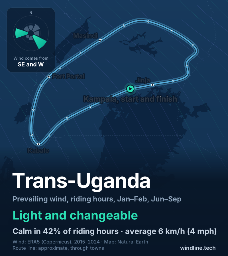
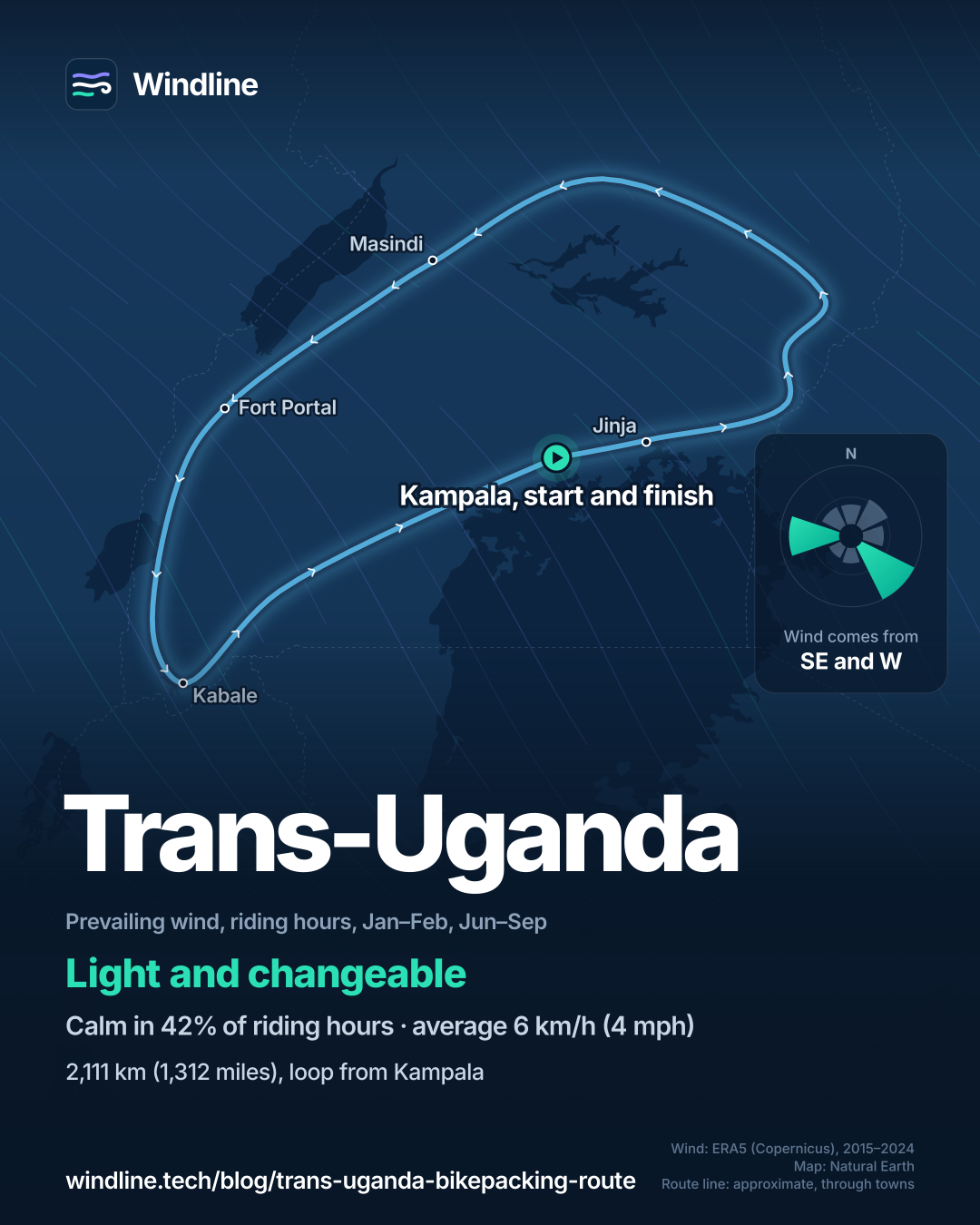
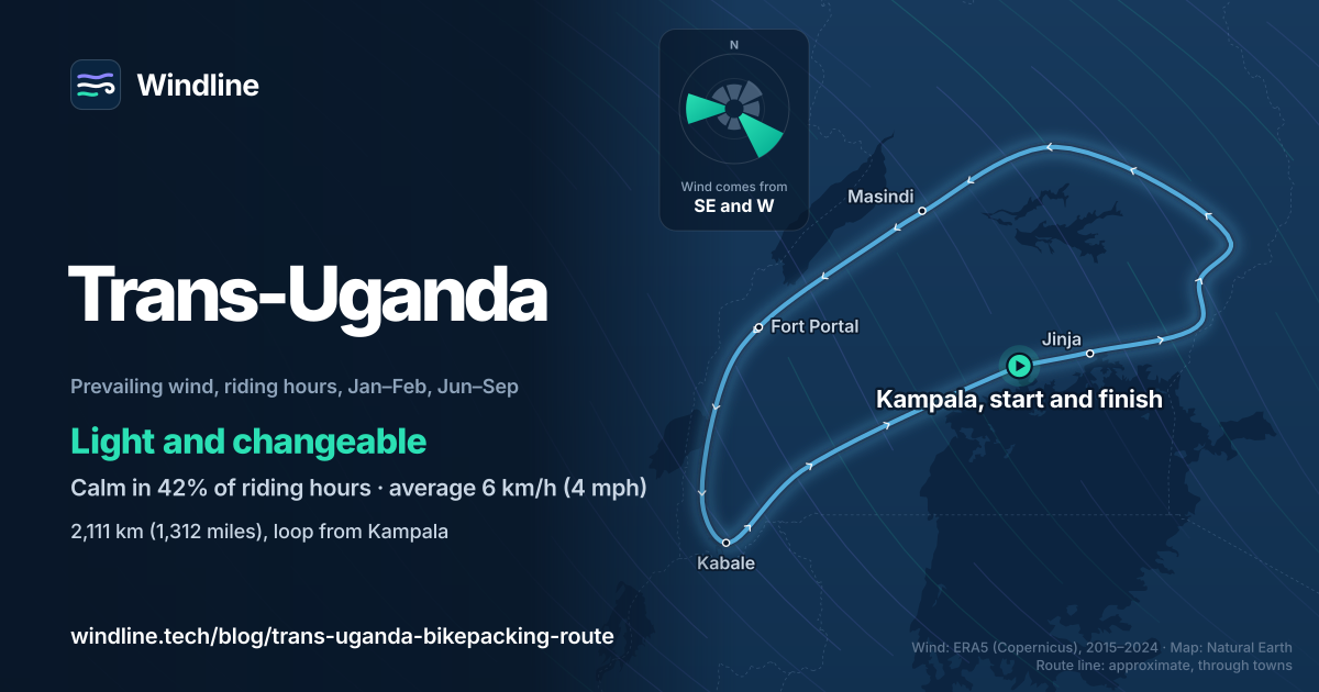
The Trans-Uganda bikepacking route is a 2,111 km (1,312 mile) loop from Kampala, 92% unpaved, which its makers at BIKEPACKING.com ride in about 40 days. It passes Jinja, Mount Elgon, Murchison Falls and Bwindi. Go in the dry seasons, late December to February or June to September, and expect mud after rain.
Key takeaways
- A 2,111 km (1,312 mile) dirt loop from Kampala with 26,030 m (85,400 ft) of climbing.
- Wind barely matters. In the best months it averaged 6 km/h (4 mph).
- Rain matters more. Even in the dry seasons, 43–84% of days were wet.
- Wild camping is nearly impossible, so plan hotels, community camps or a yard.
What is the Trans-Uganda bikepacking route?
The Trans-Uganda is a 2,111 km (1,312 mile) dirt loop from Kampala, published by BIKEPACKING.com, linking most of Uganda's parks and landscapes. It's one of our 10 most popular cycling tours in Africa, and sits in our guide to the world's great cycling routes.
| The route at a glance | |
|---|---|
| Length | 2,111 km (1,312 miles), a loop from Kampala |
| Country | Uganda |
| Usual days | 40 (the route makers' figure) |
| Surface | 92% unpaved, 15% singletrack; 26,030 m (85,400 ft) of climbing, high point 2,487 m (8,160 ft) |
| Signage | None: ride from the published GPS track |
| Best months | Late December to February, June to September |
Its makers mapped it as they rode it. Their notes date from 2016 and warn that roads get paved and paths become fields, so look for recent reports.
Which stages make up the loop?
Five, heading east from Kampala to Mount Elgon first, then west across the north, south through the western parks and back.
- Kampala to Jinja: two or three days, via Mabira forest and the Nile.
- Jinja to Sipi Falls: sugarcane lowlands, then big climbs and some hike-a-bike on the slopes of Mount Elgon.
- Central Uganda and Murchison Falls: the hardest, with less resupply north of Lake Kyoga. A ferry at Masindi Port leads to Budongo Forest, Murchison Falls and Lake Albert.
- The West: the Crater Lakes, Kibale's chimpanzees, the Rwenzori foothills, Queen Elizabeth National Park and Bwindi.
- The Return: Lake Bunyonyi, Lake Mburo National Park, where buffalo mean the park requires a paid ranger escort, and a ferry to Lake Victoria's islands.
Want this for your own route? Windline shows the wind for every stretch, timed to your pace. Free. Make a free ride page →
What's the weather like through the year?
Rain sets the calendar; wind and temperature hardly change.
Weather across the year on the Trans-Uganda (loop from Kampala), 2015–2024
| Month | Wind from | Average wind, km/h (mph) | Gusty days | Start → high, °C (°F) | Wet days |
|---|---|---|---|---|---|
| Jan | NE, W | 7 (4) | 0% | 18° (64°) → 26° (78°) | 43% |
| Feb | NE, W | 7 (4) | 0% | 18° (64°) → 27° (80°) | 52% |
| Mar | ~Changeable | 6 (4) | 0% | 18° (65°) → 26° (79°) | 71% |
| Apr | SE, E | 6 (4) | 0% | 19° (65°) → 25° (77°) | 87% |
| May | SE, S | 6 (4) | 0% | 19° (66°) → 25° (77°) | 74% |
| Jun | SE, W | 6 (4) | 0% | 18° (64°) → 25° (77°) | 58% |
| Jul | SE, W | 6 (4) | 0% | 18° (64°) → 25° (77°) | 50% |
| Aug | ~Changeable | 6 (4) | 0% | 18° (64°) → 25° (77°) | 66% |
| Sep | ~Changeable | 6 (4) | 0% | 18° (65°) → 25° (77°) | 84% |
| Oct | E, SE | 6 (4) | 0% | 19° (66°) → 25° (76°) | 89% |
| Nov | E, NE | 6 (3) | 0% | 19° (66°) → 24° (75°) | 92% |
| Dec | NE, W | 6 (4) | 0% | 18° (65°) → 25° (76°) | 69% |
In the best months, January–February and June–September, the riding-hour wind averaged 6–7 km/h (4 mph), and under 1% of days were gusty in any month. Rain is what to plan around: 43% of January days were wet, 84% of September's and 92% of November's. Mornings started at 18–19°C (64–66°F) all year, and highs reached 24–27°C (75–80°F).
Which way should you ride it?
Either way: the wind won't decide it. In the best months of 2015–2024, 42% of riding hours were calm and the wind averaged 6 km/h (4 mph), most often from the south-east or west (28% of hours), so we call it light and changeable.
August and September were changeable in direction. At these speeds a headwind costs little (see how much a headwind slows you down), so let the rains decide your dates instead. These are averages of past seasons, not a forecast.
How do you plan water, nights and safety?
Read your own government's travel advice first, then plan around water and beds.
- Travel advice: check your own government's advice for Uganda before you book and before you ride. The UK's, for example, reports terrorist attacks in western Uganda near the DRC border, including two tourists killed in Queen Elizabeth National Park in October 2023, and advises against travel outside main towns after dark.
- Getting there: fly into Entebbe International Airport; the route's makers recommend Kampala as a base for building your bike.
- Nights: wild camping is nearly impossible. Ask to pitch in a yard, or use hotels in most towns, community-run camps and budget camping near the parks. See wild camping rules by country.
- Water: filter everything. Aid-built pump wells are in most places, but scarcer between Elgon and Masindi and in the far south-west. See our food and water guide.
- Traffic and dust: trucks pass fast between Hoima and Kagadi, and dry-season dust is heavy.
Frequently asked questions
How hard is the Trans-Uganda?
Hard in its length and logistics more than its climbs. Its makers rate it 7 out of 10 for difficulty, but call the climbing fair, at about 12 m per km (65 ft per mile). The pace is slow on rough dirt, Mount Elgon has some hike-a-bike, and the north has the least food and water. Spread over 40 days, the loop averages about 53 km (33 miles) a day.
Can you ride just part of the Trans-Uganda?
Yes. Kampala to Jinja is a two- or three-day ride on its own, and Jinja makes an easy place to stop. The western stage, from the Crater Lakes past the Rwenzori foothills to Bwindi, links the parks most visitors come for. Plan transport to and from your section's ends before you go, and see [how far to bikepack in a day](/blog/how-far-to-bikepack-in-a-day/) to size it.
Do you need a visa to cycle in Uganda?
British visitors do, so check your own government's advice for your passport. The UK's says Britons must apply online before travel and need a passport valid for six months after arrival. It also describes the East African Tourist Visa: 100 US dollars as of October 2026, for multiple entries to Kenya, Rwanda and Uganda over 90 days. That suits riders adding Rwanda's Congo Nile Trail or Kenya.
Get the wind for your ride.
Upload a GPX, add your start time and pace, and see the headwind, gusts, rain and heat for every stretch of the route, timed to when you’ll be there. Free for riders.
Make a free ride page →Sources and method
- BIKEPACKING.com (2026). The Trans-Uganda
- UK Foreign, Commonwealth & Development Office (2026). Uganda travel advice: safety and security
- UK Foreign, Commonwealth & Development Office (2026). Uganda travel advice: entry requirements
- Copernicus Climate Change Service (ECMWF) (2026). ERA5 hourly time-series data on single levels from 1940 to present
Route facts are from the route's makers on BIKEPACKING.com, and safety and visa facts from the UK Foreign, Commonwealth & Development Office, all read on 10 October 2026. Length, usual days, the share unpaved and singletrack, climbing, high point, difficulty and best months are the route makers' own figures, the same as in our Africa list. Best months are their dry seasons, late December to February and June to September; the weather figures for the best months leave out December, because the season starts late in the month. The 53 km (33 miles) a day is our arithmetic: 2,111 km over 40 days. Weather across the year: Windline's own analysis of hourly ERA5 reanalysis (Copernicus Climate Change Service, ECMWF), 1 January 2015 to 31 December 2024, downloaded from the Copernicus Climate Data Store, at three sample points spread around the loop (Mbale, Fort Portal and Kabale, nearest 0.25° grid cell), pooled. Riding hours are 08:00 to 17:00 local time. Wind is 10 m (33 ft) wind; the directions shown are the two commonest of eight compass sectors, and months when the hours barely agree on a direction are shown as changeable in direction; hours under 5 km/h (3 mph) count as calm. A gusty day has a riding-hour gust of 50 km/h (31 mph) or more; a wet day has 1 mm or more of rain; start is the 08:00 temperature and high is the warmest riding hour. These are averages of past seasons, not forecasts. Contains modified Copernicus Climate Change Service information (ERA5, 2015–2024); neither the European Commission nor ECMWF is responsible for any use of this information. The map's route line joins towns on the published route in riding order; it is approximate and not an official route. Town coordinates are from Wikipedia. Conversions use 1 mile = 1.609 km, 1 m = 3.281 ft and °F = °C × 1.8 + 32, rounded.
About the author
Wes Thomson, Founder, Windline. Wes Thomson builds Windline, live wind and weather forecasts timed to when riders reach each stretch of road. He built it for his own 2,093 km tour from Pont Drift to Cape Town, and writes these guides with the same focus: what the wind will do to your ride, and how to plan around it.