The Congo Nile Trail by bike: route, stages, weather and travel
Plan five days along Lake Kivu, see the weather for every month, and check the travel advice before you book.
The short answer
The Congo Nile Trail is Visit Rwanda's 227 km (141 mile) route along the eastern shore of Lake Kivu, from Rubavu to Rusizi, and takes about five days by bike. It's hilly, mostly on dirt roads and tracks, and best ridden in Rwanda's two dry seasons: mid-May to mid-September and December to February.
Key takeaways
- Visit Rwanda gives 227 km (141 miles) and about five days.
- BIKEPACKING.com's 257 km (160 mile) version climbs 5,822 m (19,100 ft).
- The wind averaged under 10 km/h (6 mph) every month. Rain decides when to go.
- Read your own government's travel advice first. The trail ends beside the Congolese border.
Definitions
- Base camp
- On the Congo Nile Trail, an overnight stop built into the route, from a simple campsite to a lodge.
What is the Congo Nile Trail?
The Congo Nile Trail is a 227 km (141 mile) route roughly parallel to the eastern shore of Lake Kivu, from Rubavu (once Gisenyi) to Rusizi, says Visit Rwanda. It opened in 2011. It's one of Africa's 10 most popular cycling tours and sits in our guide to the world's great cycling routes.
| The route at a glance | |
|---|---|
| Length | 227 km (141 miles), Rubavu to Rusizi |
| Country | Rwanda, along Lake Kivu |
| Usual days | About 5 |
| Surface | Dirt roads and singletrack; some tarmac in the south |
| Signage | Not described by Visit Rwanda; ride with a GPS track |
| Best months | Mid-May to mid-September, December to February |
Which sections do people ride?
Most riders take five days, and Visit Rwanda says single stages work if you have less time. The trail crosses five districts: Rubavu, Rutsiro, Karongi, Nyamasheke and Rusizi.
BIKEPACKING.com's "Bikepacker's Edition", ridden in 2016, splits it like this:
- Rubavu to Kinunu, 42 km (26 miles): lakeshore dirt roads.
- Kinunu to Kibuye (Karongi), 64 km (40 miles): the hardest day.
- Kibuye to Nyungwe, about 45 km (28 miles): almost 1,000 m (3,200 ft) of climbing into the tea highlands.
- Nyungwe to Ishara, 64 km (40 miles): a rough forest track, or a gravel bypass.
- Ishara to Kamembe, 45 km (28 miles): all tarmac, to Rusizi.
BIKEPACKING.com says the original trail south of Kibuye was paved in 2014, so its version detours through the tea estates and Nyungwe National Park, making 257 km (160 miles). Roads here change, so check before you go.
Want this for your own route? Windline shows the wind for every stretch, timed to your pace. Free. Make a free ride page →
What's the weather like through the year?
Mild and calm all year; rain is what changes.
Weather across the year on the Congo Nile Trail, 2015–2024
| Month | Wind from | Average wind, km/h (mph) | Gusty days | Start → high, °C (°F) | Wet days |
|---|---|---|---|---|---|
| Jan | W, SW | 6 (4) | 0% | 19° (66°) → 22° (72°) | 76% |
| Feb | W, SW | 6 (4) | 0% | 19° (67°) → 23° (73°) | 75% |
| Mar | W, SW | 6 (4) | 1% | 20° (67°) → 23° (73°) | 82% |
| Apr | SE, SW | 6 (4) | 1% | 19° (67°) → 22° (72°) | 89% |
| May | SE, SW | 7 (4) | 0% | 20° (67°) → 22° (72°) | 57% |
| Jun | SE, SW | 8 (5) | 0% | 19° (67°) → 22° (72°) | 28% |
| Jul | SE, SW | 8 (5) | 0% | 19° (66°) → 22° (72°) | 13% |
| Aug | SE, SW | 9 (5) | 0% | 19° (67°) → 22° (72°) | 28% |
| Sep | SE, W | 8 (5) | 0% | 19° (67°) → 23° (73°) | 61% |
| Oct | SW, W | 7 (4) | 0% | 20° (67°) → 22° (72°) | 79% |
| Nov | W, SW | 6 (4) | 1% | 19° (67°) → 22° (71°) | 90% |
| Dec | W, SW | 6 (4) | 0% | 19° (66°) → 22° (71°) | 89% |
At our three lakeside sample points, the riding-hour wind averaged 6–9 km/h (4–5 mph) in every month, and gusty days were 1% or fewer. Mornings started at 19–20°C (66–67°F), with highs of 22–23°C (71–73°F). July was driest, with 13% wet days. December to February, BIKEPACKING.com's "less-dry" season, still had rain on 75–89% of days, so pack rain gear.
Which way should you ride it?
North to south, as Visit Rwanda describes it. The wind is too light to argue otherwise.
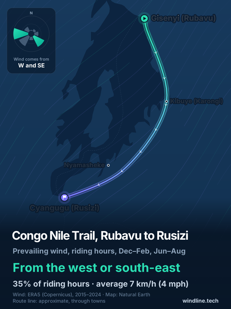
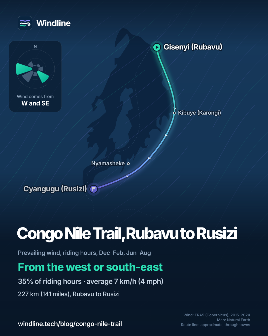
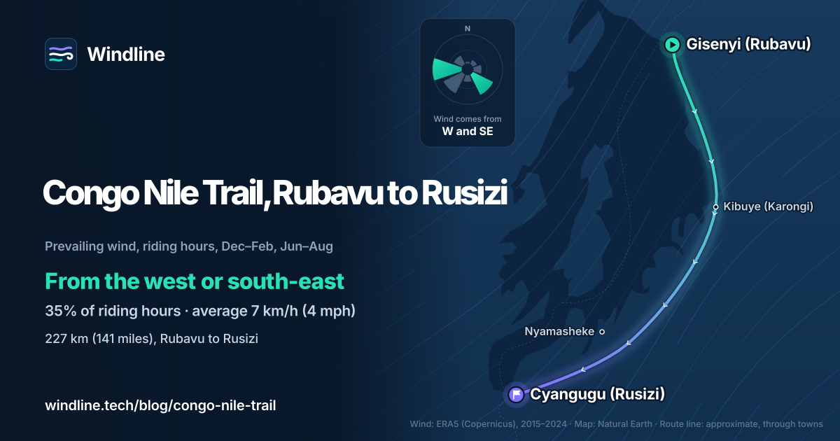
In our June–August and December–February riding hours for 2015–2024, the wind came from the west 20% of the time and the south-east 15%, and 31% of hours were calm. It averaged 7 km/h (4 mph). From June to August, south-east and south-west winds were commonest, so southbound riders met a light headwind more often than a tailwind. From December to February, west and south-west winds were commonest, at just 6 km/h (4 mph).
These are past averages, not a forecast. A light headwind still costs time (see how much a headwind slows you down), but the climbing will shape your days more.
How do you get there, and what should you check first?
Fly to Kigali, then take a bus west: Rwanda has no railway. In 2016, BIKEPACKING.com's riders took a bus from Kigali's Nyabugogo station to Gisenyi, about 3.5 hours, buying two seats per unboxed bike.
- Travel advice. Read your own government's travel advice for Rwanda before you book, and again before you leave. As of 10 October 2026, the UK advises against all but essential travel within 10 km (6 miles) of the Congolese border in Rusizi District, including Kamembe Airport. That covers the trail's southern end.
- Plastic bags. Banned since 2008 and confiscated on arrival. Pack in dry bags.
- Water and nights. Water comes from springs and boreholes, so bring a filter. Base camps range from campsites to lodges. See our food and water guide and wild camping rules.
Frequently asked questions
How hard is the Congo Nile Trail?
Hard for its length. BIKEPACKING.com rates its version 6 out of 10, with 5,822 m (19,100 ft) of climbing and a high point of 2,499 m (8,200 ft). It says lodging lets you stretch the trip to seven days. Our [beginner bikepacking routes](/blog/best-beginner-bikepacking-routes/) guide rates it the hardest of its picks.
Can you walk the Congo Nile Trail instead of cycling it?
Yes. When the Rwanda Development Board opened the trail in 2011, the UN World Tourism Organization said its itineraries can be covered on foot, by bike or by jeep. Visit Rwanda also suggests walking it, and says single stages work if you have less time.
What bike do you need for the Congo Nile Trail?
One with wide tyres and low gears; Visit Rwanda mentions mountain bikes. BIKEPACKING.com's version is 75% unpaved, with 12% singletrack. Its riders met about a dozen fallen trees on the Nyungwe forest track, and thorny growth can choke it in or after the wet season, so it also maps a gravel bypass.
Get the wind for your ride.
Upload a GPX, add your start time and pace, and see the headwind, gusts, rain and heat for every stretch of the route, timed to when you’ll be there. Free for riders.
Make a free ride page →Sources and method
- Visit Rwanda (Rwanda Development Board) (2026). Cycling
- Visit Rwanda (Rwanda Development Board) (2026). Lake Kivu
- Visit Rwanda (Rwanda Development Board) (2026). Rubavu
- Visit Rwanda (Rwanda Development Board) (2026). Rusizi
- Visit Rwanda (Rwanda Development Board) (2026). Getting around
- Visit Rwanda (Rwanda Development Board) (2026). Plastic ban
- UN Tourism (formerly UNWTO) (2011). Inauguration of the Congo-Nile Trail in Rwanda
- BIKEPACKING.com (2026). The Congo Nile Trail (bikepacker's edition), Logan Watts
- UK Foreign, Commonwealth & Development Office (2026). Rwanda travel advice: warnings and insurance
- Copernicus Climate Change Service (ECMWF) (2026). ERA5 hourly time-series data on single levels from 1940 to present
- Natural Earth (2026). Terms of use (public domain map data)
Route facts are from the official bodies in the sources, opened on 10 October 2026: the length (227 km), start, finish and "about five days" are Visit Rwanda's, as in our Africa list and beginner bikepacking routes guide; the 2011 opening, the five districts and "on foot, by bike or by jeep" are from the UN World Tourism Organization's announcement; walking and mountain biking are from Visit Rwanda's Rubavu page. The stage split, the 257 km (160 mile) version, climbing, difficulty, surface shares, the 2014 paving, water, base camps and the bus details are BIKEPACKING.com's, from a guide based on a ride in early 2016, and may have changed. Best months are the two dry seasons BIKEPACKING.com gives (mid-May to mid-September, December to February); the months used for the wind are June to August and December to February, leaving out the half months. Travel advice is the UK government's as of 10 October 2026, quoted as one example. Weather across the year: Windline's own analysis of hourly ERA5 reanalysis (Copernicus Climate Change Service, ECMWF), 1 January 2015 to 31 December 2024, downloaded from the Copernicus Climate Data Store, at three sample points along the route (Gisenyi, Kibuye and Cyangugu, nearest 0.25° grid cell), pooled. Riding hours are 08:00 to 17:00 local time. Wind is 10 m (33 ft) wind; the directions shown are the two commonest of eight compass sectors; hours under 5 km/h (3 mph) count as calm. A gusty day has a riding-hour gust of 50 km/h (31 mph) or more; a wet day has 1 mm or more of rain; start is the 08:00 temperature and high is the warmest riding hour. These are averages of past seasons, not forecasts. Contains modified Copernicus Climate Change Service information (ERA5, 2015–2024); neither the European Commission nor ECMWF is responsible for any use of this information. The map's route line joins town centres in riding order (coordinates from Wikipedia and Wikidata); it is approximate and not an official route. Conversions use 1 mile = 1.609 km, 1 m = 3.281 ft and °F = °C × 1.8 + 32, rounded.
About the author
Wes Thomson, Founder, Windline. Wes Thomson builds Windline, live wind and weather forecasts timed to when riders reach each stretch of road. He built it for his own 2,093 km tour from Pont Drift to Cape Town, and writes these guides with the same focus: what the wind will do to your ride, and how to plan around it.