Namib desert bikepacking: the SAND route to Swakopmund
Plan the SAND route's Namib segment with its sections, a year of weather and wind, the water to carry and the permits you need.
The short answer
The SAND route's Namib segment is a Namib desert bikepacking route of 1,199 km (745 miles), 95% unpaved, from the Orange River at Sendelingsdrift to Swakopmund on Namibia's coast. It usually takes 15 days. Towns are often more than 200 km (124 miles) apart, so carry at least 10 litres (2.6 US gallons) of water.
Key takeaways
- Mostly quiet gravel roads; wind, heat and long gaps between shops are the hard parts.
- The Orange River is the only reliable surface water, so plan every refill.
- You need a Namib-Naukluft Park permit for the D2186 to Mirabib, sold at Sesriem.
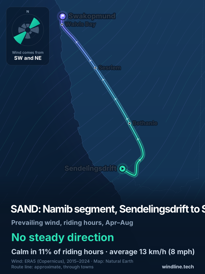
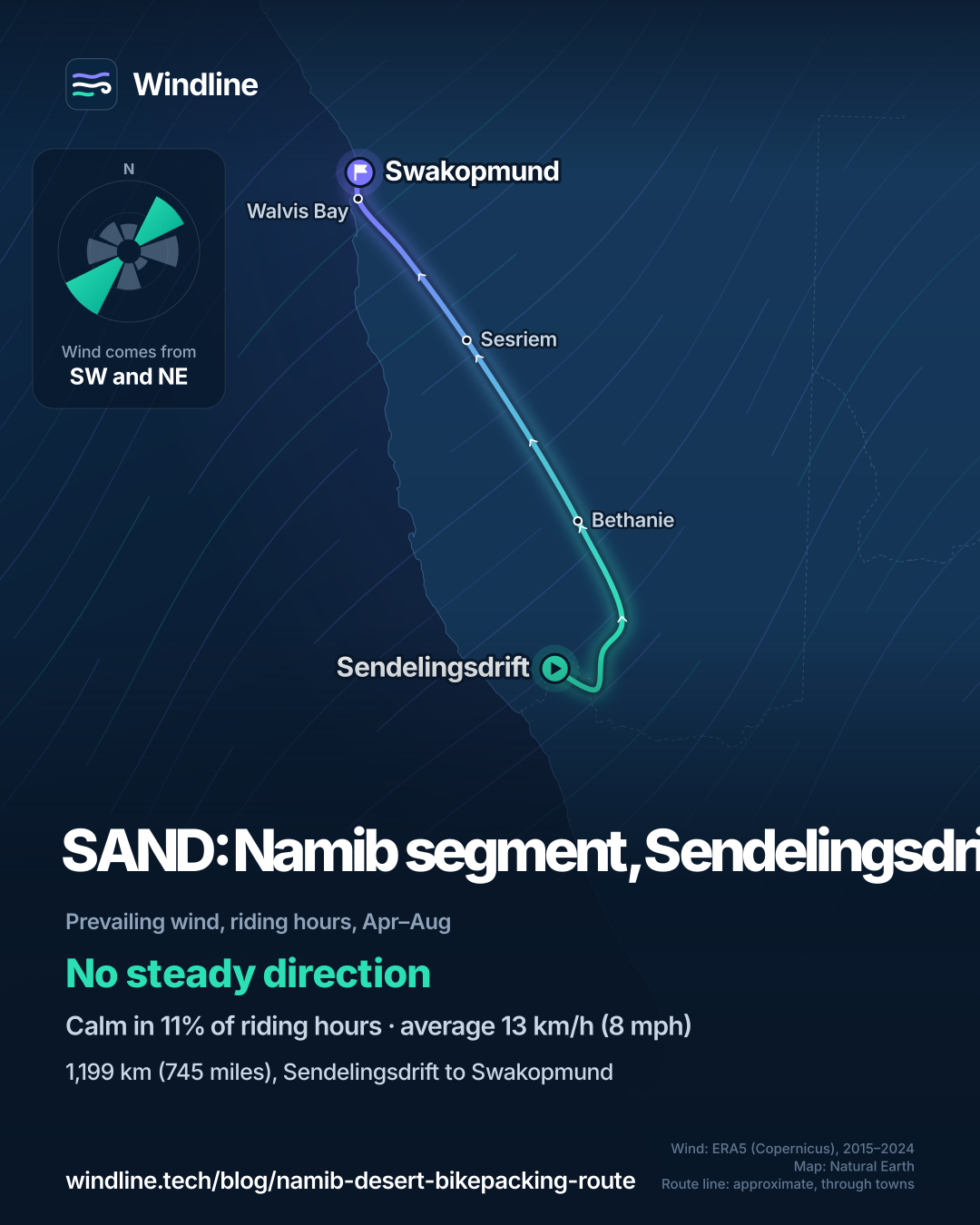
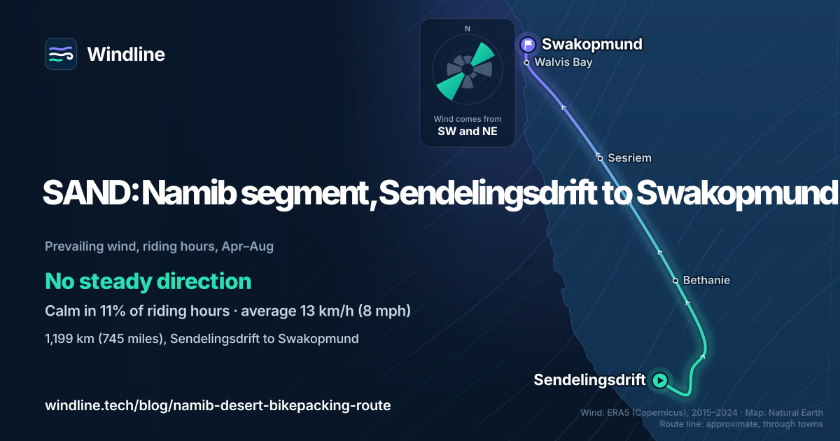
- From May to August, riding-hour winds averaged 12–14 km/h (8–9 mph), with no steady direction.
What is the SAND route's Namib segment?
It's the fourth segment of SAND, a bikepacking route mapped by South African rider Johan Wahl and published on BIKEPACKING.com. For Namib desert bikepacking, it links the Orange River to the Atlantic on gravel. It's one of our 10 most popular cycling tours in Africa, in our guide to the world's great cycling routes.
| The route at a glance | |
|---|---|
| Length | 1,199 km (745 miles), Sendelingsdrift to Swakopmund |
| Country | Namibia, from the South African border |
| Usual days | 15 |
| Surface | 95% unpaved: gravel, corrugations, some soft sand |
| Climbing | 6,894 m (22,618 ft) |
| Signage | None: ride from the published GPX |
| Best months | Winter and the shoulder seasons; rideable all year |
Its makers rate it 6 out of 10: the riding is straightforward, but wind, heat and resupply make it hard.
Which sections do people ride?
Four stretches, almost all on quiet public gravel roads.
- Sendelingsdrift to Aussenkehr: along the Orange River, with the optional, sandy Kamchab River Trail.
- Aussenkehr to Hobas: a 10 km (6 mile) detour reaches the hot springs at Ai-Ais; Hobas has the park office and a campsite.
- Hobas to the D707: long, straight roads and a stretch of the B4 with mining trucks. Riding north, Bethanie is the first real town in over 400 km (249 miles).
- D707 to Swakopmund: through the private NamibRand reserve on a public road (no overnight stays), Sesriem, the Kuiseb Canyon and Mirabib, then Walvis Bay.
From Swakopmund, the Kaokoveld segment carries on north.
Want this for your own route? Windline shows the wind for every stretch, timed to your pace. Free. Make a free ride page →
What's the weather like through the year?
Little rain, steady wind, and heat that eases in winter.
Weather across the year on the SAND: Namib segment (Sendelingsdrift to Swakopmund), 2015–2024
| Month | Wind from | Average wind, km/h (mph) | Gusty days | Start → high, °C (°F) | Wet days |
|---|---|---|---|---|---|
| Jan | SW, W | 13 (8) | 8% | 20° (69°) → 29° (85°) | 6% |
| Feb | SW, W | 13 (8) | 6% | 20° (68°) → 30° (85°) | 6% |
| Mar | SW, W | 13 (8) | 3% | 19° (66°) → 29° (84°) | 3% |
| Apr | SW, W | 13 (8) | 4% | 17° (63°) → 28° (82°) | 3% |
| May | ~Changeable | 12 (8) | 3% | 15° (59°) → 27° (80°) | 1% |
| Jun | ~Changeable | 13 (8) | 12% | 12° (54°) → 24° (75°) | 2% |
| Jul | ~Changeable | 14 (9) | 11% | 12° (53°) → 23° (74°) | 2% |
| Aug | ~Changeable | 13 (8) | 9% | 12° (53°) → 23° (74°) | 1% |
| Sep | SW, W | 14 (9) | 12% | 14° (57°) → 25° (76°) | 1% |
| Oct | SW, W | 14 (9) | 14% | 17° (63°) → 27° (81°) | 1% |
| Nov | SW, W | 15 (9) | 16% | 19° (66°) → 28° (82°) | 1% |
| Dec | SW, W | 14 (9) | 13% | 20° (67°) → 29° (83°) | 2% |
From April to August, the riding-hour wind averaged 12–14 km/h (8–9 mph), changeable in direction from May. Wet days were 1–6% in every month. Highs fell from 30°C (85°F) in February to 23°C (74°F) in July and August, after 12°C (53°F) mornings. These figures include cool, coastal Swakopmund; the makers say interior summer days reach 40°C (104°F).
Which way should you ride it?
Either way. The makers see no real advantage, and riders report headwinds in both directions.
From April to August, the wind came from the south-west in 21% of riding hours, the north-east in 18% and the east in 14%, averaging 13 km/h (8 mph). From September to April, south-westerlies and westerlies were commonest. The route heads broadly north-west, so those come across or partly against you riding north, most of all on the westward run down the Kuiseb.
These are past averages, not a forecast. See how much a headwind slows you down.
How much water should you carry?
At least 10 litres (2.6 US gallons), the makers say. The Orange River is the only perennial river, and stretches of 100 km (62 miles) or more have nothing.
- Fill up at every chance; refill points are marked on the GPX.
- Farm groundwater often tastes strongly of minerals.
- Passing drivers will usually share a bottle.
- Mirabib has camping but no water; Sesriem's petrol station has a well-stocked shop.
See our food and water guide.
What permits and practicalities do you need?
A Namib-Naukluft Park permit for the D2186 to Mirabib, and for Sossusvlei if you go in. The makers bought theirs at the Sesriem park office.
- Fees: from 1 April 2026, Namibia's environment ministry charges adults N$280 (other foreign nationals) or N$180 (SADC nationals) in entrance and conservation fees.
- Fish River Canyon: the Namibian side of the park is free to ride through; you pay only to enter the facilities at Hobas.
- Park rules: Namibia Wildlife Resorts' published regulations forbid overnight stays outside rest camps, and crossing park borders between sunset and sunrise. See also wild camping rules.
- Getting there: Sendelingsdrift is a small border post with a pontoon and no public transport. The makers suggest Noordoewer, 100 km (62 miles) upriver, if you need a bus. Swakopmund has buses to Windhoek.
- Travel advice: read your own government's advice for Namibia, and for South Africa if you cross from there. UK passport holders, for example, have needed a visa since 1 April 2025.
Frequently asked questions
Can you ride the SAND Namib segment on a gravel bike?
Yes. Its makers say virtually any bike that can carry enough water will do, including a gravel bike, though wider tyres help. Linking the rougher segments either side needs a mountain bike with wide tyres. Thorns are common near riverbeds, so run plenty of sealant. The only bike shops are in Walvis Bay and Swakopmund.
Is there phone signal and can you pay by card in southern Namibia?
Rarely, away from towns. The route makers found little or no signal outside the larger towns, so they relied on campsite and farm wifi. Most small shops take cash only, and cards work mainly at larger supermarkets. The Namibian dollar is fixed one-to-one to the South African rand, and both are accepted.
Can you ride the Namib segment in summer?
Yes. It's the one SAND segment its makers say can be ridden all year, though interior summer days reach 40°C (104°F) and you'll need to carry more water. Rain is rare, but when it falls, roads can flood and stay unusable for weeks. In June 2026, Namibia Wildlife Resorts reported floodwater still receding in the Fish River Canyon.
Get the wind for your ride.
Upload a GPX, add your start time and pace, and see the headwind, gusts, rain and heat for every stretch of the route, timed to when you’ll be there. Free for riders.
Make a free ride page →Sources and method
- BIKEPACKING.com (2026). SAND: Segment 4, Namib
- Ministry of Environment, Forestry and Tourism, Namibia (2026). Revised park entrance and conservation fees from 1 April 2026 (published by Namibia Wildlife Resorts)
- Ministry of Environment, Forestry and Tourism, Namibia (2026). /Ai-/Ais-Richtersveld Transfrontier Park
- Ministry of Environment, Forestry and Tourism, Namibia (2026). Namib-Naukluft Park
- Namibia Wildlife Resorts (2020). Park regulations
- Namibia Wildlife Resorts (2026). Sesriem Campsite
- Namibia Wildlife Resorts (2026). Hobas Lodge
- Namibia Wildlife Resorts (2026). /Ai-/Ais Hotsprings and Spa
- Namibia Wildlife Resorts (2026). Update on operations at /Ai-/Ais Hot Springs & Spa
- UK Foreign, Commonwealth & Development Office (2025). Namibia travel advice
- Copernicus Climate Change Service (ECMWF) (2026). ERA5 hourly time-series data on single levels from 1940 to present
- Copernicus Climate Change Service (ECMWF) (2026). ERA5 hourly data on single levels from 1940 to present
- Natural Earth (2026). Terms of use (public domain map data)
Route facts are from the route's makers on BIKEPACKING.com (length 745 miles or 1,199 km, 15 days, 95% unpaved, 6,894 m or 22,618 ft of climbing, high point 1,639 m or 5,377 ft, difficulty, sections, water, permits at the time of their test ride, bikes, money and signal) and from official Namibian sources: the Ministry of Environment, Forestry and Tourism (MEFT) for the Sendelingsdrift border post and pontoon and for the park fees in force from 1 April 2026, and Namibia Wildlife Resorts (NWR) for its camps, its June 2026 Ai-Ais update and the park regulations it publishes. All were read on 10 October 2026. The route page names no months: it recommends "winter and shoulder seasons" and says the segment can be ridden all year, so best months are April to August, the winter named on its sister Kaokoveld segment, as in our Africa list. The route page gives no signage; the route is a published GPX line on public roads. The weather table and wind figures are Windline's own analysis of Copernicus ERA5 reanalysis, 1 January 2015 to 31 December 2024, downloaded from the Copernicus Climate Data Store (hourly time series for the nearest 0.25° grid cell), at three sample points along the route (Sendelingsdrift, Sesriem and Swakopmund), with hours and days pooled across the three. Riding hours are 08:00 to 17:00 local time. Wind is the 10 m (33 ft) wind; directions are the commonest two of eight compass sectors, hours under 5 km/h (3 mph) count as calm, and months with no steady direction are called changeable in direction. A gusty day has a riding-hour gust of 50 km/h (31 mph) or more; a wet day has 1 mm or more of rain; start is the 08:00 temperature and high is the warmest riding hour. ERA5 cells are about 25–30 km (16–19 miles) across, and one of the three points is on the cool coast, so the pooled temperatures sit below the interior's. The direction reading compares the wind with the route's overall heading, roughly north-west from Sendelingsdrift to Swakopmund. These are averages of past seasons, not forecasts. Contains modified Copernicus Climate Change Service information (ERA5, 2015–2024); neither the European Commission nor ECMWF is responsible for any use of this information. The map's line is an approximate line through town waypoints, not the route makers' GPX; basemap from Natural Earth (public domain). Conversions use 1 mile = 1.609 km, 1 US gallon = 3.785 litres and °F = °C × 1.8 + 32, rounded.
About the author
Wes Thomson, Founder, Windline. Wes Thomson builds Windline, live wind and weather forecasts timed to when riders reach each stretch of road. He built it for his own 2,093 km tour from Pont Drift to Cape Town, and writes these guides with the same focus: what the wind will do to your ride, and how to plan around it.