Windline turns your GPX routes into one live link. Every rider sees the headwind, gusts, rain and heat for the exact hour the group reaches each stretch of road, on a multi-day tour, a stage race or the Saturday club ride.
Windline for Android is here. Every ride rated for the wind, Fly the route in 3D, the alert the evening before.Download ›Weather apps forecast one place at one time. A tour covers 200 km a day, through different weather, at different hours. The wind at the start tells you nothing about the climb at 11.
Load the routes once. From then on, every time someone taps a day, they get the newest forecast, timed to their ride.
Upload the GPX file for each stage. Windline reads the distance, climbing and direction of every stretch of road.
Date, start time, riding speed and stops. We work out when the group reaches each part of the route, slower on the climbs.
Paste it into the group chat. Each day gets a live Good, Fair or Tough rating, and one tap opens the full map.
Pick what you are running. Windline sets the page up the way your riders use it.
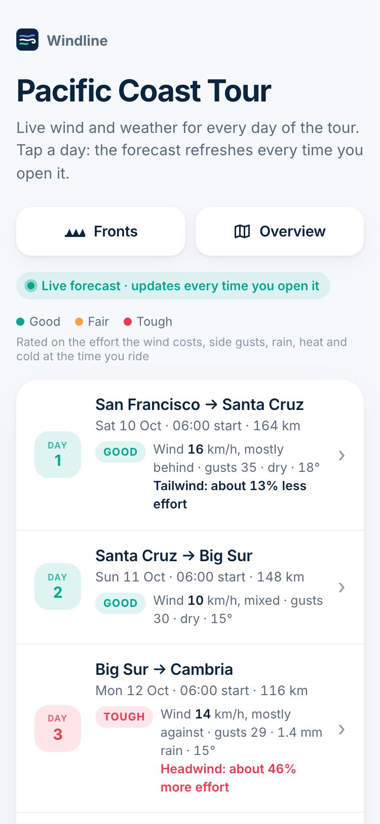
Every day of the tour on one page, each rated Good, Fair or Tough, timed to the group's pace with climbs and stops built in.
Set a planned speed for each stage. Every rider shifts it faster or slower to see the wind for their own time on the road.
One link that never changes. It always shows the next four rides on your route, and each rider sets their own pace.
Cold fronts due over your days, an overview map of the whole event, and a branded image of any day to post on Instagram or Facebook.
San Francisco to Solvang along California’s coast, 628 km, always starting two days from today. Each day below was just rated in your browser from the latest Apple Weather forecast, exactly as your riders would see it.
Connect Strava once. After every ride, Windline adds what the wind did to it to the ride’s description: where it was against you, where it pushed you home, the gusts and the temperature, at the times you actually rode. Your followers see it too.
Coffee stop in Franschhoek ☕ 🌬️ Headwind ride: the wind made it about 18% harder. Toughest from km 40 to 55, 19 km/h head-on. Wind 14 km/h from the south-east, gusts to 36 · 14–19°C · dry Ride weather by Windline · windline.tech/strava · Apple Weather data
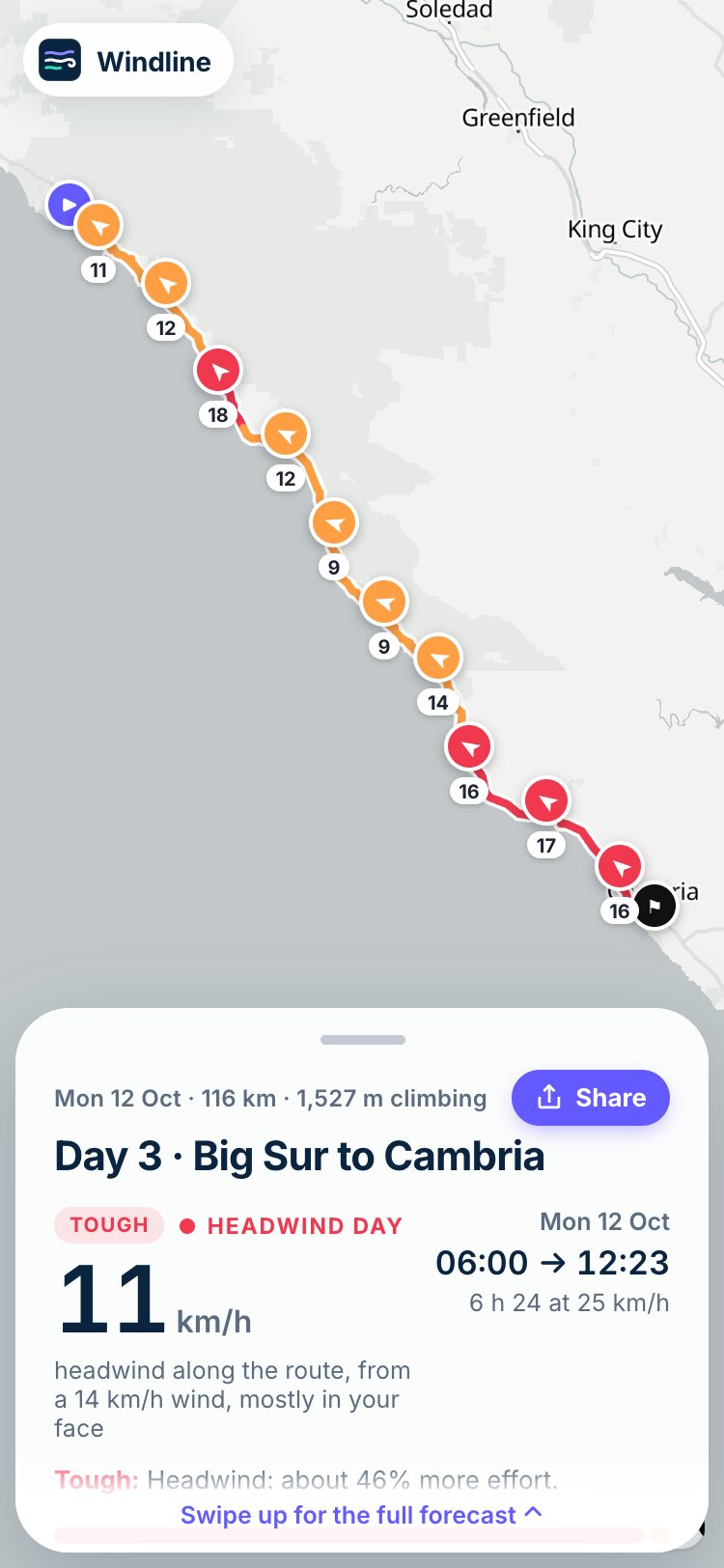
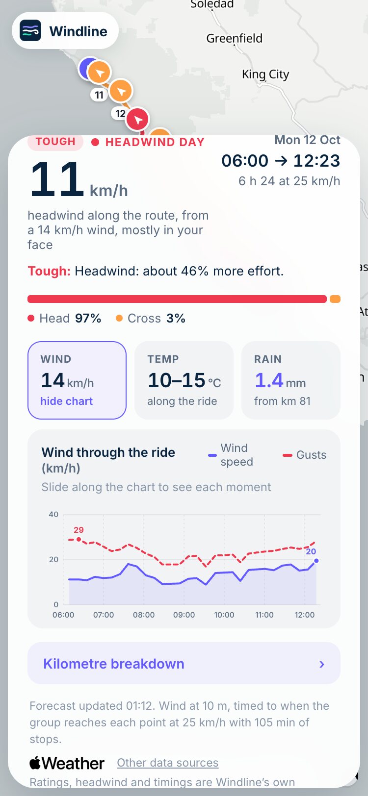
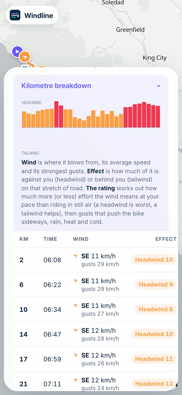
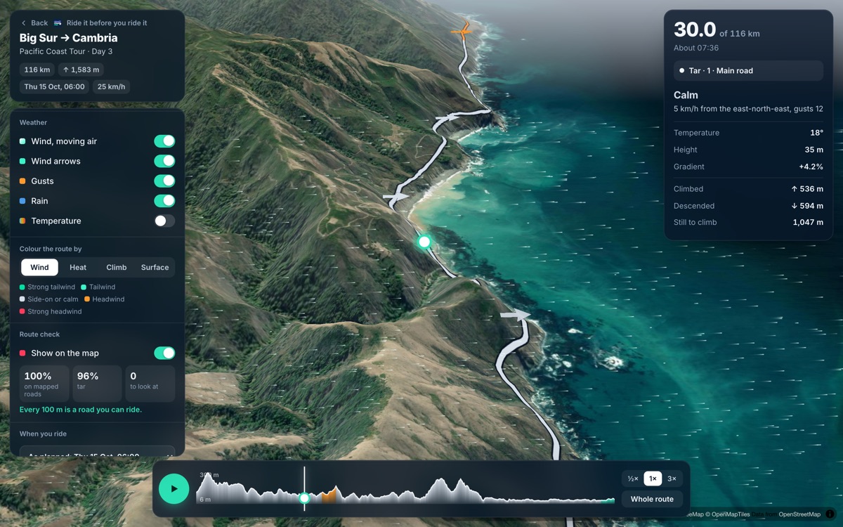
Tap a day and the whole stage opens on the map. These are real screens from the 116 km Big Sur stage, into a headwind.

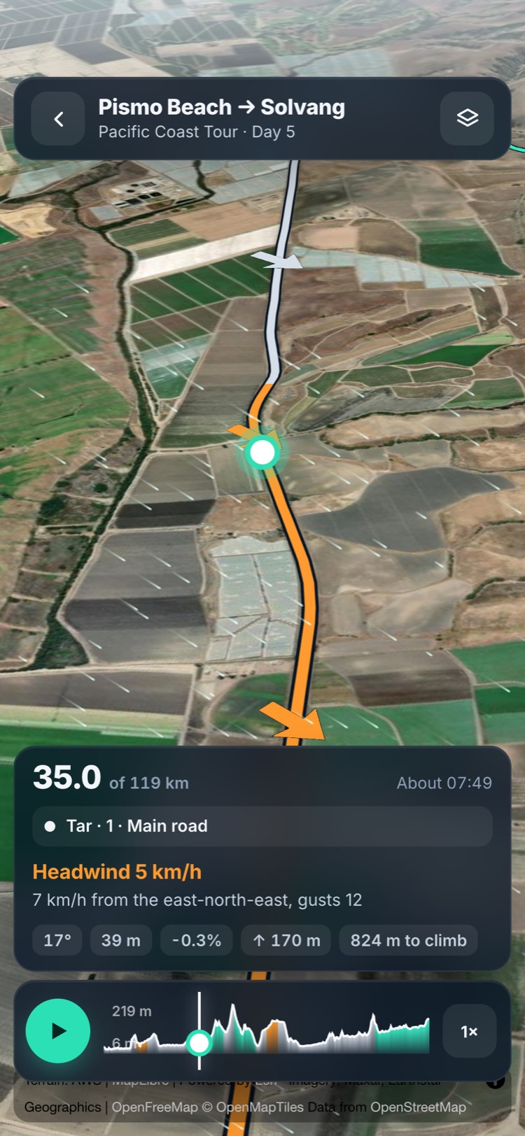
Each arrow is the wind where the group will be at that hour. Red is in your face, amber is from the side, green is at your back.

Tap wind, temperature or rain for a chart through the day. See when the wind builds and the gusts peak, and plan the regroup before then.

“Headwind 10, gusts 28, at 06:47.” Every few kilometres, the wind and what it means for the bunch.
Fly any day on satellite imagery, with the wind at the hour you’ll be there and every climb. Windline checks every 100 m of road, so the farm track or the line across a field shows up now, not on the day.


Headwind, tailwind, gusts, rain and heat along every stretch, timed to your start and pace. Colour the route by wind, heat, climb or surface.
Tar or gravel, a mapped road or not, private roads and paths where bikes aren’t allowed, each one marked on the map.
Drag along the profile to any point: the height, the gradient, what you’ve climbed and what’s still to come.
On every day of every event, on the web and in the Windline app for iPhone and Android. Free for everyone. How it works →
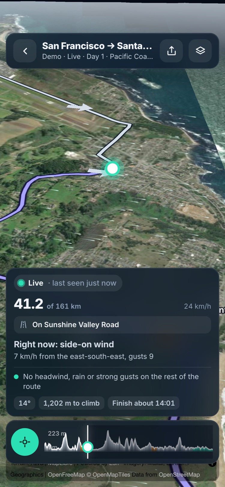
Share one link. Family, friends and your club watch the ride on a satellite map, with the wind and weather where the rider is, what’s ahead, and a finish time that updates as they go.
Pin it in the group chat. It opens in any browser, with nothing to install, and in the Windline app on iPhone.
“Right now: headwind 8 km/h.” Then what’s coming: “Headwind from km 112, about 13:40.”
Live, delayed or no signal, said plainly, with a clearly marked estimate until the real track fills in.
While a ride is being tracked, it’s at the top of the club’s Windline page. Supporters find it without being sent anything.
Sent from the Windline app (iPhone or Android) by the ride’s owner, only while they track it. Hidden near home on private rides, positions deleted after 7 days. Free for everyone.
The forecast behind Apple’s Weather app, read hour by hour at every stretch of your route, anywhere in the world.
Wind is blended between hourly readings to the moment the group reaches each stretch, not rounded to the hour.
Each day’s rating works out the effort the wind costs or saves at your pace, then side gusts, rain, heat and cold. A tailwind never counts against you.
Tailwind: about 37% less effortForecasts refresh through the day, up to 10 days ahead, and every rider sees the same forecast on every page.
You plan the start times, the regroups and the support vehicles. Windline gives you the wind for every one of those decisions, and gives your riders one place to look.
Windline is free for organisers and riders. Create your account, upload your routes and share your first link today.